I was contacted recently to write an article for the Adventure Cycling Association about my 2019 Western Wildlands route ride. Check it out!


I was contacted recently to write an article for the Adventure Cycling Association about my 2019 Western Wildlands route ride. Check it out!
With some forced downtime from travel due to Covid-19, I have had some time to reflect. I have cycled in 21 countries covering approximately 37,000km around this beautiful planet. While I have only been to maybe 10% of all countries, here is a list of my 10 favourite places I have ridden my bike. The order of least to most favourite changes often!
Where have I been on my bike?: Vietnam, Laos, Cambodia, Thailand, Myanmar, South Korea, Taiwan, China, Australia, New Zealand, Mongolia, Pakistan, India, Tajikistan, Kyrgyzstan, Canada, USA, Chile, Argentina, Greece, Nepal
These are routes that I cycled from 2011-2019 so obviously some of the information will not be up to date, but I hope it gives a decent overview.
1. Mongolia (2015)
Why?: In my mind, Mongolia just may be one of the last frontiers for adventure travel. Wide open, vast and fenceless – it was a journey that for me, defined freedom. The landscape ranged from wide open steppe, pine forests, desert and mountains in the west. Being a nomadic country, the people are also incredibly welcoming and accustomed to travellers, because it is ingrained in the culture. I was often invited to stay with families in their gers (yurts). They fed me homemade noodles and suutei tsai (a milky, salty tea). The country also has one of the lowest population densities on the planet. So, if you like space and remoteness – a trip across this amazing country is probably for you.
Routes: I loved the ride from Tsetserleg to the North side of Terkhiin Tsagaan Lake and from Ulaangom to Ulgii
Camping: Without a doubt, one of the best places for wild camping. With not a whole lot of private land, you can pretty much pitch a tent anywhere. Sometimes, I asked to pitch my tent next to a ger, but I was often invited inside to stay with families as a result.
What bike?: The majority of Mongolia (in 2015 at least) was made up dirt roads and horse tracks. I had my Thorn Nomad mk2 with panniers and 2.15 inch tires. It did the job well. A mountain bike or a touring bike with a minimum of 2” tires will work.
Dangers and annoyances: Unfortunately I have heard of more than a few women who have faced sexual harassment crossing Mongolia. Alcoholism is a big problem in some of the towns, and I generally wouldn’t hang around very long for this reason. I was groped by a drunk man on the outskirts of one town, but this was luckily the only incident. The families living in gers were amazing and I always felt very safe. Harassment can a real issue, however, so solo women should take this seriously and take necessary precautions.
When to go: I travelled in Mongolia from early May until late June and I really enjoyed this time of year. It is still chilly, and snowed a few times, but the weather was pleasant overall and there were no mosquitoes! Travelling East to West, I often had strong headwind, which is common in spring. To see the rich green of the steppe and grasslands, summer is a better time to go. There is also the Nadaam cultural festival in July. Travelling outside of May to October you will likely have very cold weather and snow. Some brave souls have done the crossing in winter!
My Stories HERE
2. Australia (2016)
 Why?: In many ways, the Australian landscape was like an alien planet for me. There are many plants and animals there that can be found nowhere else. It always exciting to be in such a foreign environment when you were already fairly well-travelled. The red dirt roads of the outback are the places to head for, if you don’t mind remoteness, carrying a ton of water (20 plus litres) and hoards of bush flies (luckily not the biting kind). Outback sunsets are truly unforgettable as is the feeling of absolute solitude. The bizarre and interesting wildlife sightings are always a highlight, such as kangaroos, koalas, dingoes, echidnas, wombats and thorny devils – the desert dwelling lizard that can collect water simply by touching it with any parts of its body. Australia is also much more than just desert – there is also stunning coastline and mountainous gum tree forests.
Routes: The Great Central Road (dirt) from Laverton to Yulara and Uluru. Mereenie Loop from Alice Springs (dirt and paved). Grand Ridge Road in Gippsland (dirt and paved), Barry Way in New South Wales to Victorian border (dirt and paved).
Camping: Very easy in the outback. On classic paved routes like the Great Ocean Road, it is much more difficult due to fences and private land. Wild animals generally are not a problem, though I would often keep my shoes inside of the tent due to snakes and spiders.
What bike?: If sticking to the dirt roads, a tourer with 2” tires or bigger is recommend. The roads in the outback can be quite sandy and washboarded.
Dangers and Annoyances: The main issue will be traffic on the busier paved routes. I was warned about the road trains in the outback, but they were not as frequent as I expected on the Great Central Road. It is best to pull off and stop to let them pass and they will usually give you plenty of room anyways. Carrying a mirror is not a bad idea. There are obviously more than a few poisonous snakes, but they are often timid and with slither away. It never a good idea to wander through tall grass. because you may not see them!
When to go: Australian summer runs from November to March and can get crazy hot. Crossing the outback at this time is not recommended and is potentially dangerous, especially due to the lack of water. Tasmania would be fine this time of year. If crossing the outback, May to September would be ideal. I cycled in September, October and November when things were just starting to heat up.
My stories HERE
3. Karakoram Highway, Pakistan (2015)
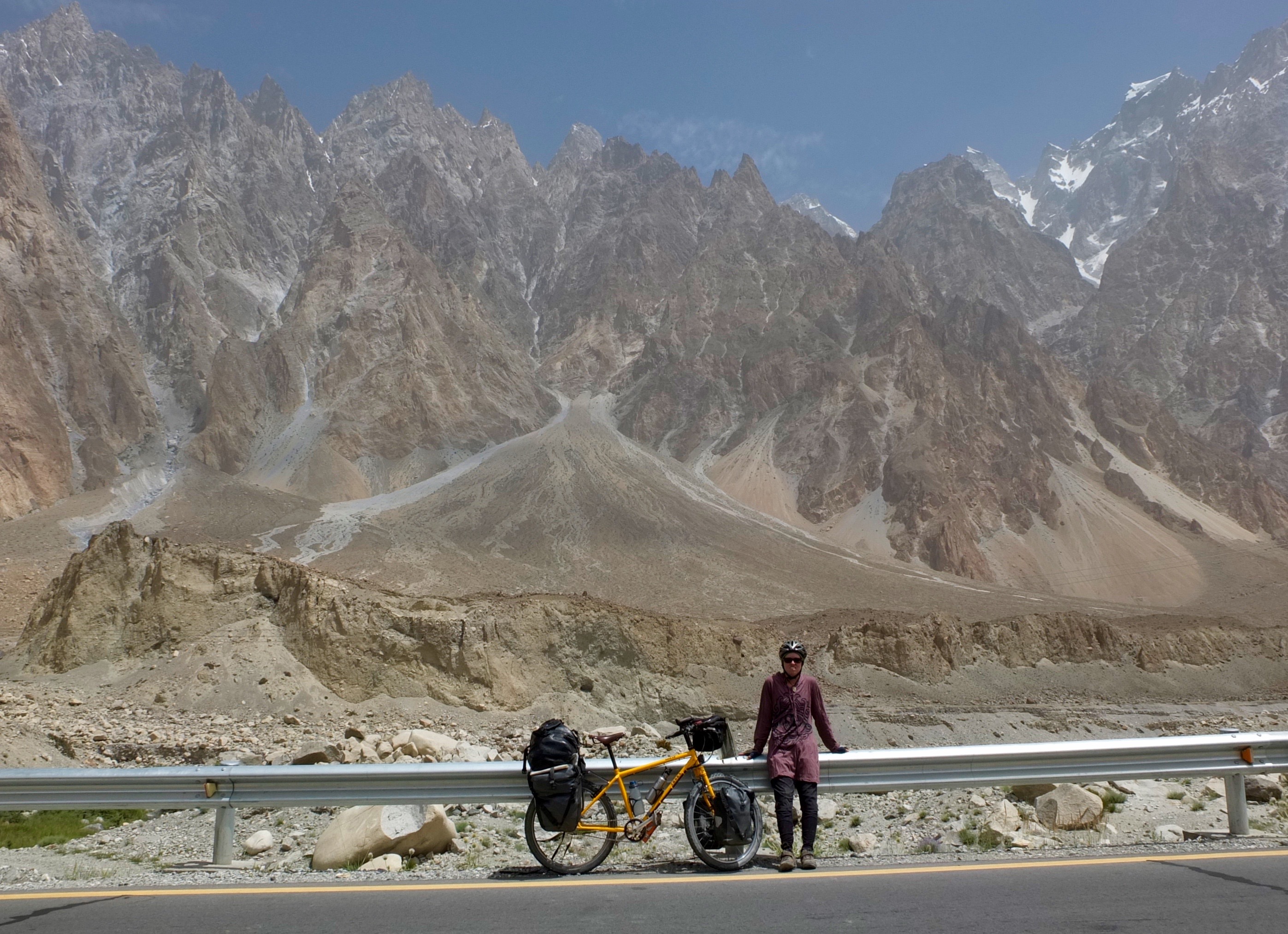
Why?: Pakistan, unfortunately is one of those countries that suffers from an image problem. Before 9/11, tourists flocked to the mountain paradise in the north that is the Karakoram Highway, a true marvel of engineering. As a solo woman, I was treated with non-stop kindness and respect. Locals were constantly trying to assure me that they were good people and would offer any help that I could possibly need. The Hunza Valley that the road passes through is absolutely spectacular and is rumoured to be an inspiration for “Shangri-La” in James Hilton’s “Lost Paradise” novel. This road is unique because instead of climbing up and over high mountain passes, it sits low in the valley while giant mountains tower on all sides. On the way, you can hike to Mt. Rakaposhi Base Camp and see a spectacular glacial field.
Route: The Karakoram Highway actually begins in the town of Tashkurgan in China. In 2015, no cycling was permitted from Tashkurgan in China to Sost in Pakistan via the Khunjerab Pass. The only way was by bus. From Sost, the Karakoram Highway officially ends in Islamabad, but I only cycled to Gilgit and took a bus to the city from there.
Camping: I camped in some hostel backyards for a small fee, but never wild camped. It is generally not advised to wild camp, especially for a solo woman.
What bike?: The Karakoram Highway is a paved road, so any bike will do. In 2015, I had heard that the road conditions worsened south of Gilgit, but I would say that a lot has changed since then.
Dangers and Annoyances: From Sost to Gilgit, I felt very safe and welcomed, even as a solo woman. I always covered my hair and wore long sleeves and pants. I was told by some in that part of the country that it wasn’t even necessary to cover my hair. I always did so out of respect. South of Gilgit, it is much more conservative and it is not recommended that women travel solo. Also, there were some security concerns at the time. I would strongly recommend taking a bus for the Gilgit-Islamabad section.
When to go: May to October. I think spring or fall would be ideal. I was there in July and it was very hot in Gilgit and further south.
My stories HERE
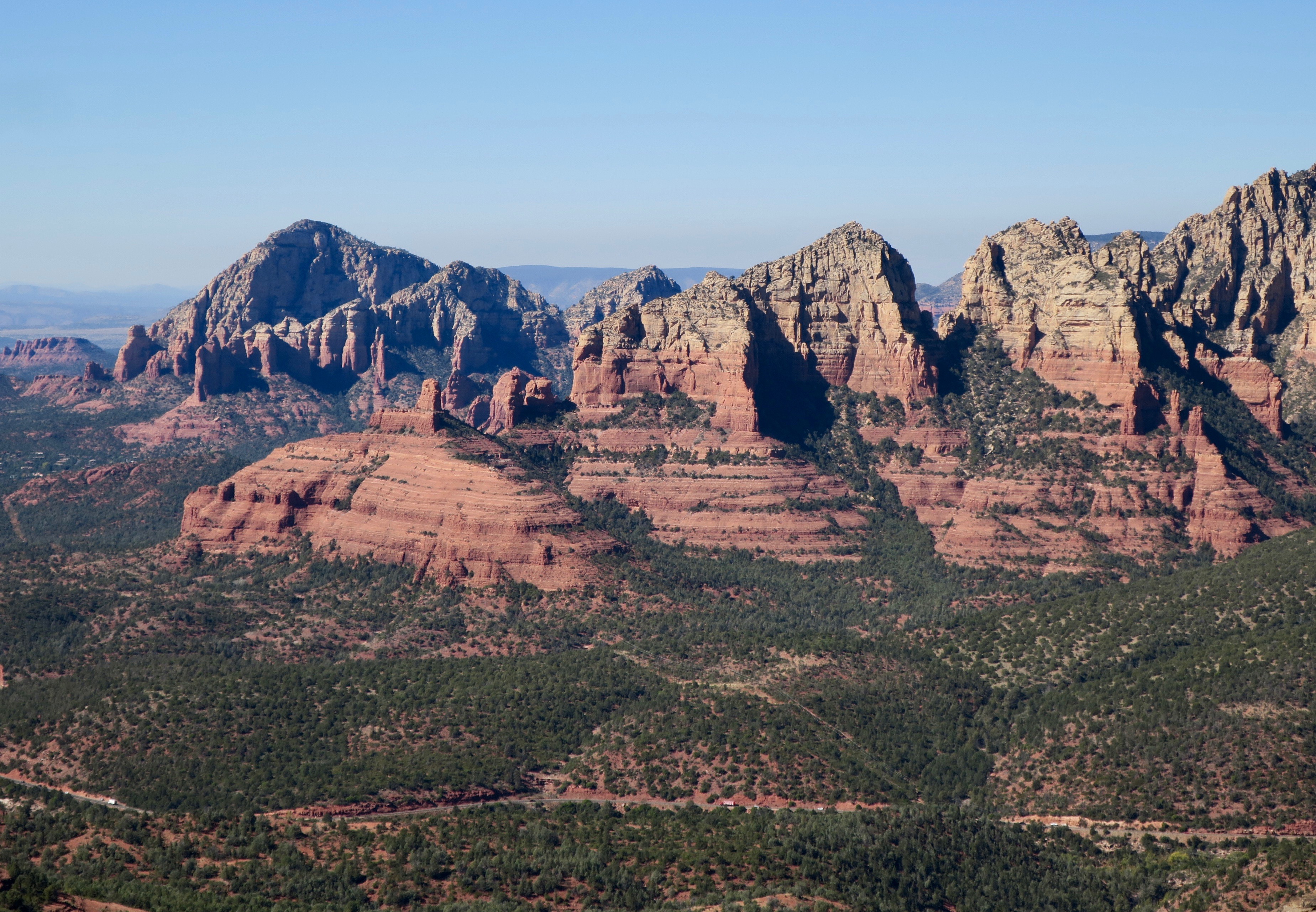
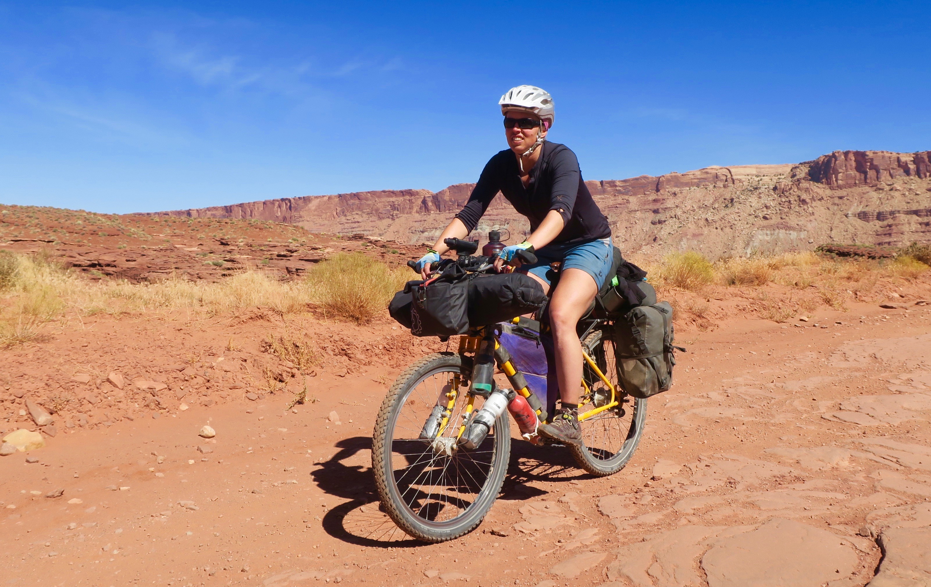
4. American West (2019)

Why?: As a teenager, I always dreamed of visiting the American West – especially the Southwestern desert with its spectacular red rocks and canyons. In 2019, I ended up following the newly created Wild West Bikepacking Route with some further detours into Utah. I passed through very interesting small towns and saw spectacular scenery. Even though the USA has a decently high population density, I cycled through large tracts of wilderness. Utah was an absolute highlight of my journey and is now one of my favourite places in the world. The American people were always friendly and kind. I didn’t pass through any town without someone coming to chat to me to give me their support or offer help if needed.
Route: I followed the Wild West Route through Montana, Idaho, Utah and Arizona to the Mexican border. I also did some detours in Utah via Bears Ears Loop and Plateau Passage.
Camping: Wild camping was very easy along the Wild West Route, as a lot of it is on public lands. It was notably more difficult in southern Idaho and northern Utah due to all the private land. Montana and Idaho in particular had a ton of free and well maintained state campgrounds.
What bike?: I used my trusty Thorn Nomad Mk2 with Schwalbe Marathon Extreme 2.25” tires (now discontinued). It worked well. I would recommend a fully rigid bike or hardtail with 2.2-2.5” tires. The ride is not technical, but there are plenty of very rough and rocky roads and ATV trails. I have not ridden a plus bike before, but the route creators mention tires larger than 2.5” are not necessary for the route. Tubeless tires are also recommended for Arizona, but I used sealant in my tubes (added in Moab, Utah) and had no flats for the whole trip.
Dangers and Annoyances: Montana and parts of Idaho are in grizzly bear country, so it is recommended to carry bear spray. There are also black bears in Utah and parts of Arizona. Never keep food in your tent and hang it high in a tree, especially in Montana and northern Idaho. There is very little traffic on the Wild West route.
When to go?: I started in the Canadian Rockies in mid August and arrived at the Mexican border in early November. I found this to be perfect timing and had very little rain. It is a good idea to be out of Southern Idaho by late September before the snow comes. I had some very cold nights in Northern Utah in early October, one night at -10C in Soldier Summit. By this time of year, snow can return to the higher elevations in Utah. Starting the Southern Arizona section is unwise between May-early September and temperatures can exceed 100F.
My stories HERE
5. Indian Himalaya (2015)
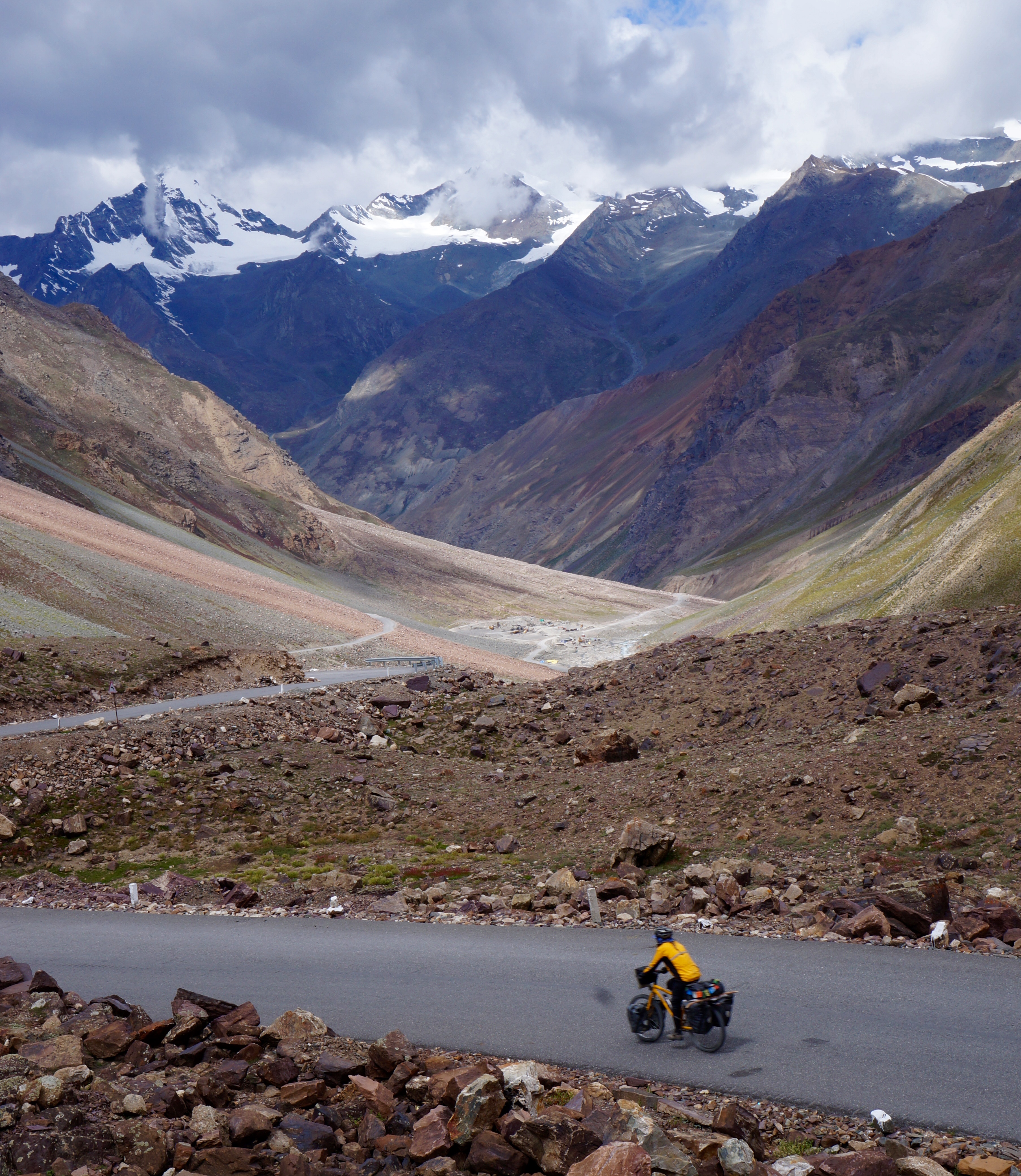
Why?: Like the Karakoram Highway, the Manali to Leh highway is one of the most famous cycle touring routes in the world and rightfully so. It is epic and colourful mountain scenery at almost every turn. The Indian Himalayan region is also one of the strongholds for authentic Tibetan Buddhist culture. During China’s Cultural Revolution in the 60s and 70s, this part of Tibet was spared. While centuries old monasteries were destroyed in China’s Tibet during this time, many on the Indian side were spared. Another highlight (and massive challenge) for a cyclist is the crossing of the Taglang La pass at 5328m, the highest I have ever ridden on a bike.
I biked these routes with British round-the-world tandem team Marcus and Kirsty of shesnotpedallingontheback.com. I met them on the road in Amritsar.
Routes: Manali to Leh, Spiti Valley. Srinagar to Leh – taking the high road above Lamayuru is highly recommended. Check out Laura Stone’s Himalaya by Bike for route inspiration.
Camping: On the Manali to Leh highway I did a combination of camping and stays in parachute tents. These tents are set up temporarily in the summer months. Here, you could order meals and snacks and sometimes sleep. I was travelling with a British couple whom I had met in Amritsar. I am not sure if it would be best for solo women to sleep in these tents because of the truckers passing through. In the Spiti Valley I mostly stayed in guesthouses which were plentiful and cheap. The same goes for the Kinnaur Valley region. On the Srinagar to Leh road in Kashmir, camping is not recommended due to security concerns and military presence.
What bike?: It is an ever-changing mix of smooth paved road, very rough “paved” road and rough dirt. I think a sturdy touring bike is fine, with 1.75” tires or larger. Again, I had my Thorn Nomad with 2.15” Schwalbe Marathon Mondial tires.
Dangers and annoyances:
Traffic: There is a fair bit of truck traffic on the Manali to Leh road. Think cliffhangers and hairpin turns. When a truck is coming, it is best to get out of the way. In India, “big is boss” – no one is yielding to pedestrians or cyclists, but it is the other way around. This can take some getting used. The Spiti Valley had very little traffic.
Altitude: You will cross several passes over 5000m and acclimatization needs to be taken seriously. Know the symptoms of altitude sickness and do not ascend higher if you are not feeling well.
Stomach sickness- India is unfortunately know to give travellers many stomach bugs – dysentry is a common one. I recommend carrying an electrolyte solution like ORS (oral rehydration sachets). Hard one to avoid.
When to go: Late June to late September for all routes. After this, the passes will be blocked with snow and the roads will close.
My stories HERE
6. Carretera Austral, Chile (2013)

Why?: I have heard that in recent years, the experience of cycling this road has changed considerably. More and more of it is being paved and some have complained of “heavy” traffic. This is hard for me to imagine, because in 2013 I maybe saw a few cars per hour on most of the route. I guess with its increasing popularity, it may be losing its charm. But in 2013, it was paradise. Lush forests, mountains, glaciers, waterfalls and the odd estancia (ranch), the Carretera Austral was an amazing dirt road ride. It was rugged, lonely and remote. Built in the 1970s, it connected a number of remote communities in Chilean Patagonia that were previously only accessible by boat. I biked this route with my dear friends and world cyclists Marianne and Heidi of Danish World Ventures.
Route: The road runs 1240km from Puerto Montt to Villa O’Higgins. There are several ferry crossings along the way.
Camping: Lots of wild camping opportunities and some paid campgrounds. My friends are I were invited in by locals on a few occasions .
What bike?: Although the route is steadily being paved, there are still some significant dirt sections. In 2013, under 200km of the route was paved. I would recommend a sturdy touring bike or mountain bike with 1.75” tires minimum. I had my Thorn Nomad with 2.15” Schwalbe Marathon Mondial tires.
Dangerous and annoyances: I can’t really think of any.
When to go: Patagonian summer from November to March. I went in March, which seemed like an ideal time of year, because fall colours started to come out and there were fewer tourists. Be prepared for rain.
More photos HERE
7. Friendship Highway, Tibet and Nepal (2011)
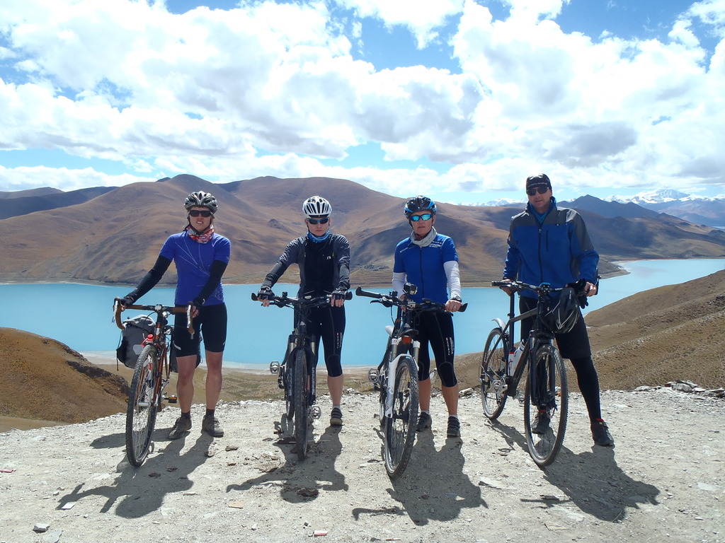
Why?: This was my first bike tour overseas, so it will always have strong sentimental value. This was a supported trip as it is not legal for foreigners to travel this road without a guide and driver. I remember seeing a photo of the piercing blue Yamdrok Lake in Tibet (shown in photo) in the Adventure Cycle Touring Handbook. I then knew that I had to go to Tibet. I got to see the iconic Potala Palace where the Dalai Lama once lived, many beautiful monasteries and magnificent vistas of the Himalayas. There was also an exciting side trip to Everest Base Camp on the Tibetan side (this may be closed off now). Sadly, the TAR (Tibetan Autonomous Region) is heavily controlled, with several police checkpoints and locals living under constant surveillance. Encounters with the Tibetan people were very special and this is probably one of the most spectacular roads I have ever cycled. There is also a famous 4000m decent from the Tibetan plateau to the lowlands of Nepal, supposedly the world’s longest.
I also met two of my dearest friends and world tourers Marianne and Heidi from Denmark on this trip. We met over Lonely Planet’s Thorn Tree forum, where I was in search of a group to ride this route to lower the cost of the mandatory support.
Route: 1100km from Lhasa to Kathmandu. At the time, it wasn’t possible to cycle the route unsupported.
Camping: A combination of wild camping and inexpensive guesthouses
What bike?: The road is paved, except for the side trip to Everest Base Camp, so you don’t need anything too rugged. I had a Trek 520 with 700X35C tires, which worked fine, except when it snowed after leaving Everest Base Camp!
Dangers and annoyances: High altitude. There are five passes over 5000m on this route.
When to go: September to early November is a good time to avoid Monsoon season in Nepal.
More photos HERE
8. Pamirs, Tajikistan (2015)
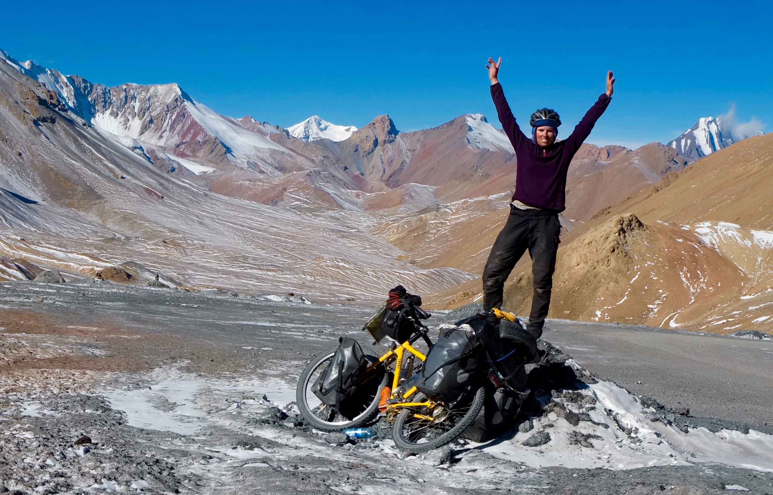
Why?: A definite classic in the bike touring world. Spectacular mountains, remoteness and the wonderful hospitality of the Tajik people. These people eke out a harsh existence in an extreme environment. You get an an insight into a unique culture where mass tourism has not yet hit. In the summer months there will be many cyclists.
Routes: Dushanbe to Khorog and through the Wahkan corridor, which follows the border with Afghanistan, just across the Panj river. You traces the curves of the river through the narrow and deep valley, with views of the mountains. Travelling in the fall is especially colourful with the trees that dot the roadside. The remote Upper Wakhan Valley was a highlight. I also really wanted to ride the Zorkul route, but had to turn back due to sickness. I have heard this section was a highlight for some cyclists in the area. For an easier, paved option take the paved Pamir Highway from Khorog to Osh.
Camping: Wild camping is possible in this areas, with many options for local homestays along the way. I used this option when the weather turned colder in fall. Meals are often included in the price – in 2015, room and board was around $10 or less.
What bike?: A sturdy mountain or touring bike is recommended with at least 2” tires due to the rough roads that are a mix of dirt and paved.
Dangers and annoyances: In 2018, there was a brutal attack on four foreign cyclists in this area by the Islamic State. When I cycled there in 2015, I had heard about the risk of possible civil conflicts, but that it was generally a safe area for foreigners. The 2018, story was truly horrible to hear. The area had a somewhat heavy military presence when I was there, but I never felt unsafe. I was stopped at military checkpoints, but mainly for selfies with soldiers. I was asked the usual questions of the whereabouts of my husband and children (Tajikistan is a Muslim country) but I never felt threatened. I almost got bribed at one checkpoint, but I acted confident and nothing happened.
High altitude is also a concern, as a large chunk of the route is over 4000m. Proper acclimatization is very important.
I had stomach issues on a few occasions. Like in India, this can be a tough one to avoid with the local food, which is normally of low quality.
When to go: This is definitely a summer route. Late June to early October is best. I got caught in a heavy snowstorm in late October tying to cross the Kyzyl-Art Pass into Kyrgyzstan and had to hitch a ride across the border.
My stories HERE
9. Great Divide Mountain Bike Route, Canada Section (2019)
Why?: I have always travelled far and wide for my bike tours, never really taking the time to explore my own country. In 2019 I cycled from Canmore to the USA border via the Great Divide Route, where I connected with the newly formed Wild West Bikepacking Route. This section passes through a spectacular part of the rockies, with very low traffic. The Elk Lakes FSR and Flathead Valley road were two of the most spectacular and exciting roads I have ridden in North America.
Route: The Canadian section of route nows starts in Jasper and runs all the way to the USA border. In 2018, I biked the section from Hinton to Banff before I had to quit my planned Great Divide ride due to an injury. The majority of the route is off-road, following forestry roads and some non-technical single track.
Camping: Lots of opportunities to wild camp, but this is bear country, so it is very important to take the necessary precautions. Around the Spray Lakes and Kananaskis area there are lots of paid campgrounds that are very busy in summer. I avoided these and chose to stealth camp instead near some MTB trails. There are a few free cabins to stay in in the Flathead Valley section. Due to the high concentration of grizzly bears in the area, I think this option is best.
What bike?: Touring bike or mountain bike with at least 2” tires. I had a hybrid bikepacking/touring set up and this worked well for me. I think packing light is the most important.
Dangers and annoyances: Bears! Many of them. It is very important to not leave food in your tent. Hang your food at least 100m from your campsite and in a tree high off of the ground. It is highly recommended to carry bear spray. When riding occasional yell or make some kind of noise so that the bears are aware of your presence and you are less likely to surprise them, which could trigger a defence attack. I came across a grizzly bear with 2 cubs on a powerline trail. I got off my bike, backed away slowly and found another route around the bears.
When to Go: In summer/early fall from late June to early October. Before and after these months the route can be covered in snow.
My stories HERE
10. Myanmar (2016)

Why?: For years, this country was largely closed off to foreigners under the rule of a military dictatorship. Biking through this country was an absolute joy, mainly due to its incredible people. I have never encountered so many smiles and so much enthusiasm from locals. Almost everyone seemed to be super excited to see me, all the time. There are some incredible sights to see, such as the temples of Bagan, but for more the highlights were getting off the beaten track and into the smaller villages.
Routes: To be honest, a lot of the scenery in the country wasn’t particularly exciting except for the ride through mountainous Chin State. This was a particularly exciting ride because it was technically off limits to foreigners without a special permit and guide. I ended up sneaking my way in before eventually being politely escorted out (after an invitation to spend the night and have dinner with a local politician and his family). Story here.
Chin state was definitely was of the most off the beaten track places I have ever travelled, where few foreigners have gone.
Camping: Wild camping is illegal in Myanmar, but I ended up stealth camping a few times. Foreigners (in 2015) were only supposed to stay in hotels. I ended up in the home of a local once, where the police seemed to turn a blind eye. Some cyclists stayed at monasteries. This is trickier for solo women, who are not permitted to stay with the monks. I did hear reports of some finding nunneries to stay at.
What bike?: Most bikes will be fine, other than a road bike. The roads in Chin State were very rough, so 2” tires are recommended. There are quite a few paved roads in the country.
Dangers and annoyances: Landslides in Chin State during the rainy season. Other than that, I can’t think of any!
When to go: December to February is the dry season and the cooler time of year. I was there in March and found it to be pleasant in the mountains, but unbearably hot in the lowlands.
My stories HERE
Where I want to go next…
-Peru’s Great Divide
-Puna of Argentina and Chile
-Namibia (I haven’t been anywhere in Africa before)
-Georgia (country, not the US state)
-Great Divide USA (I loved cycling across the USA so much that I would probably do it a second time!)
-Baja Divide, Mexico
-Japan
-Iceland
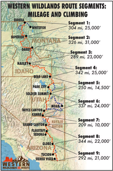
I recently wrote an article for bikepacking.com about last year’s trip on the Western Wildlands Route. I was really excited to contribute to this awesome website. Check it out!
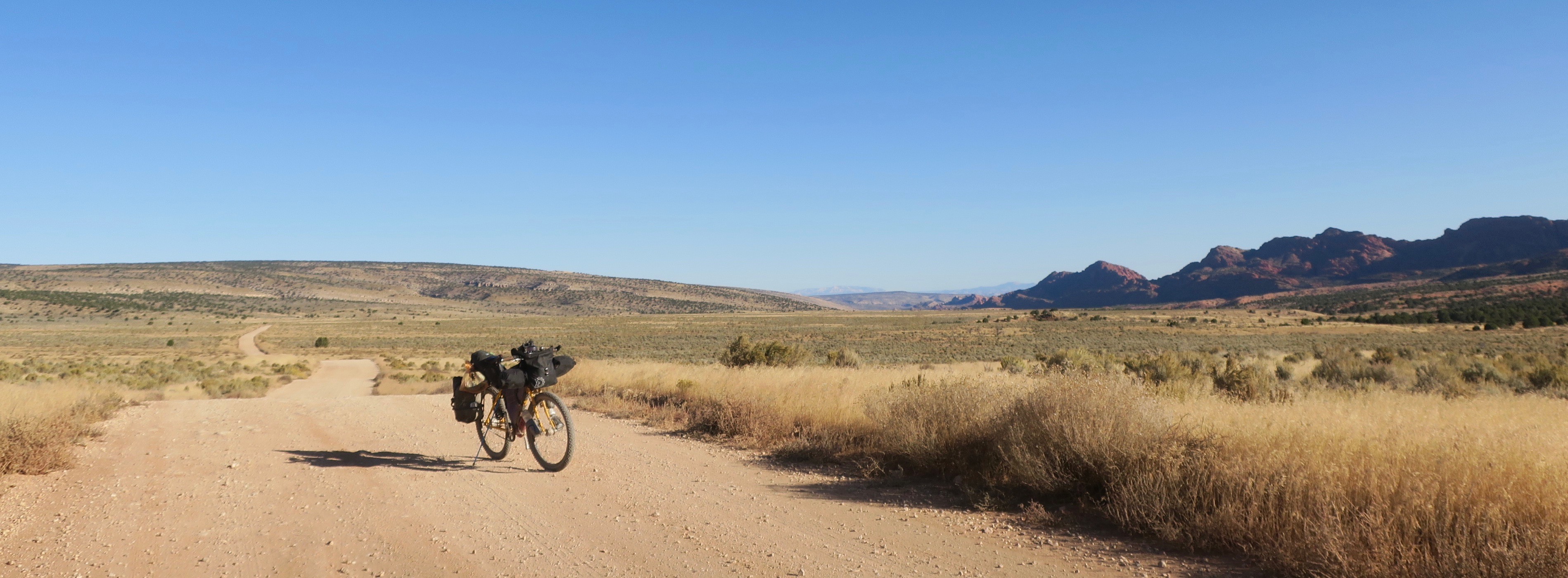

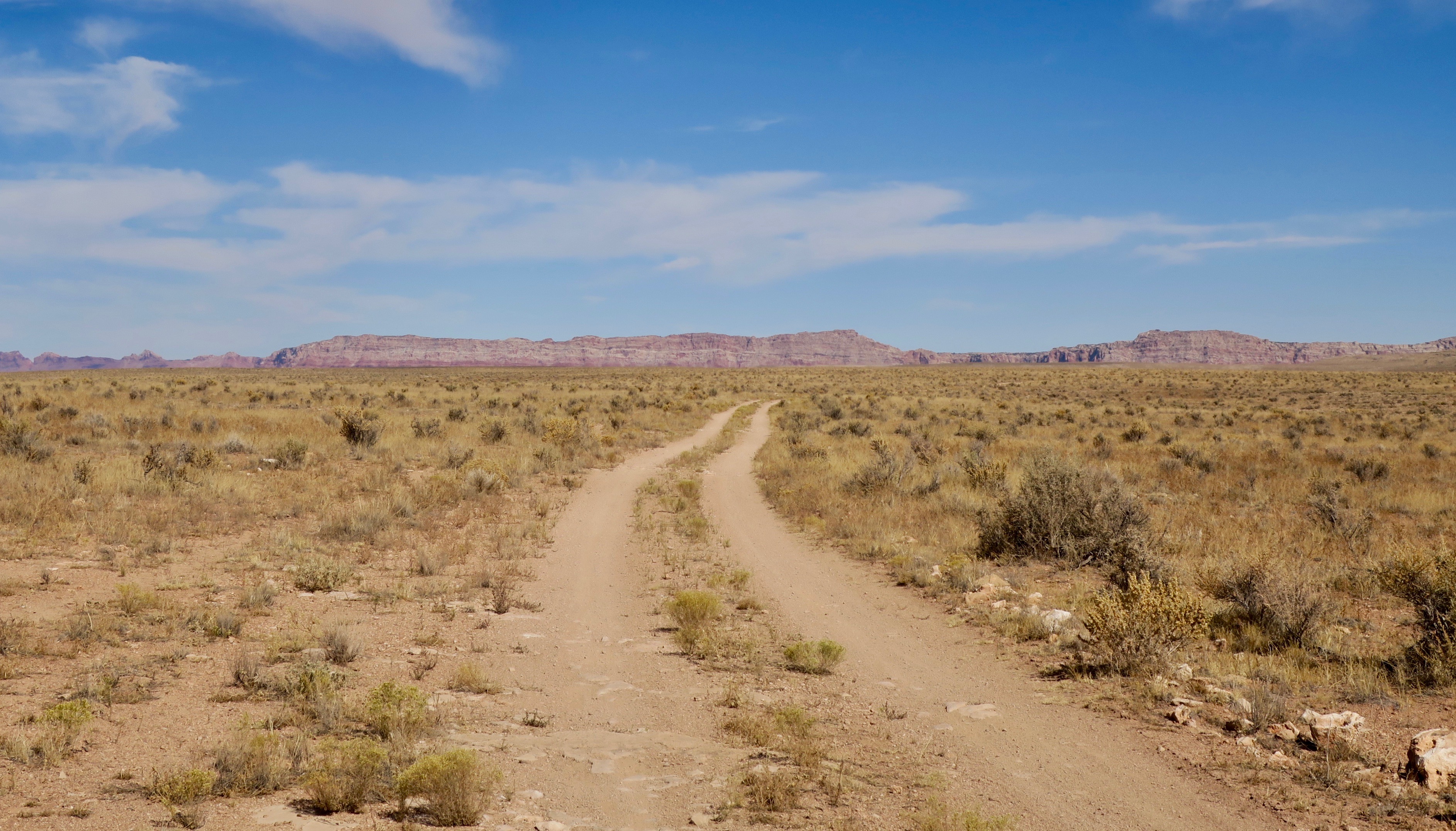
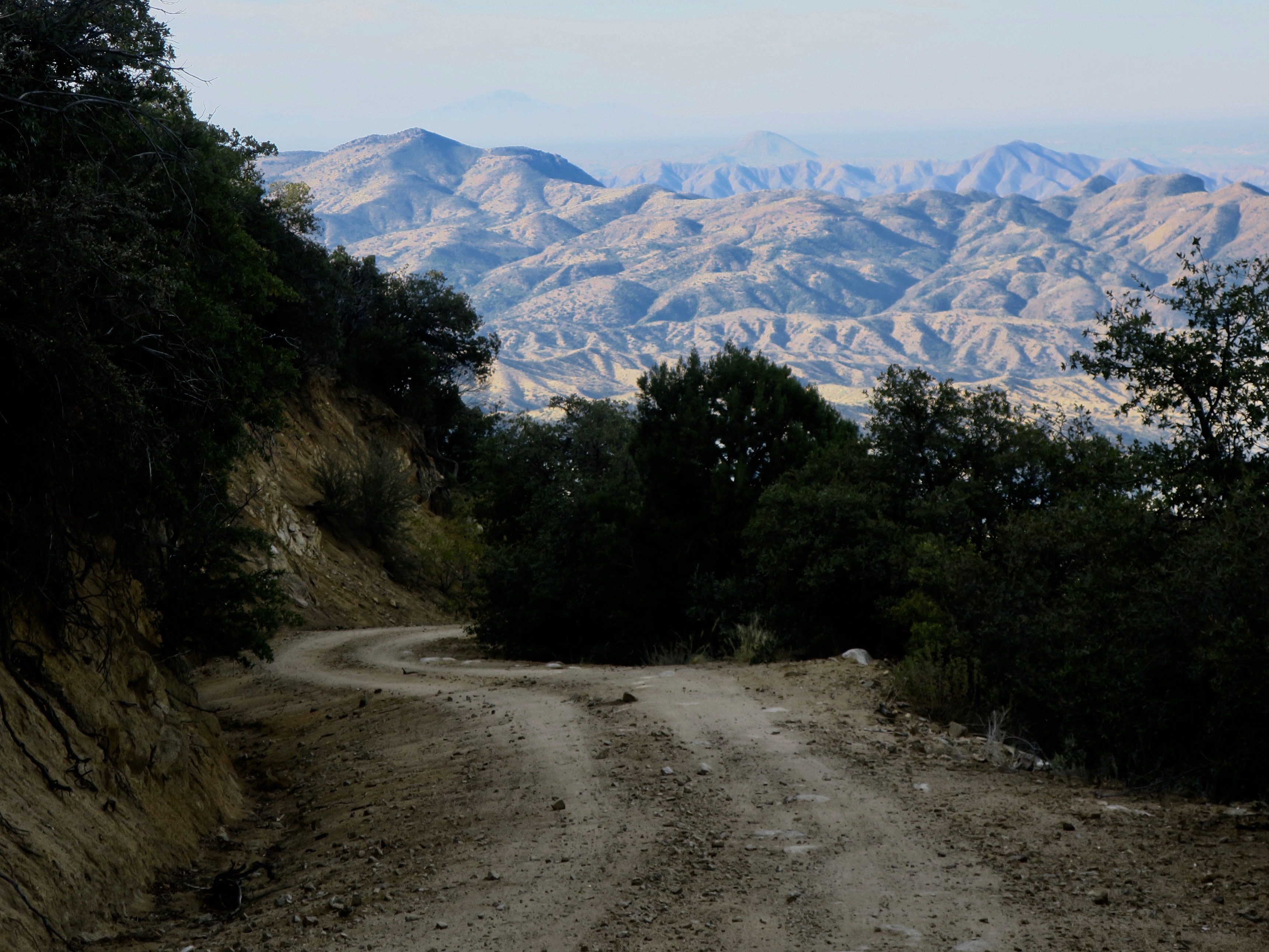
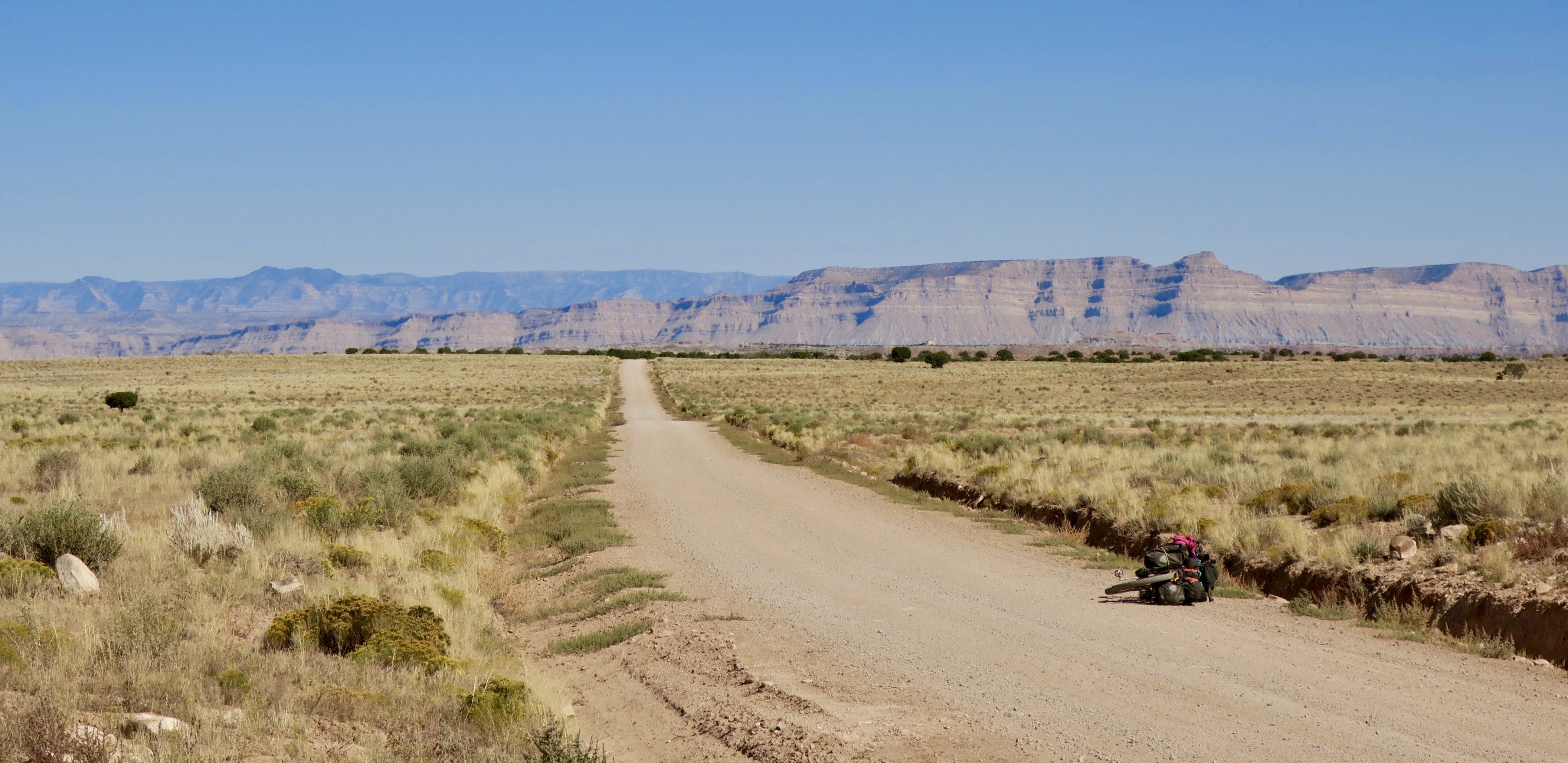
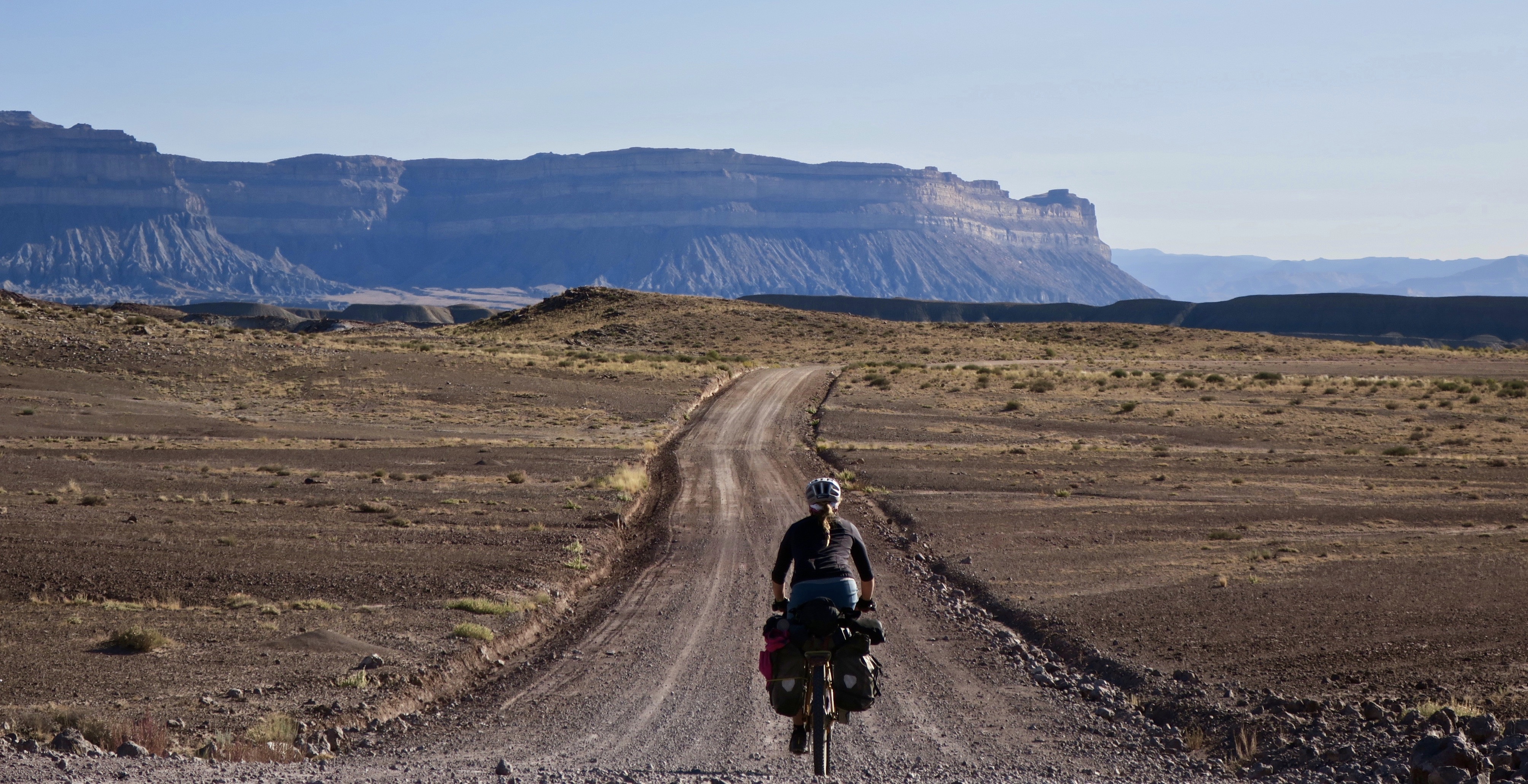
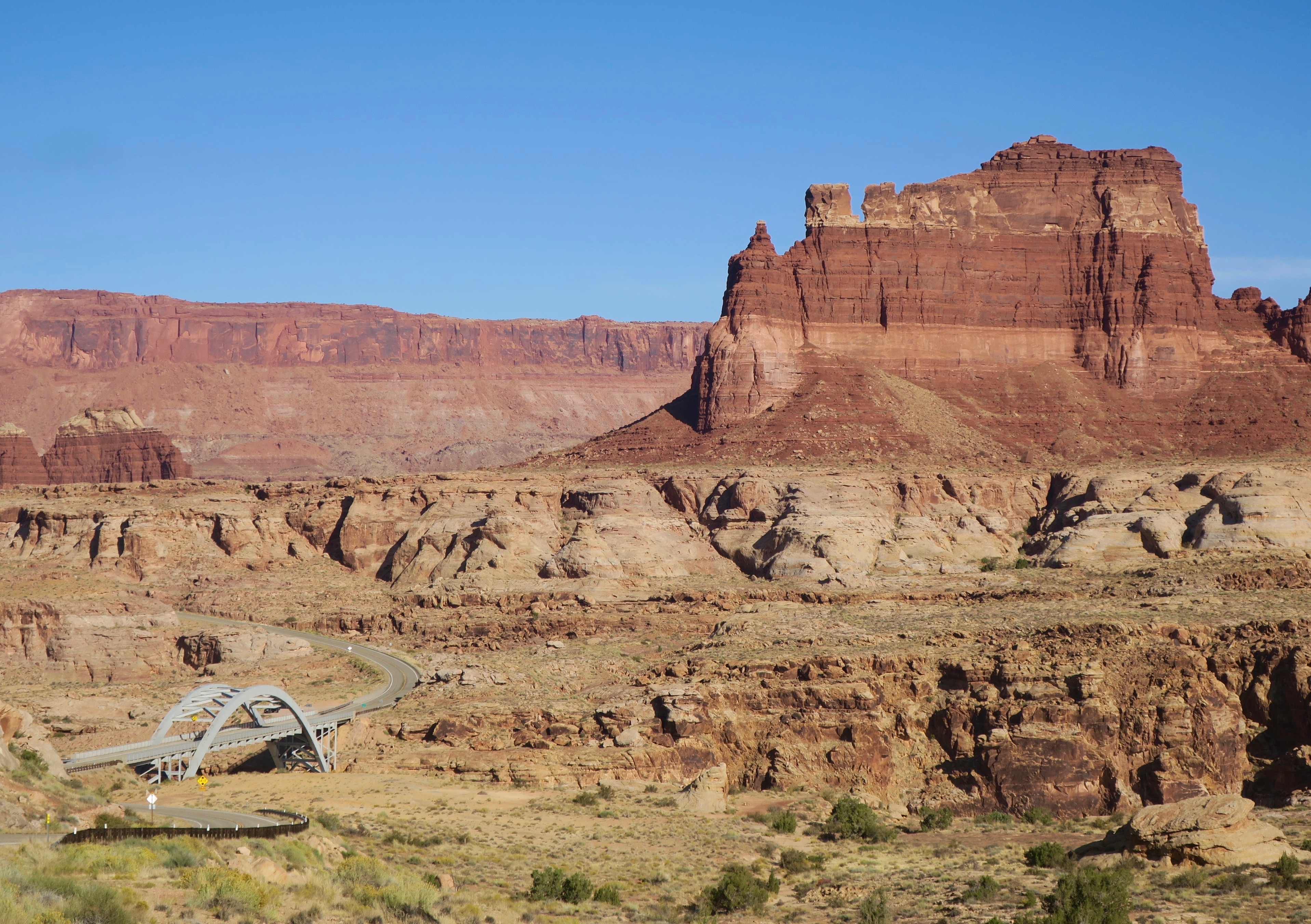
The kingdom of the sagebrush extended its reach as I entered Arizona, final state of the trip. Some miles after leaving Kabab, Utah I turned my tires back onto a new strip of dirt carving its way into another vast and empty landscape. Dry hills sparsely dotted with vegetation drew me into the distance. I came across a lone pickup truck, the only vehicle I saw the rest of day. The nice couple inside offered me water, saying that they came from “over the mountain,” pointing to the hills in the distance where I was headed. The gravel track lead to some steep climbing through Juniper woodlands to the northern end of the Kaibab Plateau.
Descending into the House Rock Valley, I passed by a California Condor release site. There was a retired couple there, both avid birders. They had a telescopic type lens set up and invited me to take a glimpse of a condor perched high on a cliff. I have seen Andean Condors in the past and it was exciting to have another siting of this absolutely massive bird.
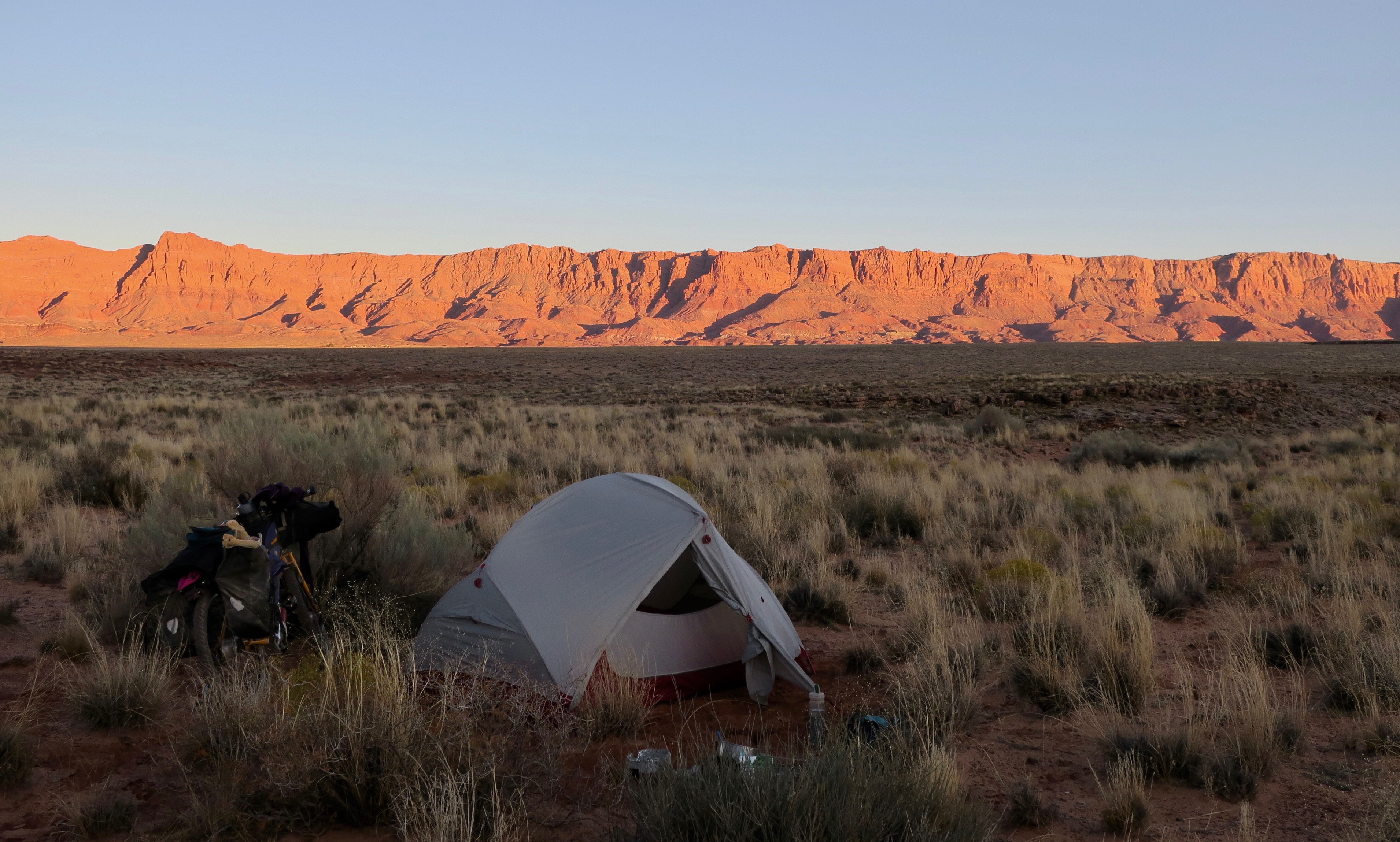
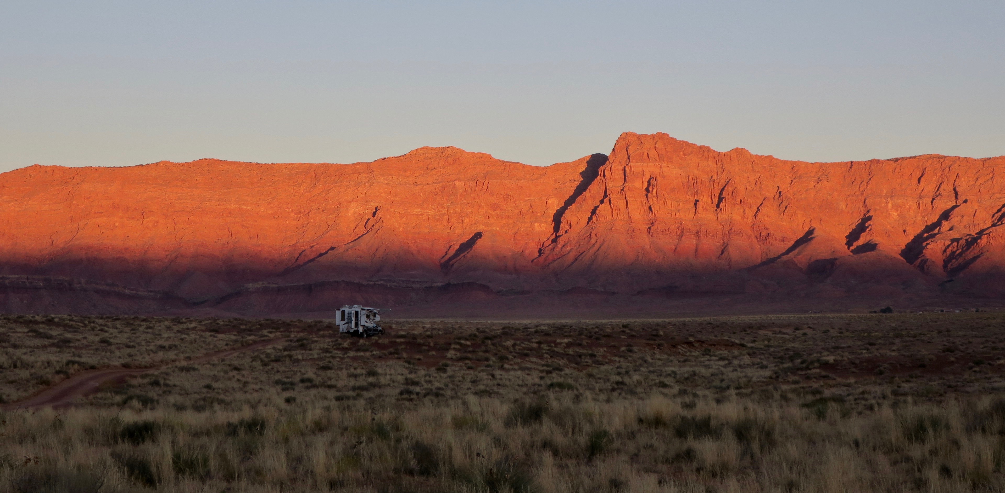
I continued cycling into the shadow of the Vermillion Cliffs – powerful and imposing. I stared at the rocky giants in all of their glory at sunrise the following morning. I emerged from my tent into the cold morning air to see a spectacular projection of colour onto the faces of rock.

Vermillon Cliffs, Arizona at sunrise

Only a few days in and I was already in awe of the landscapes of this state. I was now on a tighter time frame as I had spent more time exploring Utah than planned. I had already cycled for two weeks non-stop and in order to make it to the Mexican border and in time for my November flight home, I basically had to continue almost non-stop for another three weeks. My body was tired, lips sore and blistering from the powerful UV rays. But my enthusiasm to explore was stronger than ever. I would push as hard as my body would allow me to.
I was now approaching Navajo Nation, one section of the Western Wildlands Route I was really looking forward to. This area is all private land, but Western Wildlands Route riders were granted special access to the land with the purchase of a mandatory backcountry permit. Its conditions involved only cycling the designated GPS route and only camping in certain spots, marked by GPS waypoints. Not long after I left the highway to turn onto the reservation, I was stopped by a woman in a pickup truck, who told me to turn around, insisting that I was trespassing. I politely argued, saying that I had been granted special permission and possessed a permit. It took a while to convince her, but after allowing her to take a photo of my permit, she eventually left. Even though I knew I was 100% allowed to be there, I still felt pretty uncomfortable after the encounter. These thoughts eventually drifted away as I pedalled further away from the highway onto another vast and empty landscape.
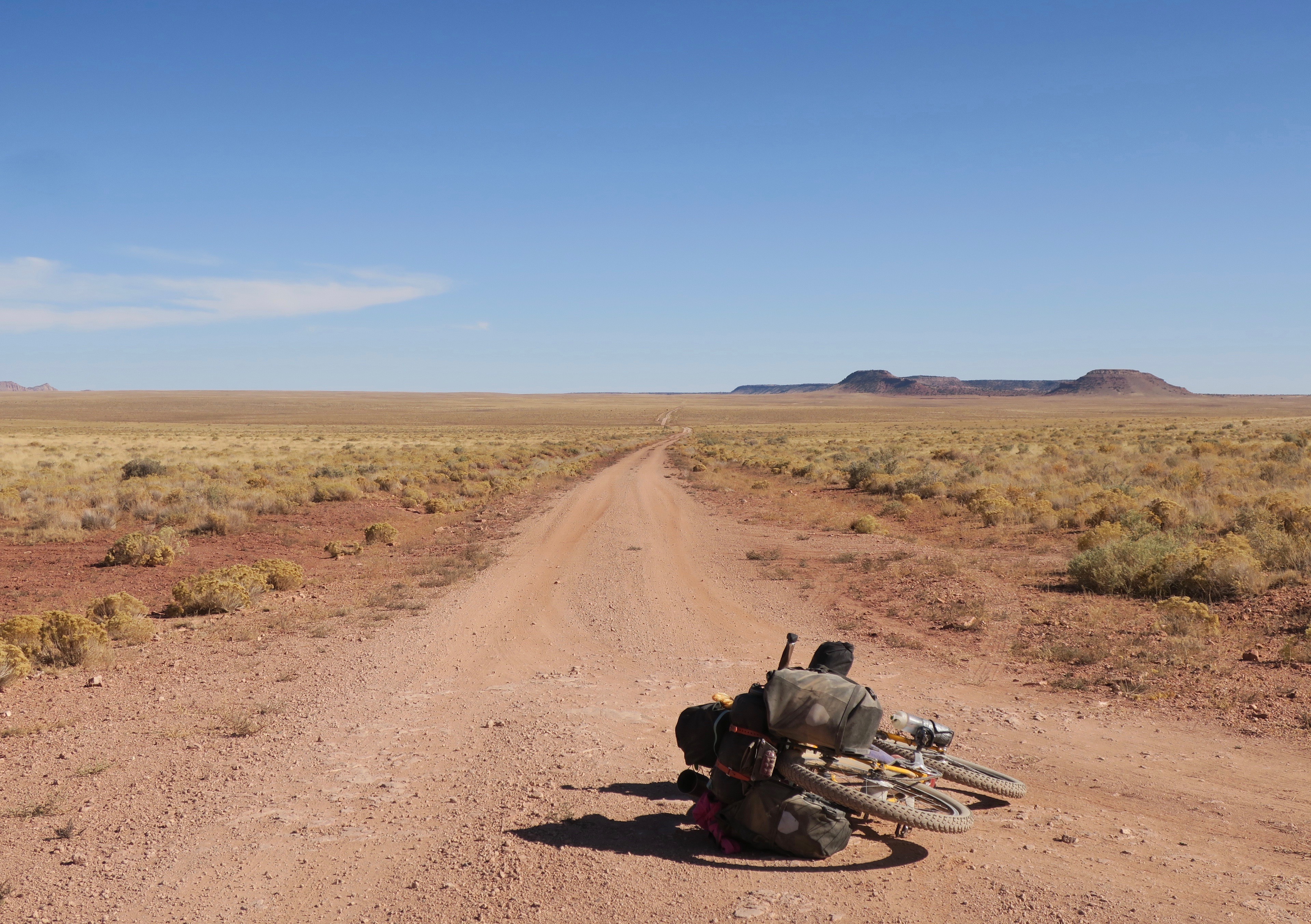
Big skies, big landscape on the Navajo Nation, Arizona
Along meandering dirt tracks and trails, I traversed high rolling grasslands and desert. The odd singular formation of crimson-coloured rock swelled to the surface. While some of the dirt roads were rough and washboarded, others were among the smoothest of the trip. Out in the distance I could see the odd Hogan, the traditional Navajo dwelling. Later, I came across my second vehicle of the day. It was a beater of a pickup truck hauling a large water tank. There were four or more children crammed into the front. I didn’t even see the driver. A young girl closest to the passenger window asked me where I was going. “We’re bringing water to our house!” she said. Then, the truck starting moved again, leaving a horizontal dust tornado behind. I would imagine life out there to be harsh – being in a desert, all water would have to be brought in. I myself was carrying a three day supply on my bike (12.5 litres).
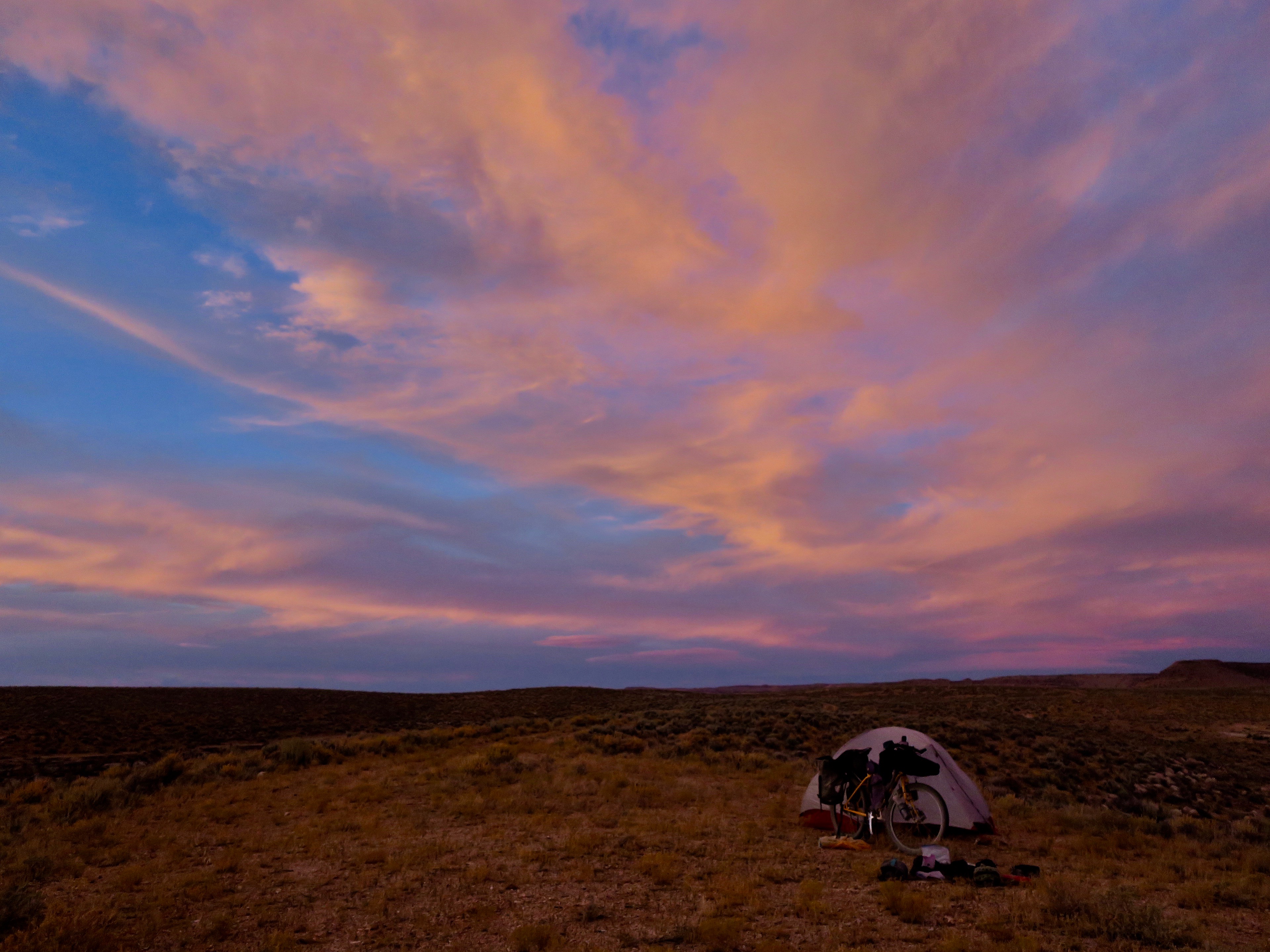
I arrived at one of the designated campsites. It wasn’t developed or signed in any way. It was merely a section of flat ground high up on a rocky, exposed area. The wind was strong and whipped up sparse clouds of dust and tiny rocks. The land empty, largely void of civilization with only one lone hogan to be seen far in the distance.
After I finished setting up my tent, an extraordinary thing happened. The wind died instantly. The sun was beginning to set, casting out streaks of oranges, pinks and purples across a still piercing blue sky. High on that ledge, the fierce colours surrounded me 360 degrees. If I were a religious person, I might say that at that moment, God revealed itself. I felt so incredibly small and all I could see and feel was sky. I also suddenly felt intense loneliness. I wanted someone to be there with me to be able to grasp the power and magnitude of what I was experiencing. Eventually, the blue deepened to navy, then to black and the brilliant colours faded into darkness. It turned into a silent, starless night.

Amazing skies camping. Navajo Nation
The next day, I passed through more parched and desolate landscapes, only coming across one other person on the reservation in a truck. I pedalled past groups of wild horses, who were often spooked by the sight of me. “Quit scaring the horses! “ the friendly man in the pickup laughed. “I’ve seen it happen lots – they don’t seem to like bicycles or motorbikes.” He lived on the reserve and was just returning from a run into town. At the this point I was pretty close to the highway again. The Navajo Nation crossing had been a true highlight of the journey.
The route did its best to avoid busy Highway 89, taking small dirt detours where it could. I got to touristy Cameron and its trading post, where throngs of people flocked en route to the Grand Canyon. It is always a bit of shock to arrive in places like this, especially after the mostly uninhabited Navajo Nation section I had crossed. The only official camping on offer was an RV park across the highway for $15/night with no bathroom or facilities. The desk clerk at the hotel said that I could camp behind the gas station for free, which was the overflow area for RVs. I set up my tent on a small dirt patch in the parking lot. I pulled out my earplugs I had purchased for my first gas station camp out at Soldier Summit, Utah. I eventually fell asleep; the nocturnal diesel hymns of the highway fading away into dreams.
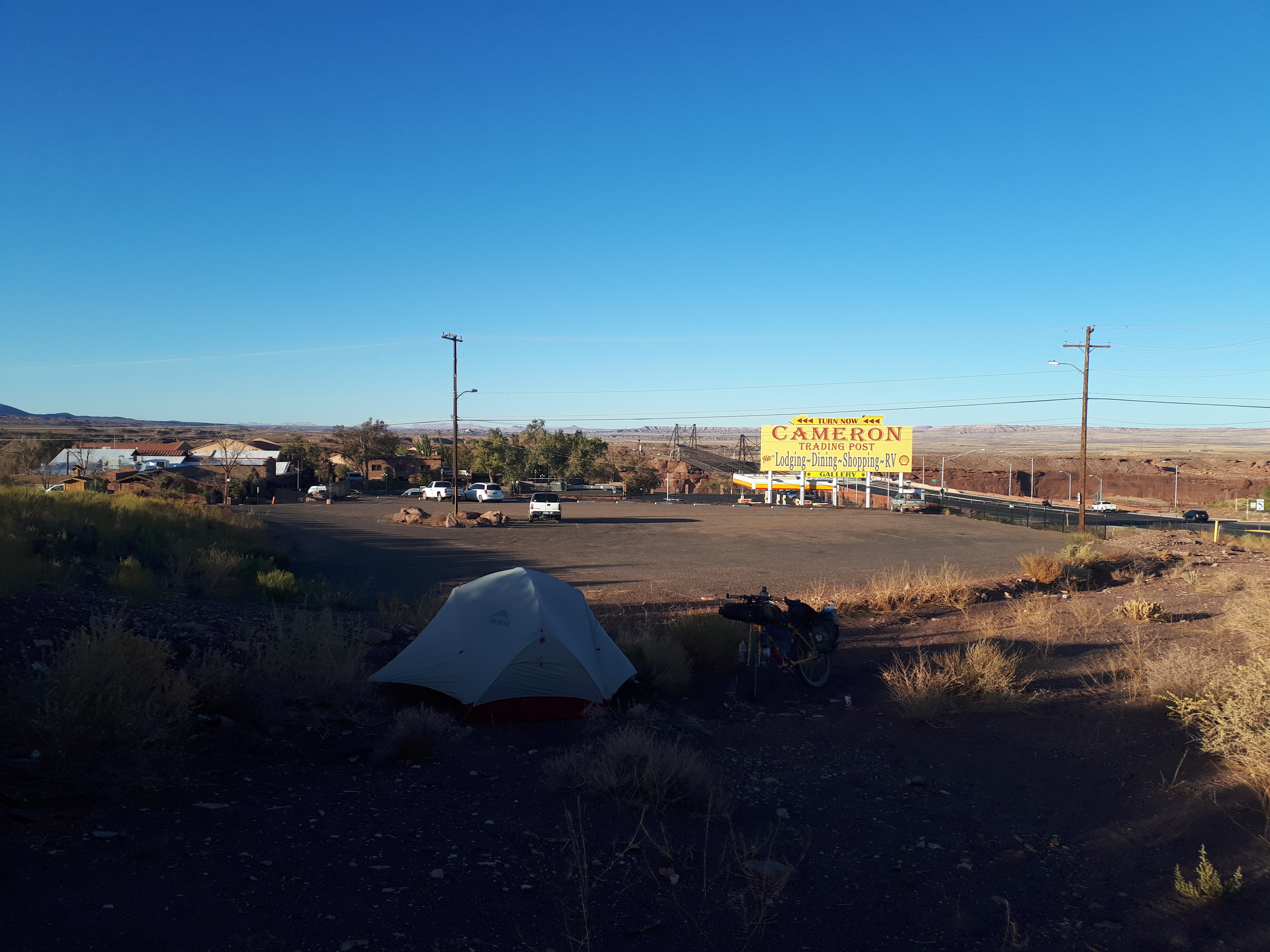
Gas station campout #2 – Cameron, Arizona
After a breakfast of instant noodles, I headed towards the Grand Canyon. The route passed through Little Colorado River Tribal Park, amongst smaller canyons and gorges. I followed old rail grades, eventually getting to a gate across the highway with the sign: ROAD CLOSED. There was a gap just large enough to squeeze a bicycle through. This led to an old tarmac road with faded yellow lines and large cracks through its surface. Nature had begun to reclaim it, with greenery forcing its way through the openings and into the light. It felt eerie and post-apocalyptic.

Abandoned old highway en route to the Grand Canyon
I climbed most of the day, eventually reaching the Grand Canyon. It was certainly an impressive sight, but I will admit that I wasn’t overwhelmed the way I was with Bryce Canyon. Perhaps this was because of how intangible the size of it was from my viewpoint. At 277 miles/446km in length and a average of 1 miles/1.6km in depth, I almost think the best way to experience it would be a flight or a hike down into the canyon. The view was still fantastic. I enjoyed watching a few crows using the drafts to coast back and forth effortlessly along the edges.
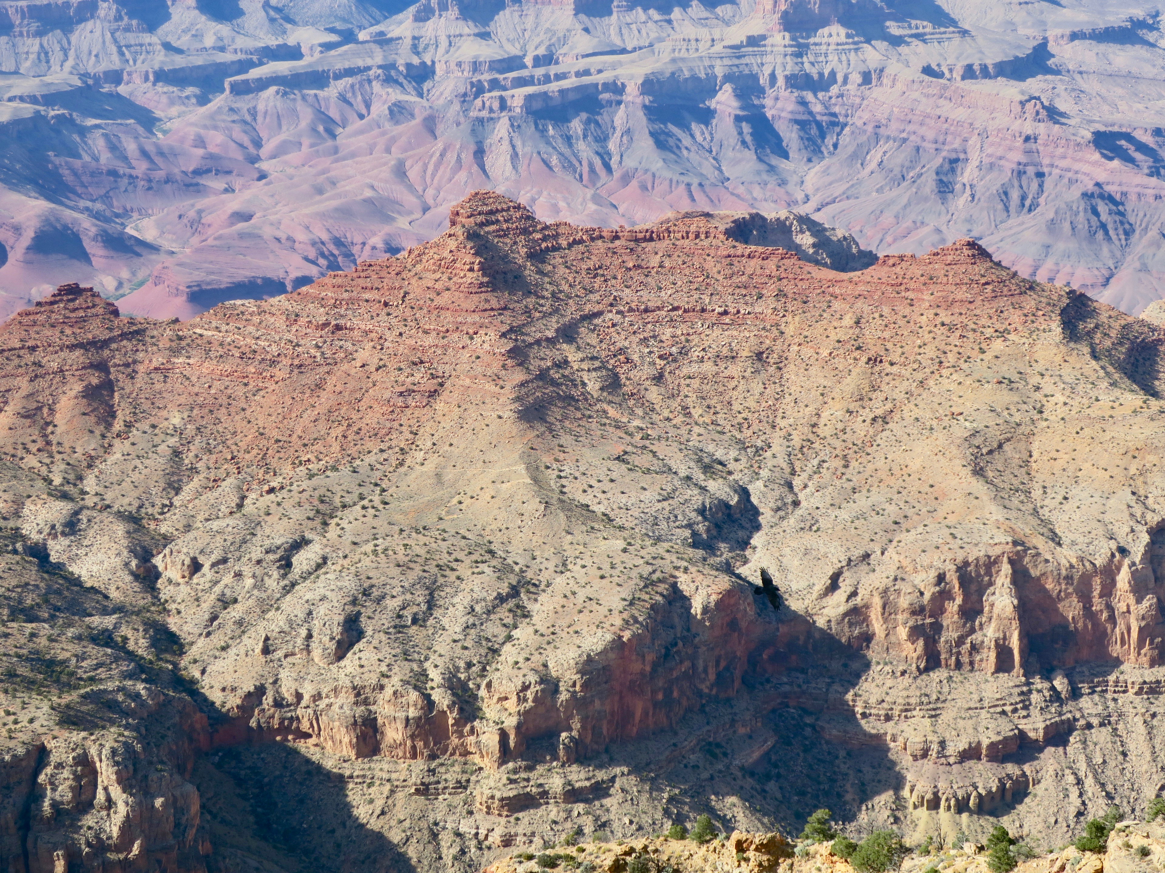
Crow coasting in the Grand Canyon

Grand Canyon at Desert View Overlook
It was starting to get late and I needed to be clear of the park boundary in order to be able to wild camp. It was another chilly evening. I eventually turned off the main paved road onto a pretty gravel road through Ponderosa pines. Like the sagebrush, this tree had become a familiar companion all the way from Montana.

Yikes! Leaving the Grand Canyon..
Wild camping in these parts was very easy, like the rest of the route. Basically, I could just pull off of the dirt road whenever I felt like it. I passed the odd RV’er doing the same, but for the most part I was alone with the pines.
I woke up the following morning feeling very tired. I had been riding for weeks straight and I was starting to feel it. I was ambitious, however and wanted to get to the border in time before my flight. For me, the A to B mode of travelling isn’t usually a motivator, it is about the places I pass through. But, for some reason, I just really wanted to get to the end – to finish the Wild West Route. I had been so focused on being present during the trip – not using social media and only updating friends and family. I wasn’t even listening to music. On that morning I decided to listed to a song by Fleet Foxes, “Mykonos.” I was so moved by his voice that I started to cry. It was a brief moment of reconnection to the power of music. I was ready to keep going.


The mellow riding through the pines stretched on a bit longer – a tunnel of green illuminated by the sun’s rays that brought little warmth, only enhancing the colour. The road turned into rocky double track on the Arizona trail that was probably more suited to a mountain bike. Eventually, it smoothed out into pleasant single track.

The nicer section of the Arizona Trail on the WWR

Leaving the Arizona Trail, I pedalled Lockett Meadow road, golden aspen lining the hillsides. At the entrance to the road was a map outlining the areas for fall colour spotting. It was obviously the thing to do around here, because it immediately went from zero traffic to car after car on a steep climb. I had an amazing view of the green San Francisco peaks. One doesn’t often think of Arizona as being “mountainous”. I was already very impressed by the diversity of the landscape in this state alone.

San Francisco Peaks near Flagstaff, AZ
After pushing my bike uphill along a rough and rocky trail, I came across a guy and girl hiking at the summit. They were mellow in nature and never stopped smiling. The two were from Flagstaff. They gifted me some sun block with zinc in it for my lips when I talked about my ongoing issue with sun exposure. I joked that I must look “road weary.” The guy said, “yes, you look feral, but in the best way.”
It was an amazing descent on the Schultz Pass/Waterline Road and into Flagstaff. Beautiful, but cold. There were green mountains in the distance fringed by acres of charred forest. I decided that I would take a half day off Flagstaff, with a Warm Showers host. I really liked the feel of the little college town and wish I had more time to hang out there in its cosy coffee shops.
It was late October and winter was fast approaching in the area, which meant a possibility of snow in the near future. I had a particularly cold and windy night camping in more pine forest at a higher elevation about the town. Luckily, no snow.
The next day I biked some ridiculously rough roads. The first was a series of rocky ATV trails, where I spent a good amount of time walking, even downhill. I played hopscotch with a couple of hunters in a side-by-side who would stop every now and then. Eventually we met up and they stopped to chat.
“Don’t you ever take a break?” they said.
They two men were out elk hunting and they told me that they were impressed by my bravery. They were also surprised that I wasn’t carrying a gun myself. In general, people in Arizona seemed a little more paranoid about personal safety. The guys were very friendly as I had experienced with most ATV riders on the trip. They just wanted to make sure the crazy cyclist on her own was surviving out in the wild.
After leaving the densely forested ATV trails, I followed the signs to Schnebly Hill Road. It was here that I got my first glimpse of the spectacular pink cliffs of Sedona.
Pink cliffs of Sedona, Arizona

At the summit, the view was incredible. This was the only thing that made the hilariously bad 8km decent on Schnebly Hill somewhat bearable. Without exaggerating, it was probably one of the roughest, rockiest descents I’ve ever done. I think I averaged about 5-6km per hour going downhill. My hands hurt from braking so much and I had to stop often to rest them. Tourists on excursions in pink mini jeeps laughed as they bounced around on the ridiculous surface. If the view wasn’t so spectacular I probably would have complained to the Wild West Route creators!
The town of Sedona itself seemed overly glossy, full of souvenir shops and jewelry stores. I bought an overpriced coffee and pumpkin bread, filled up on water and left. I followed some scenic mountain bike trails that paralleled the highway. From here the landscape began to change again as I dropped lower in elevation. The gangly ocotillo desert plant became a more common sight.

After the ridiculously rough Schnebly Hill Road, I wasn’t too keen when I saw the marked waypoint “very rough road” ahead on my GPS. It must really be rough, I thought if nothing was mentioned about Schnebly hill. Not keen, I turned left instead of right following a dirt road in good condition uphill to the quiet HWY 3. This led to a bit more pavement riding, but I think it was the better option. Not just dirt for the sake of dirt.

Rim Road, Arizona
After a brief stint on paved road, I climbed up to the Rim Road, almost like a mellower version of the Magruder Corridor in Idaho. It was there I met Belgian cyclist couple Daan and Griet. They were on a honeymoon multi month bike trip. They had started riding the Great Divide route, but switched to the Wild West Route in Utah due to late season foul weather. It was great to ride with them. We all complained about Sedona’s rough Schnebly Hill Rd. and talked almost non-stop throughout the day. We enjoyed some beers together, camping in the bush at night. Unfortunately, Griet woke up at around 3am in severe pain. We were in the middle of nowhere, about 40km from the tiny community of Young, with barely any cell service. We managed to flag down a passing truck in the dark. It took some convincing, but the man agreed to take them to find help. They ended up leaving their bikes and camp behind. I heard weeks later from Daan via email. It turns out Griet had an ovarian cyst that ruptured. Luckily, she was treated in hospital and they were covered by insurance.
The very rural community of Young, AZ
Young was probably the most rural community on the route. It had two small hotels, a small shop, gas station and a few other closed businesses. This would be the definition of a “one horse” town. The shop was run by a pretty blonde woman. The older, weathered-looking local residents buzzed around her like flies. I guess this was the place pass the time – people seemed to have plenty of it in this town.
I chatted with the friendly lady for a bit. She had heard about the Wild West Route because she had met a few of the cyclists who were scouting it the previous year. She said I was probably the third or fourth cyclist to have come through this year.
Into the hills about Young, Arizona
Leaving Young, I climbed again high above large swaths of confers and rolling hills. This section to Globe was another great highlight of the journey. The WWR route memo describes a decent to the Salt River and “into the realm of the Sagauro cactus.” That was enough to get me excited. I absolutely love cacti. After a seemingly endless climbing through more pine forests, the road started to descend into a desert wonderland. I marvelled at all the strange and wonderful plants of the Sonoran desert.
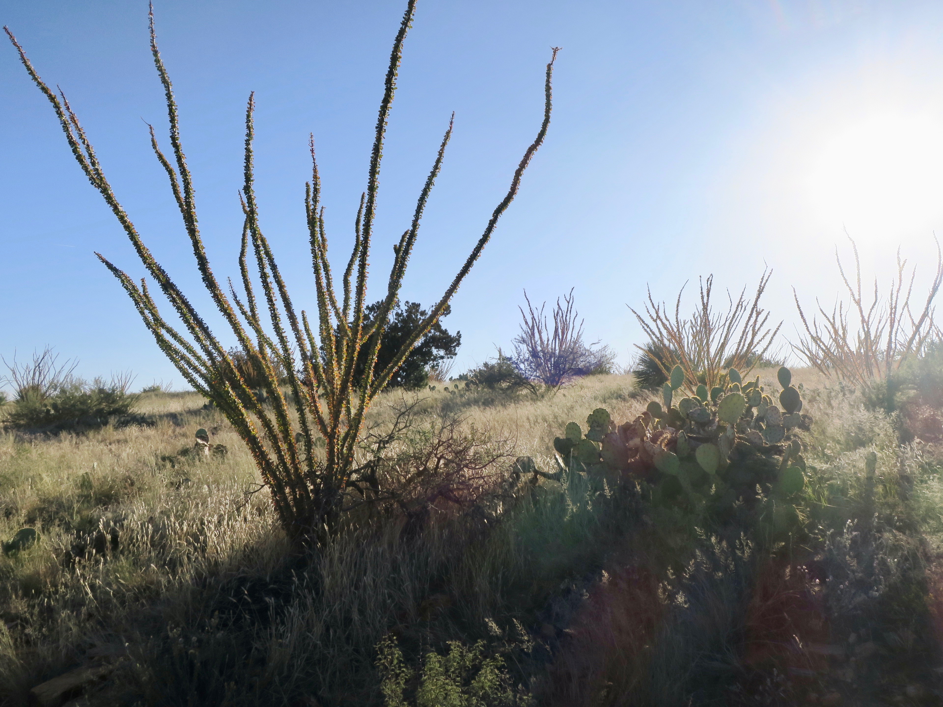
Octotillo plant
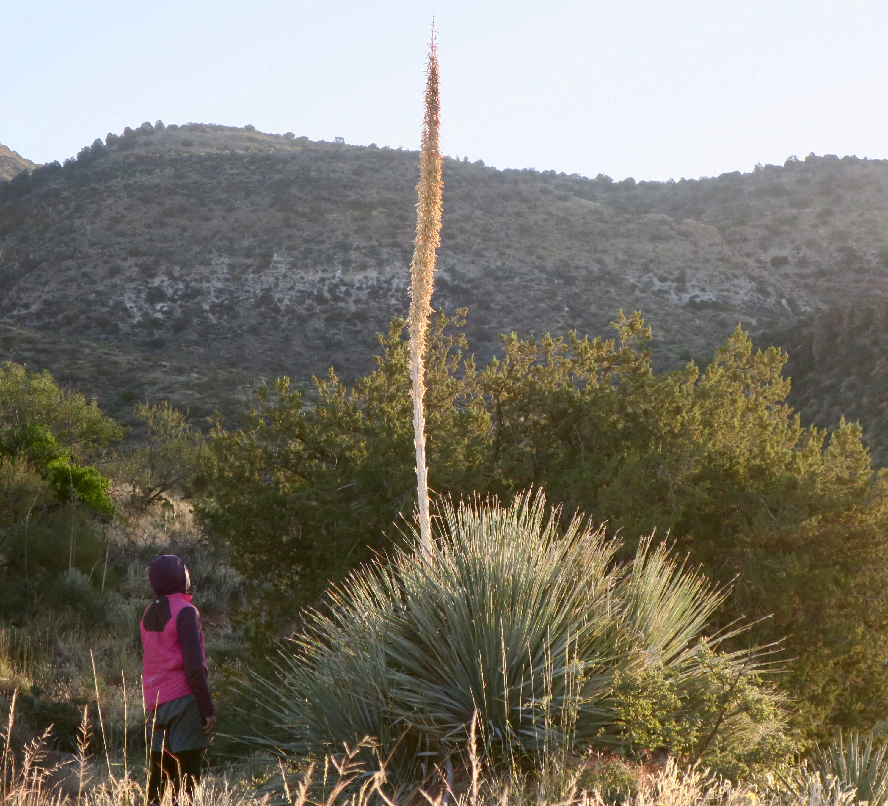
Agave plant, I believe
 Then, the cacti started to appear – first as a sprinkle on the landscape, then an entire valley full of it. Against the sharp blue of the Salt River, it was an unforgettable sight. I couldn’t stop taking photos and make very slow progress downhill. I couldn’t believe how massive the Saguaros were!
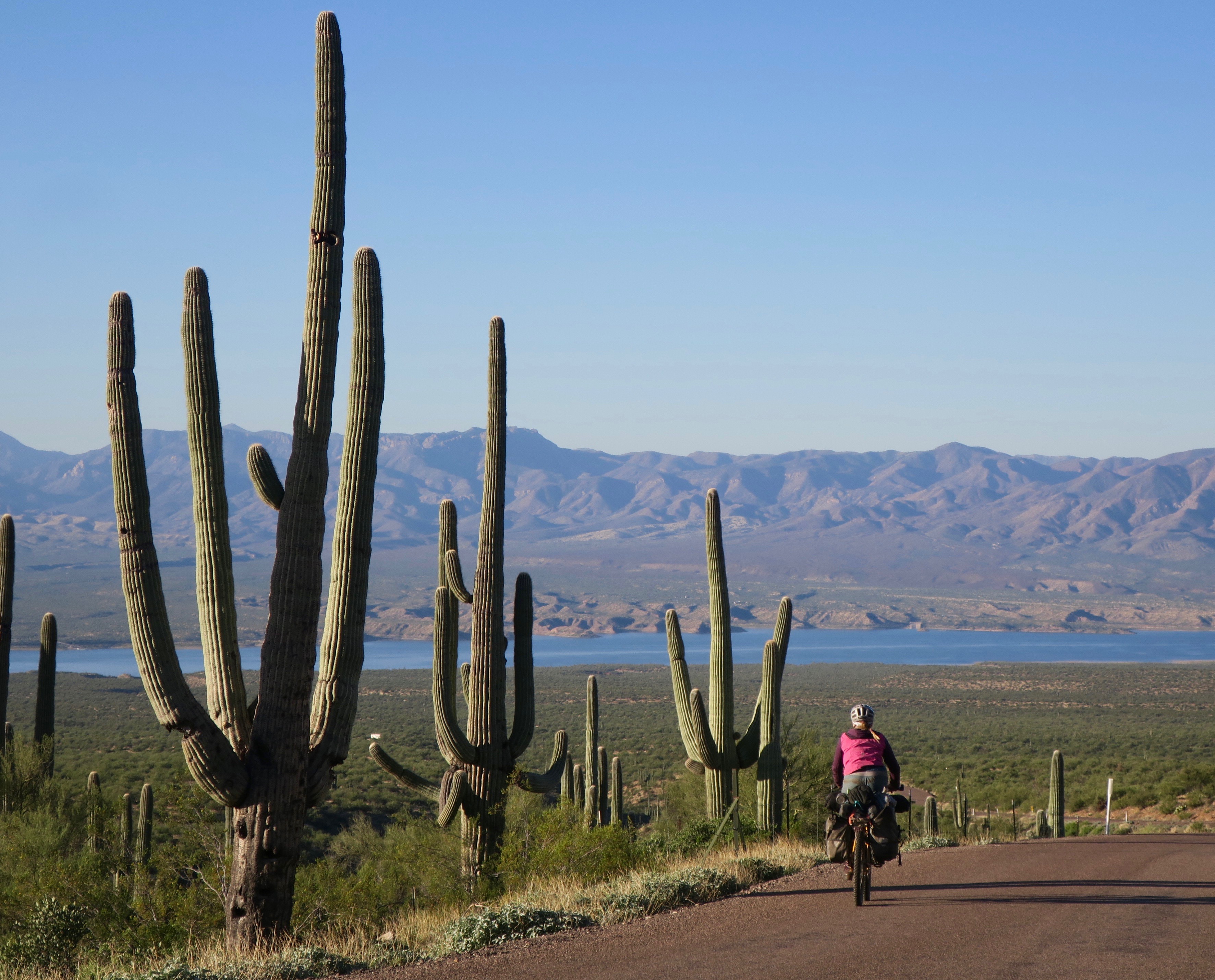
Riding amongst giant saguaros. Globe-Young “highway”
On the descent to the Salt River (not actually salty)

View to the Salt River near Globe, Arizona

In Globe, I made my customary gas station stop for a drink and snack and washed my second pair of shorts in the bathroom sink. I was adamant about wearing clean shorts – not as much about everything else. I sat outside on the curb, messing around on the internet. As usual, friendly Americans came to talk to me, to ask about my journey and to give me praise.
I climbed out of Globe and into the Pinal mountains a little too late in the day. About half way up to the summit, I completely burned out and had to desire to continue climbing. Unfortunately, there was little in the way of good camping spots. It was steep everywhere. I came across a decently wide pullout on the side of the dirt road. It was less than ideal with no cover whatsoever and I was only about 50m from the actual road. Too tired to care, I decided to set up. My lazy decision making didn’t work in my favour and I was in for a sleepless night.
Worst night camping ever, but a nice view…
Only a few cars had passed in the time since I had set up camp. I stiffened each time I heard wheels crunching on gravel, my tent illuminating as they approached. I breathed a sign of relief each time they passed without stopping.
It was around 9pm and on the other side of my paper thin tent wall, I heard a terrifying sound.
It was a hoarse, low-pitched growling sound. It almost sounded like a human imitating a wild cat – like a devious child trying to scare a friend. I froze in fear and a wave of heat rushed over me. I used my instincts as Canadian bush worker and immediately yelled out “hey-oh! Hey oh!” to try and scare off whatever seemed to be only a few feet away from my tent. I threw a rock outside that I had used to hold town my tent. I heard nothing. I didn’t moved for about an hour, senses heightened. Eventually I had to pee so badly that I made myself go outside, large rock in hand. I slowed rotated 360 degrees, leading with the light of my headlamp. Nothing. I did what I had to do and quickly zipped myself back inside. I am assuming I had heard a puma, but I really wasn’t sure. Around 11pm, the 4th vehicle of the night drove by, but this time it slowed to a stop. I heard a guy’s voice say “hey!” before they sped off. This only added to my anxiety. It was one of the most nerve-racking nights of wild camping I can remember.
Sleep deprived, I got up before sunrise the next morning to pack up and continue the climb. I couldn’t get away from that spot fast enough.

Pinal Mountains, Arizona
 It was a cold and beautiful climb. I loved the dramatic wrinkles and folds of the Pinal range that spread out like waves in all directions. After a rough descent, I pushed my bike through an old creek bed, eventually coming to a fenced area. It was some sort of government facility, according to the sign and there were (wild?) boars running around. I wasn’t aware that they existed in this part of the world.
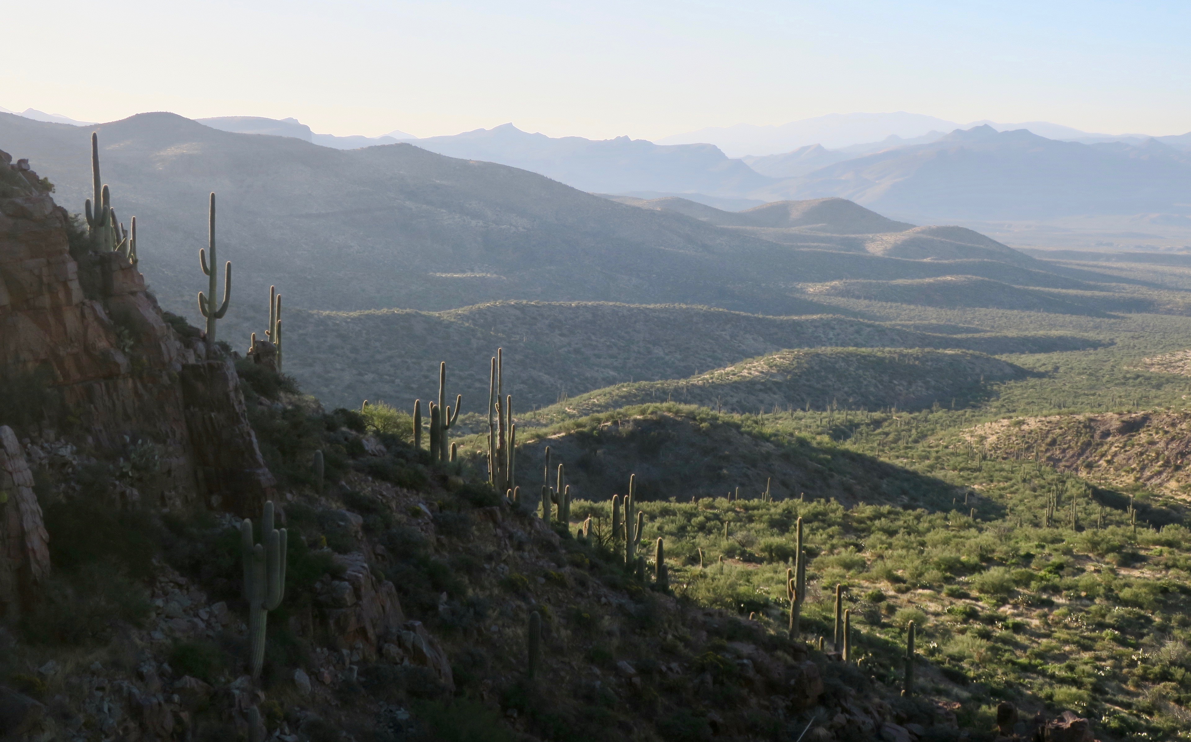
The dirt roads continued through more awesome desert landscape, covered in Saguaro cacti, the gangly ocotillo and Dr. Seuss-like agave plants. I think I already loved Arizona almost as much as I loved Utah.

 I stopped in the unexciting town of Winkleman for a gas station feast, where I often spent too much money. Constantly hungry, it was hard to resist pizza, burritoes and ice cream – all at once! After Winkleman I passed Oracle, home of Biosphere 2. If I had time, I would have paid a visit. Unfortunately, I also had to take the shortcut to San Manuel, cutting out the climb to Mt. Lemmon.
I continued downhill through a wonderland of Saguaro cacti on a paved road before re-connecting with sand and washboard to Benson, another uninspiring town of chain stores and restaurants. I stayed at the Red Barn campground just off of the highway. Its facilities were in a great state of disrepair, much like its aging owner. The man seemed overly paranoid in general and only reacted to my exploits with overt concern “there’s a lot of weirdos out there, can’t trust no one these days.” I seemed to encounter this attitude much more often in Arizona compared to the other states I had passed through.
I set up my tent on the gravel platform under a wooden shelter. I would say that the campsite at $26/USD was overpriced if it weren’t for the entertainment I would receive that evening.
I was cooking my usual pasta and tuna concoction on a park bench, when a pick up pull in front of the campsite. An older man stepped out. He said that he was the owner’s assistant and had heard about a woman travelling alone on a bicycle. “I thought,” he said “I just have to go and talk to her! Do mind? Am I interrupting your dinner?”
“Not not at all!” I said. He also brought over a six pack of beer to share with me.
I talked a bit about my trip and the places I had passed through. We also got into a conversation about a life outdoors in general – him working on a ranch with horses and me in the forests of Canada. It was pleasant and interesting, until it suddenly took a bizarre turn. “Yes, I love being out in the land, because here, in America, we are the country under God.”
Oh boy, I thought.

Sadly, there were a few of these around in Arizona
Then, he went off on a tangent about the evil democrats and how Christianity saved the Native Americans (saved??). I have never been a good debater by nature and just awkwardly listened to him rant. Eventually, the religious propaganda died down and the topic switched to my personal safety. Suddenly he was like a concerned father. He said that he worried about me being out on my own. I had told him my wildcat camping story and he worried about illegal immigrants. He reached into his pocket and pulled out his wallet, taking out a $20 bill.
“Here,” he said, “I just got paid today. Now go and pull yourself some protection – pepper spray or something, I am not sure exactly what it costs.”
I insisted that I would be fine and initially politely rejected his offer, but I eventually gave in.
I will selfishly admit that I never bought that pepper spray.
Next stop on the road was the touristy Tombstone. It was set up like a wild west movie set for tourists, complete with horse drawn carriages and Wyatt Erp type duels scheduled on chalkboards outside of “saloons”. I randomly found an Italian cafe, more interested in the meatball parmesan and gigantic cinnamon buns. I only had one night left of camping on the route. It was crazy to think that it would all soon be over, but I was tired, sunburnt and sore. I was ready.

San Pedro Riparian Conservation Area
The road from Tombstone led to San Pedro Riparian Conservation area. It was a completely different landscape – grass, scrub and the odd deciduous tree. Maybe it was the nonsense rambling of the man from Benson that made me feel a bit uneasy so close to the Mexican border. I was also slightly less comfortable wild camping after that experience in the Pinal mountains.

Thorns galore in this part of the world
Much of the San Pedro trail was overgrown with thick grass and thorn bush. I felt very lucky to have gotten this far without a puncture and I was almost sure I would get one on this stretch.

The overgrown San Pedro Trail
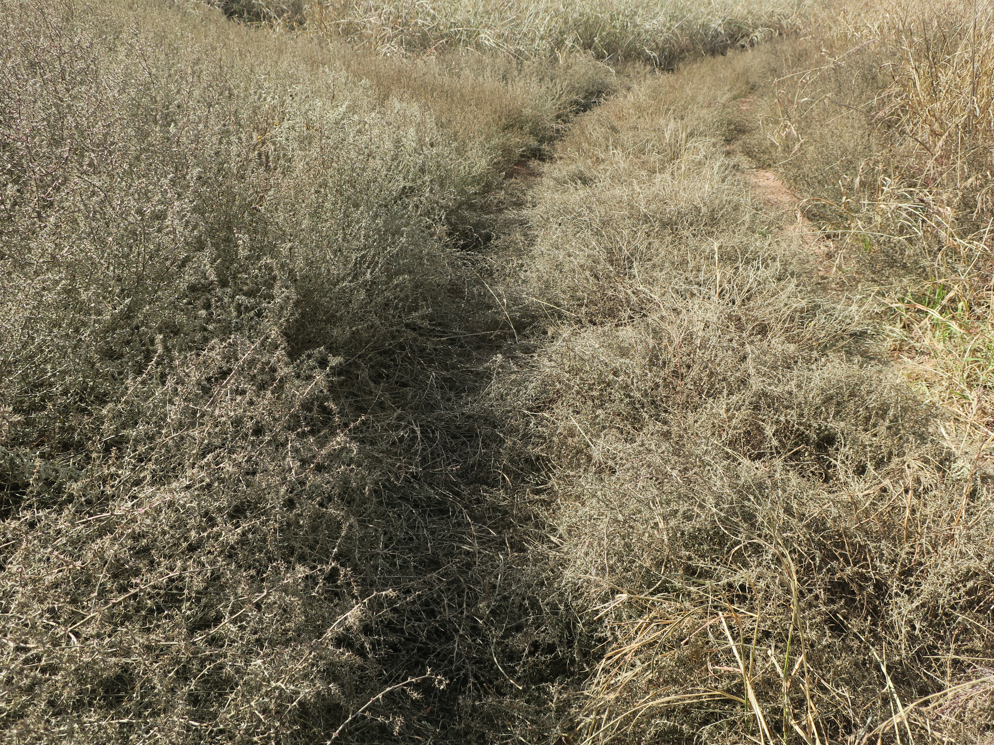
The last 800m of the route, overgrown with thorns..
The last half mile/800m or so to the Mexican border wall and the Southern terminus of the Wild West route was just silly. The trail was completely overgrown with thorns. I almost didn’t go, because I could see the end, the fence just fine from where I was. But, I guess the Instagram type mentality took over.
No, I need a photo of the finish at the fence.
Really, who gives a shit, I thought. It’s close enough, it’s just a damn fence.
I ended up scratching my legs up and I got that stupid photo.

The end!

Mexican border fence, Wild West Route Southern Terminus
Of course, ending at a border fence does seem anti-climatic. But that was it, it was done. I made it and with zero flat tires! Now it was time to backtrack 45km to the town of Sierra Vista, where I would be picked up by a friend and taken to Phoenix and then fly home.
Thoughts on the Western Wildlands Route (for interested cyclists)
There is a ton of information in the PDF download available from the Bikepacking Roots website for the route (I may be repeating some of it here). I highly recommend it and also the app for navigation and many useful points of interest. I used my Garmin GPS as a principle source of navigation and my phone as back-up. This is the first tour where I have hardly had to do any planning. Everything was mapped out ahead of me and indicated also where to get food, water, potentially camp and places of interest. Loved it!
Overall route/scenery
I really, really enjoyed this ride. With the combination of people and scenery, it was one of the best trips I’ve ever done. For me, some of the scenic highlights were:
-all of the Great Divide, Canada section (not the WWR, but I have to mention it because it was that great!)
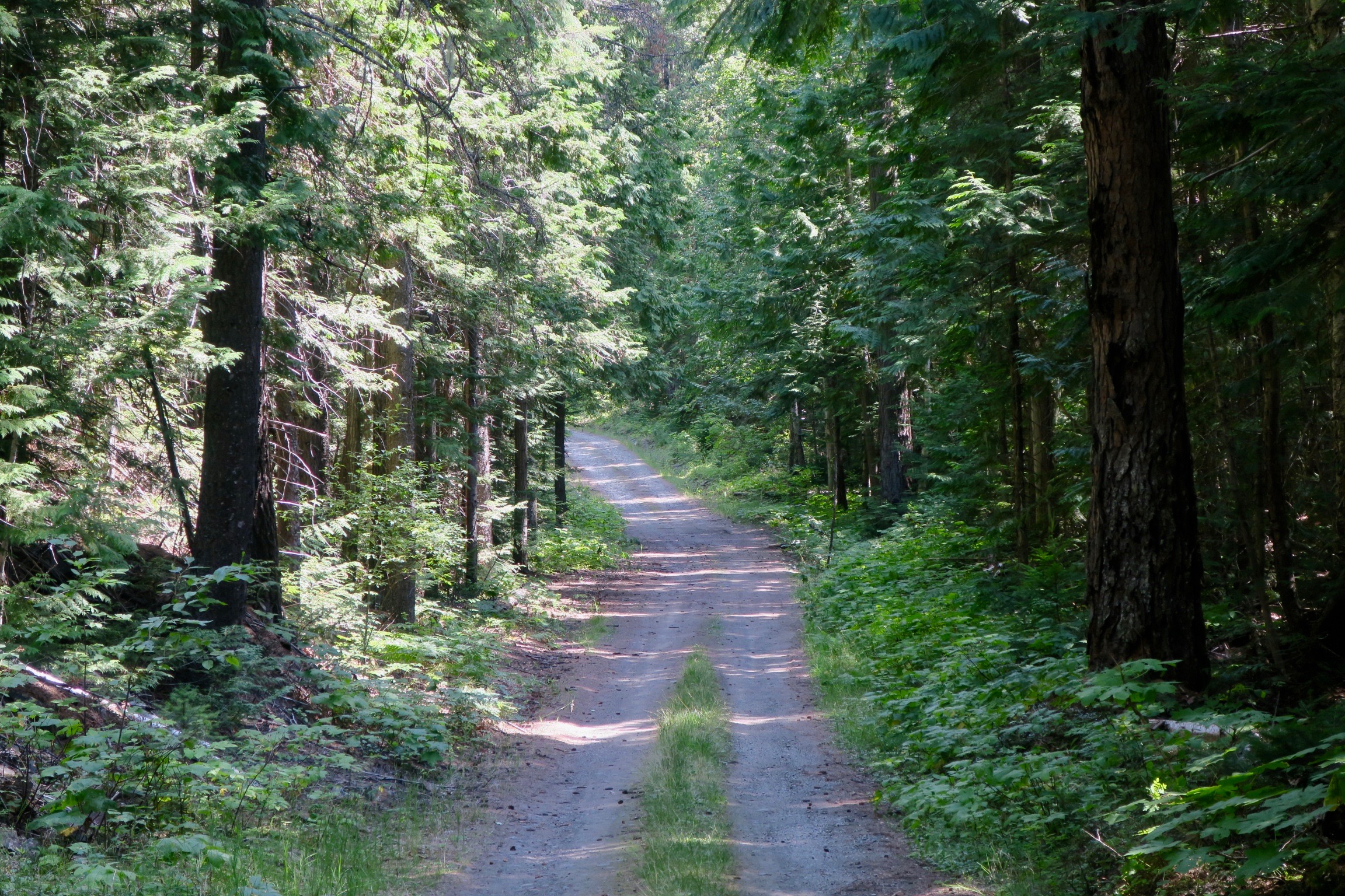
-quiet doubletrack in Purcell Mountains, Montana
-Hiawatha Rail Trail, Idaho
-Hoodoo Pass and into Clearwater country, Idaho
-Sawtooth Valley, Idaho and meeting the Smoke and Fire 400 riders
-Climb to Elk City and the Magruder Corridor crossing, Idaho
-Snake River Plain, Idaho
-Navajo Nation
-the pink cliffs of Sedona
-the many peaceful dirt roads through pine forests throughout
-Young to Globe, Arizona and the descent to the Salt River
-Saguaro cacti and desert flora in southern Arizona
-unique towns like Eureka, MT, Wallace ID, very rural Young AZ, and Flagstaff AZ
-I will mention Utah separately because the majority of my ride through the state was a detour from the Wild West Route using sections of the Plateau Passage Bikepacking route. South Eastern Utah – Canyonlands, Bears Ears, Burr Trail Rd, Bryce Canyon was THE highlight of the whole trip. It in is my top three destinations I have visited in the world.
On the Western Wildlands Route, There was the odd short section I didn’t follow exactly because sometimes it seemed unnecessarily hard and was just following dirt for the sake of it, so I would detour. An example of this would be climbing an extra 8km after already having climbed 15km to a summit. This was just to avoid a (quiet) paved descent and not adding much scenery wise. Or, following a ridiculously rough and rocky road to avoid an extra 10km of (quiet) paved road. These were very small sections and it wasn’t a common occurrence.
There was very little traffic on the route, but I often came across people on ATVs. Besides the 25+ cyclists I met in one day doing the Idaho Smoke and Fire 400 race, I only met 8 other bikepackers.
There are not many bike shops along the route, so it is important to be fairly self sufficient. Some of these towns are very rural and probably not used to bike packers like many town on the Great Divide would be. Very friendly people everywhere.
Terrain/difficulty
There is A LOT of climbing on this route, but from what I have read it is similar to the Great Divide. In Montana, daily climbs of 20miles/30ish km seemed common. The road surface varied from smooth dirt, doubletrack to very rough 4X4 tracks with a tiny bit of single track. I rode a fully rigid bike with 2.25” tires and had no issues. I occasionally had to push because of the surface or steepness, because it was never for that long. Front suspension would definitely have been nice for some of the downhills, but I don’t think it is absolutely necessary. I had a mix between a bikepacking and touring set-up.
Thorns are an issue in Arizona. I didn’t have a tubeless system, but used Schwalbe Marathon Extreme tires (unfortunately discontinued) and had sealant put in my tubes in Moab, Utah. I didn’t have a single flat. I consider myself lucky! I think most would prefer to go tubeless if their setup allowed for it.
Overall I think I averaged about 70km/day.
Weather
I left Canmore to start the Great Divide section mid August, which put me at the start of the WWR in late August. For me, the timing worked out quite well. I arrived at the Southern Terminus on November 3rd. I had some pretty chilly nights in Southern Idaho and Utah, the coldest being around -10C in Soldier Summit, Utah. I arrived in the southern Idaho section in late September and I wouldn’t want to be there much later than that. I had some frost and one hail storm but managed to avoid snow the whole trip. The high plateaus of Utah were chilly in October but never below 5C during the day. Snow in October is possible, but I avoided it, luckily. Northern Arizona until Flagstaff was chilly in mid-late October. Pleasantly warm after that.
I think I had about 7 days of rain over 85 days. Lucky!
Camping, food, water
I never had to carry more than three days food at once. The resupply options were often in small towns with a very basic shop, so not always a ton of variety. The groceries were usually a bit expensive because of this.
The most water I had to carry on the Wild West Route was a two day supply to cross Navajo Nation. I carried three days worth in sections of Utah, but that was off road. Depending on the time of year, I think it is a good idea to have a capacity of at least 10L on the bike. The most I carried was 12.5L
There is plenty of surface water in sections of Montana and Idaho. I carried a UV purifier to treat these sources. Camelback AllClear is the one that use (discontinued).
I found the wild camping to be very easy as a lot of the route is on public lands. I was also pleasantly surprised at the number of free campsites in Montana and Idaho. Most of them had washrooms and picnic tables. I got the information for these campgrounds from the PDF, but it didn’t always indicate which ones were free and which ones weren’t. RV parks were often good places to stay in towns if you wanted to get a shower/treat yourself.
Here is a tally of where I slept each of the 85 nights (whole trip):
Airbnb – 1
Campground/RV park (paid)- 10
Campground (free) – 16
Gas station (free) – 2
Hotel – 4
Friend’s house – 2
Warm Showers host – 8
Random invites (homes) – 7
Bed and Breakfast (free) – 1
Wild camping – 32
Total distance: 5300km.

I have to admit – riding through most of Montana and Idaho, I rarely felt 100%. The random stomach bug I had really took its toll on me, draining a lot my energy for over two weeks. Rolling into Utah, my most anticipated US state, I was finally feeling strong.

Sagebrush lands in Northern Utah
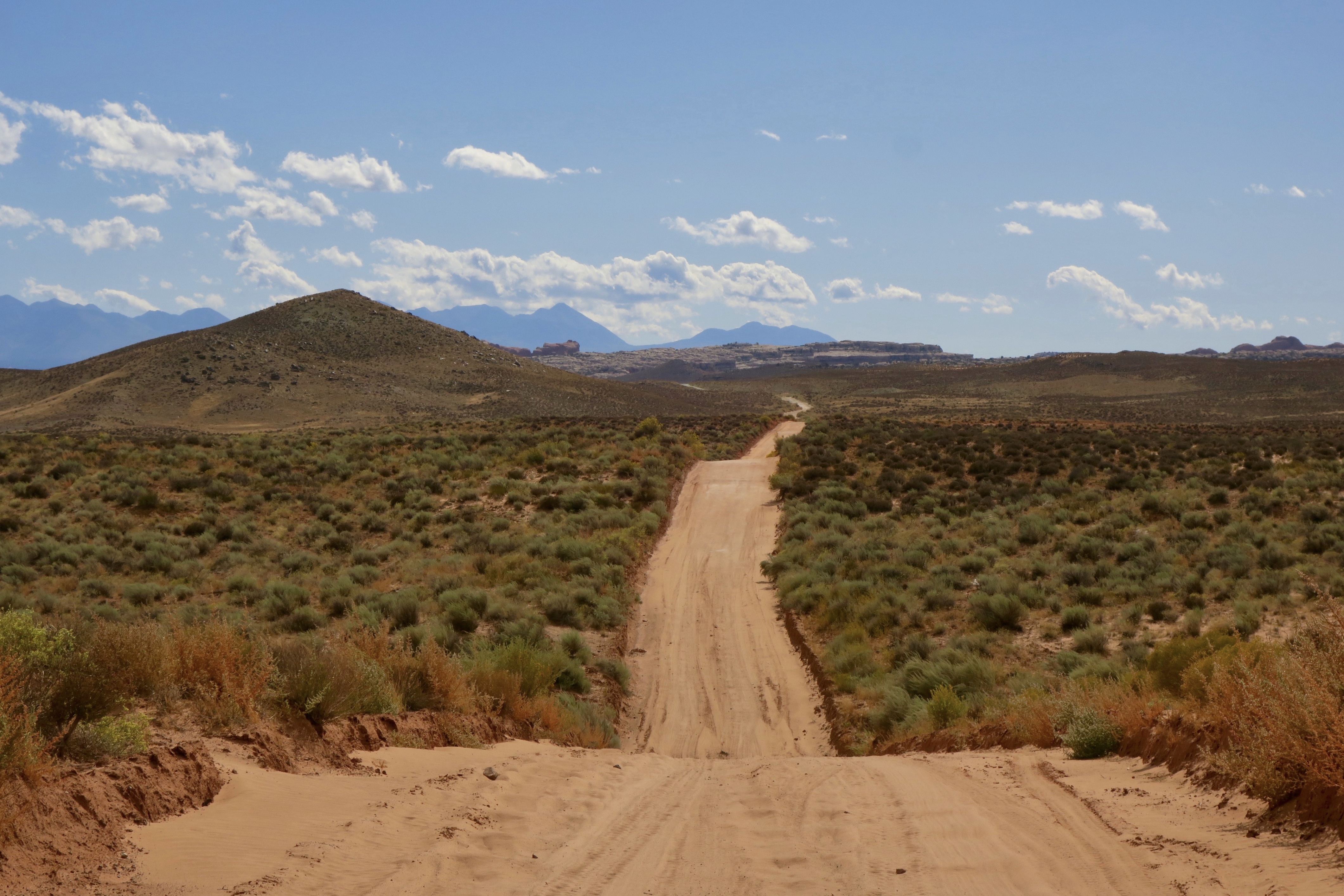
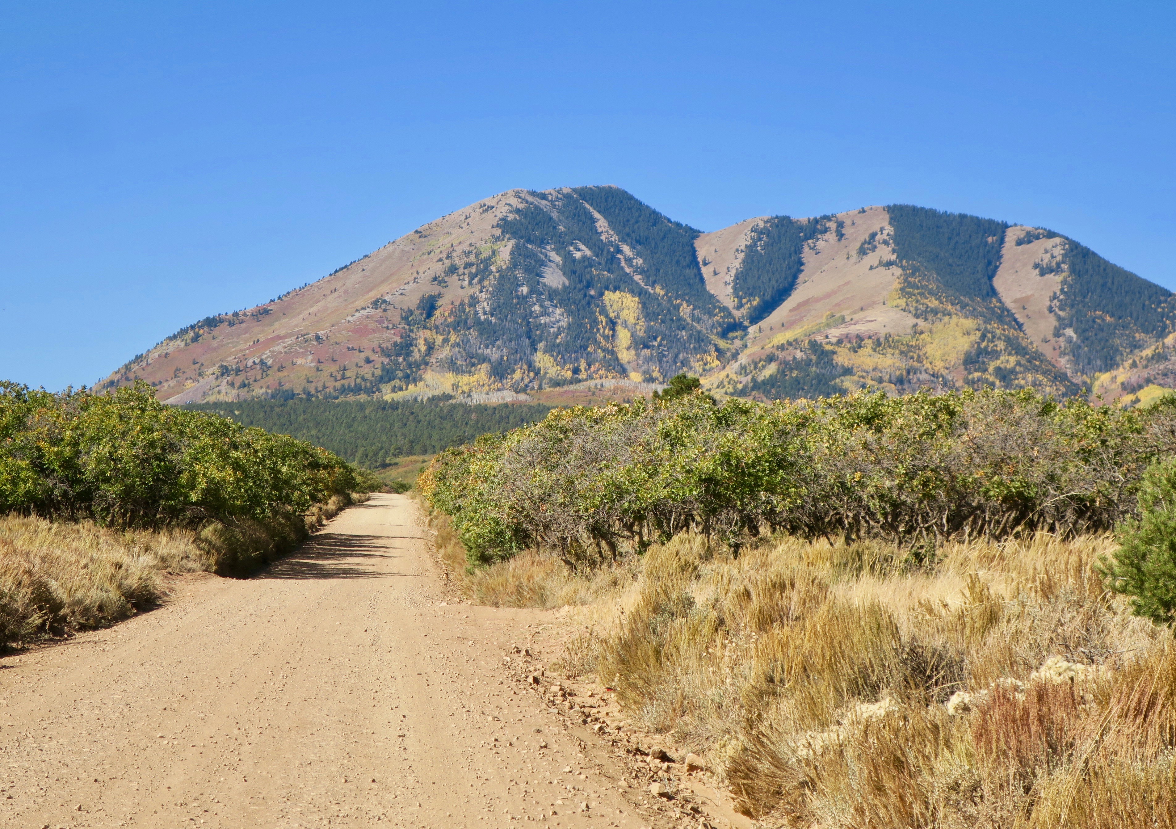
It was late September and I was in a bit of a race against the colder weather at the higher elevations that could possibly bring snow. Northern Utah was largely flanked by private land, making wild camping very difficult. I was still in the realm of the sagebrush – landscapes wide open and expansive.

The Western Wildlands Route briefly ducked into a section of Wyoming in Evanston, full of strip malls and fast food chains. The majority of the towns I passed through in Montana and Idaho were for the most part absent of these features. I won’t say I was too good for these familiar creature comforts, though, as I headed directly for McDonalds and devoured a large fries and chicken nuggets!
Of course, I was approached by more friendly locals. One man spoke to me outside of McDonalds about bikepacking. He was planning his first trip and looking for advice. Outside of the Wal-Mart (yes, for shame) I met another lady who expressed her support for me and eagerly handed over her daughter’s contact when I mentioned i was headed to Moab. And on the way out of town, a man pulled up in a pickup, where I was briefly stopped on the side of the road. He had coolers full of ice cold water in the back of his truck and said I could take what I wanted. We chatted for a little while about the places I had been and I eventually learned that he was a widower. He seemed eager to continue the conversation with me and I sensed that this man was perhaps a bit lonely and enjoyed the company. I knew that I had miles to cover and I carried his slight look of disappointment with me when I eventually said goodbye and pedalled away.
By the time I had reached Park City, I felt like I was in a bit of a slump. The riding just wasn’t nearly as interesting as I was travelling through a much more densely populated area. I knew the best was yet to come, though, and I needed to be patient.
I spent a few days with an inspiring French cycling family in Park City, who were my Warm Showers hosts. This couple had taken their kids, both under eight years old on various bicycle touring and backpacking trips around the world. The kids were very proud of the fact, asking me if I was a biker like them.
“We don’t want to travel in a fucking RV,” my host said, which was clearly the preferred mode of travel for many in this part of the world.
I left Park City with a new plan. I would deviate from the Wild West Route as there was rain in the forecast for the next few days. Not wanting to be stuck in impassible mud, I made the decision to detour onto pavement towards Strawberry Reservoir.
I decided to head to Midway, Utah, because there was a Warm Showers host there. That turned out to be an excellent decision. I had an amazing few days hanging out with the hilarious, creative, wacky and kind Steve and Noelle and their daughter Quinn. Steve is a pretty successful Youtuber with a very interesting documentary type channel called “The Talking Fly.” Another interesting fact – these guys were a family of ex-Mormons. I was in Utah, the motherland of Mormonism. This definitely gave me some interesting insight into the religion and its stronghold on the state.
On my planned departure date, the weather was still a bit nasty with strong wind and intermittent rain. But in the interest of time, I needed to keep moving. Again, I was a bit sad to leave this fantastic group of people behind.
I climbed most of the day towards Strawberry Reservoir along an unpleasant and busy highway. I was relieved when I finally turned off onto a quiet gravel road, bitter and soaked in a mess of water and asphalt grime. I found a place to camp near some RVs. The next morning, I woke up again to a very frosty tent and bike. I waited for the sun to come up and thaw me out before leaving. In the biting fall wind, I continued climbing, surrounded by barren brown hills flecked with golden aspen. I had a fantastic view of the rich blue reservoir.

Strawberry Reservoir, northern Utah
On the descent to Soldier Summit, I rode high along a ridge with an ocean of colour below.

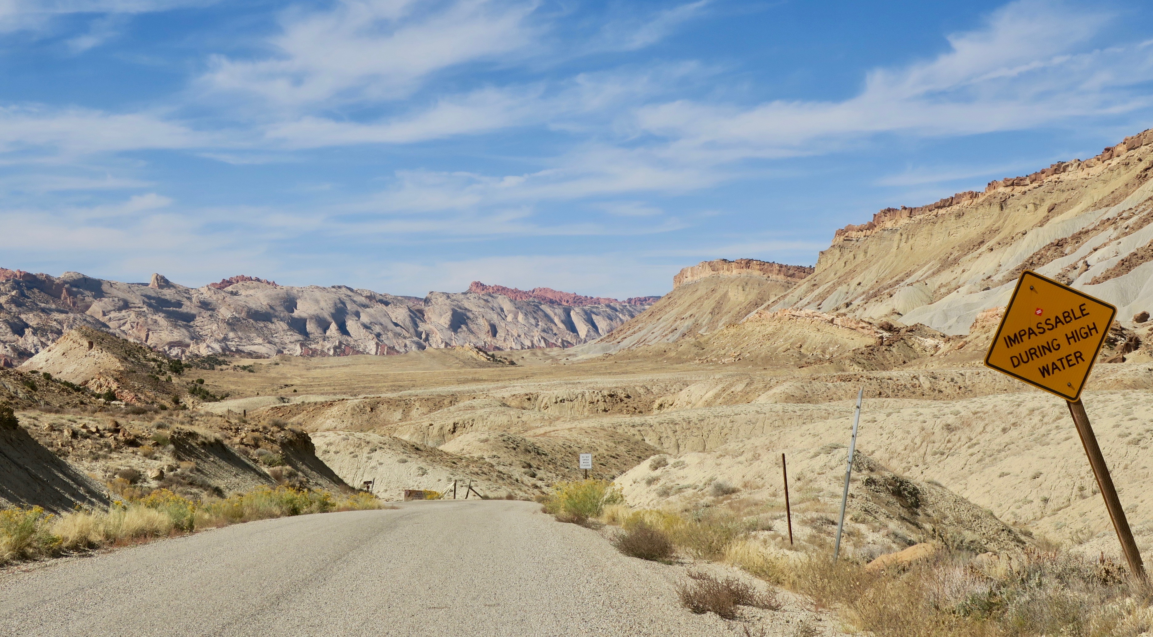
From Soldier Summit, the Western Wildlands route traversed the Wasatch Plateau along the high Skyline Drive. But due to expected cold temperatures, questionable weather and a general feeling of fatigue, I opted to beeline it for the desert. At this point, the quickest way was along more highway towards the community of Castle Dale, where I would hit dirt again.
Arriving in Soldier Summit, I was exhausted and didn’t like the prospect of looking for somewhere to camp near the highway. I thought that I would risk slight embarrassment by enquiring at the gas station (that’s all there was in Soldier Summit) to see if I could camp somewhere. To my delight, the very friendly lady said yes, I could camp behind the gas station. After, she warned me the temperature was going to dip into the ‘teens overnight (about -10C).

Camping behind Soldier Summit gas station (grey tent in the back)
I ate breakfast in the gas station on a frigid morning and reluctantly turned left onto the highway in the opposite direction of Skyline Drive. I definitely wouldn’t recommend that cyclists take this route – I just wanted to get to a lower elevation quickly.

sunrise at camp ground in Huntington, UT
I had originally planned to ride on pavement all the way to Castle Dale, but a lady in a local bakery in Huntington told me about a dirt road shortcut.
I was thrilled to leave the busier roads behind as I entered the silence and vastness of the desert.
From there, I headed east towards Moab, using a combination of dirt roads that would lead to the Plateau Passage Bikepacking Route. I would rejoin the main Western Wildlands Route near Bryce Canyon. In Utah, the Western Wildlands Route mainly follows Utah’s high plateaus and I was keen to get into the low desert and famous red rock scenery.
When the colourful waves of rock began to rise out of the scrublands, I felt like I was moving through a dream. I was buzzing all over, suddenly finding it surreal to really be where I was. I had wanted to ride through the Utah desert forever and I had finally made it here. I stopped many times to take photos and attempt to absorb it all.
I turned off onto the Cottonwood Wash road – a rough and sandy jeep track, where I only saw one vehicle all day. There was a mix of riding and pushing to get my bike across old riverbeds clogged with deep sand. I camped near the San Rafael Swell that night, completely alone under a star-filled sky.
I woke up to very cracked and swollen lips – the sun was wrecking havoc on me throughout the trip and now it was at its worst. In discomfort, I continued along a sandy trail following a power line track towards Green River. Hitting the pavement and passing through the town was a bit of shock. I went from the silence of the desert to a busy touristy circus. I didn’t linger, bought my necessary food supplies and continued on.
Sandy roads approaching Moab
As I got closer to Moab, the colour of the surrounding rock formations deepened to that famous burning red. I headed towards a wide open area where various RVs were parked. It was funny, but I selfishly admit that I maybe became inclined to camp near RVs because it often led to interesting conversations and almost always food. That night’s encounter was no different.
I was walking my bike near a group of about three RVs camped together in a clearing, with a collection of motorbikes and e-bikes. A large Grateful Dead flag was strapped to one of the awnings, flapping in the wind. One of the guys invited me over for beer and food. I was soon introduced to the “FOG” crew – the “Fucking Old Guys” as they called themselves. This group of three friends gathered every year to hang out and play in the desert around Moab. They were great to hang out with. There was a couple there – “Bubba” and his wife, whose name I forget. They had lived in Alaska for 15 years. She now worked for the State Park in Moab and “Bubba” floated around in the RV in between jobs. When they spoke, the word “fuck” and its variations often took the place of a comma in a sentence (“I was like ‘fuck’…and the fucking guy…” etc.). Old folk tunes and modern alt country greats like Chris Stapleton and Jason Isbell played from a speaker. They spoiled me with huge amounts of food and we had some great conversation over a roaring fire late into the night.
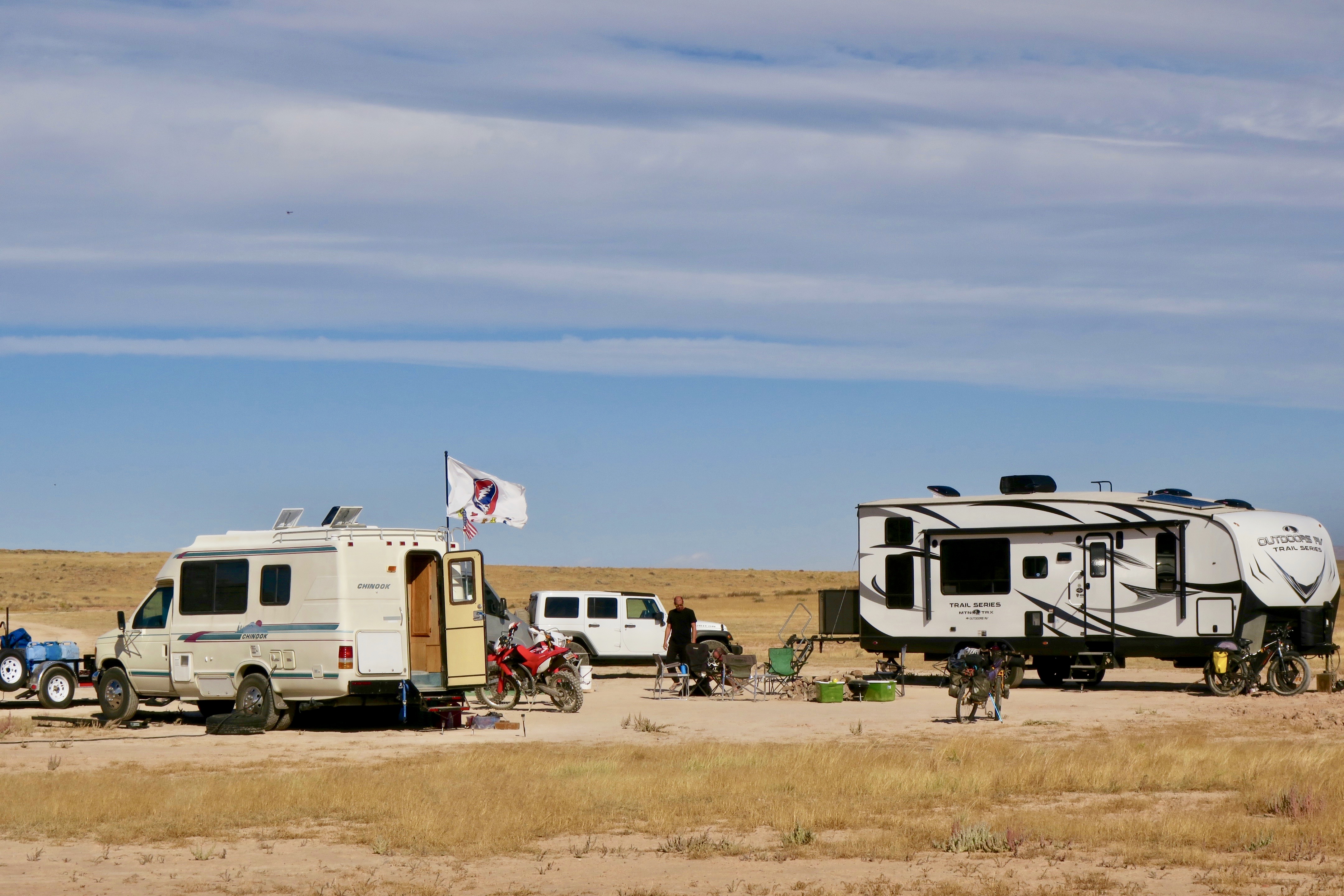
The FOG (“Fucking Old Guys”) camp
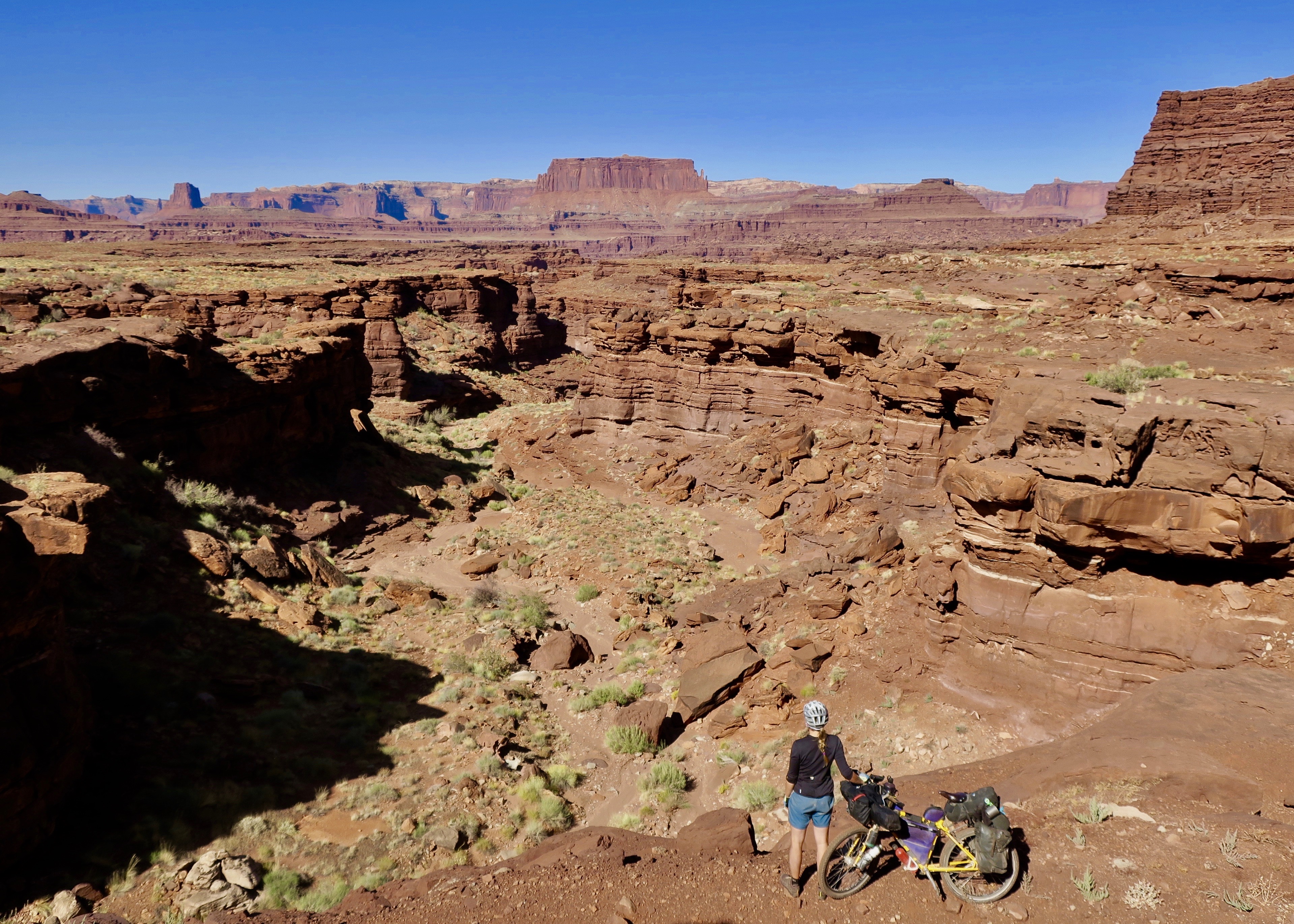
In the morning, The FOG crew fed me an enormous blueberry pancake breakfast and I leisurely made my way into Moab around noon. Getting to Moab felt like a big milestone for me – the very name evoked images of the iconic red rock scenery. Unfortunately, I was under time constraints to get to the Mexican border and I didn’t take the time to ride any of the Slickrock MTB trails that the town is famous for. I went to a bike shop and had sealant put into my tubes to safeguard me from the thorns of the Arizona desert in the future. I stayed for a night with a Warm Showers host and headed to Canyonlands National Park the next morning. From there, I started a section of the Plateau Passage Route along Lockhart Basin Road.

Canyonlands National Park – though it looks quite and peaceful in the photo, there were many ATVs on this section of the road
Thanks to the random driver offering to take this photo…

Wild rock formations, Canyonlands

The dirt road leading out of Moab into Canyonlands were spectacular, but full of ripping side-by-sides. I continually had to keep an eye out for the four wheelers whipping past to ensure I wouldn’t be run over. I climbed to a pass and started a rough and rocky descent, which involved a bit of walking. Eventually, the traffic disappeared and I maybe saw one ATV over the next hour.
A faded out sign saying “Lockhart Basin” pointed left towards a sandy river bed. I confirmed with the GPS track that this was indeed my turn off. It took me awhile to figure out exactly which way to go. This was supposed to be an ATV/jeep trail, but all I could see was a corridor of sand.

Lockhart Basin “Road”
I decided to trust the GPS track and started to push through the deep sand. I followed some motorbike tracks, which continued steeply uphill over a pile of rocks. The route was essentially following some kind of old drainage path cut into the cliff walls. I ended up having to push, drag and carry my bike uphill. It seemed impossible that a jeep could ever have made it through here.
After a genuinely difficult uphill struggle, I reached the top and finally, a distinct trail. The view across Canyonlands was magnificent and I was completely alone. I didn’t even make it 60km that day, but I was too exhausted to push on. I didn’t care – I ended up at one of the best camp spots of the entire trip.

The red canyons all around burned bright in the fading light. The shadows took on imitations of life in their shifting shapes.
The rest of the Lockhart Basin ride was challenging and it seemed like i was pushing just as much as I was riding, but the scenery was spectacular. It was absolutely worth it.

Rough going on Lockhart Basin

I questioned, though, if the rest of the Plateau Passage section would be this difficult. I had hoped that I was up to the task.
I met a few mountain bikers trail marking along Lockhart Basin for a Moab ultra running race. I met their support truck at the end of the trail and was given cold water and watermelon. The following morning, I detoured to the friendly Needles Outpost store to resupply before reaching Monticello. I climbed 1400m on mostly quiet and beautiful paved roads towards the Abajo Mountains, rich with fall colours. I had now left the heat of the Moab area behind as I headed towards the higher elevations.
Abajo Mountains near Monticello
A high speed descent brought me into Monticello, where I decided to treat myself to a stay at an RV park with showers and laundry. The next morning, I jumped on the Plateau Passage route again, leaving the town uphill on a snaking dirt road. At one point, the GPS track veered right and appeared to cut straight into bush, with no visible trail of any kind. I walked around for a while, looking for something passable, only coming across a super rough, loose and rocky ATV trail that didn’t appear to be rideable. Eventually, frustrated, I decided to head back to town to find another way around.
Disheartened, I decided to splurge on a pricey lunch at a new Thai restaurant in town. There, I met Arlo, a twenty something Pacific Crest Trail through hiker, currently living and working in Monticello. It was great to come across a like minded traveller, something that I don’t always find easy outside of my traveling life. I try to savour these meetings while on the road. He offered me a place to stay with him and his mom, Stacey for the night. He said he wanted to return the favour of being a “trail angel” because so many had done the same for him on his epic hike. His mom, Stacey was a very kind woman who had a very rough go at life. Still, with very little, she was very keen to feed me and make me feel comfortable. Yet again, another mishap led me to a random encounter with wonderful people. This is really what travel is all about.
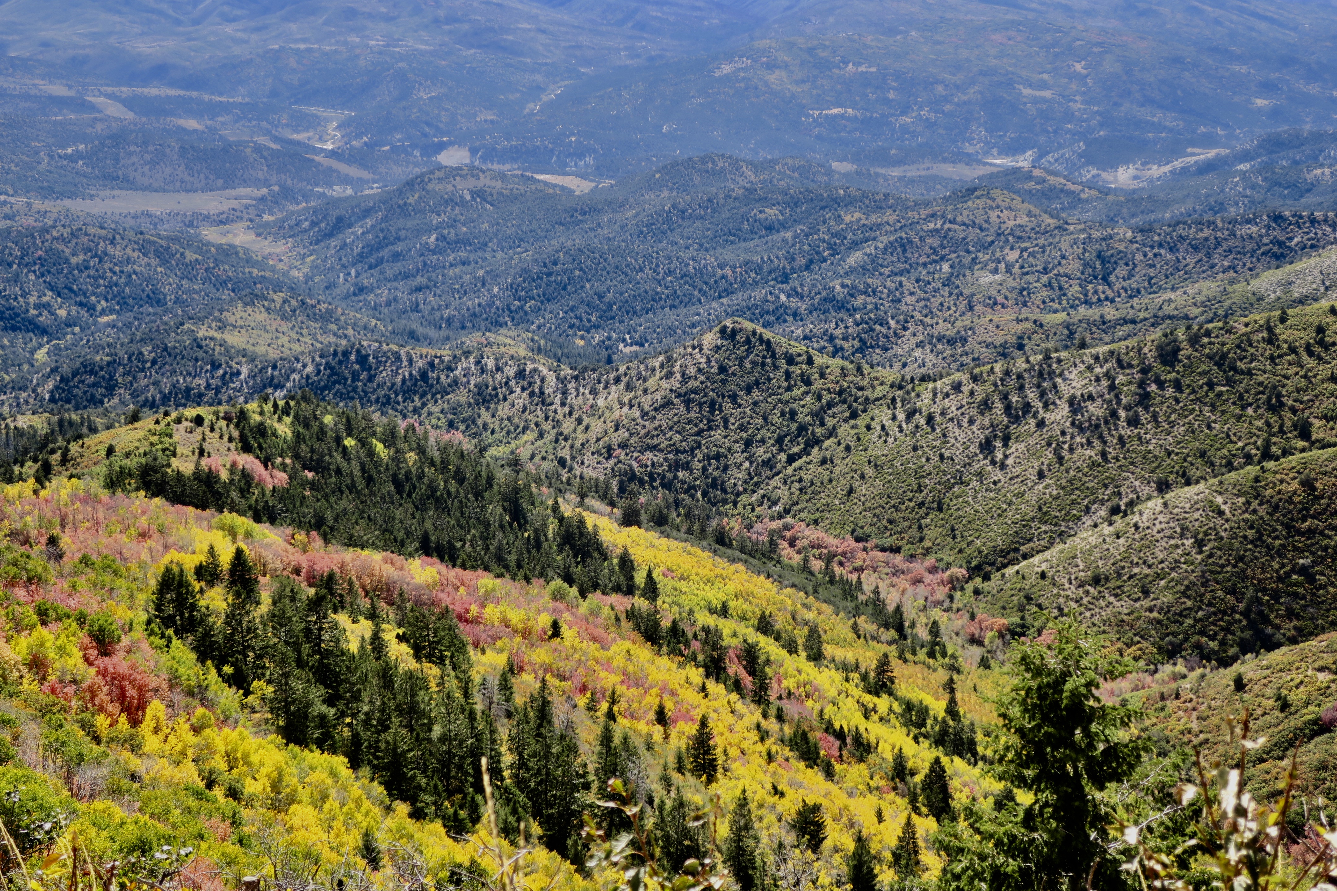
I re-attempted my exit out of Monticello, first riding a short stint of highway before hitting the dirt. Soon, I was cruising uphill along a smooth unpaved surface, surrounded by Ponderosa pine. The idyll soon came to an end when I followed the GPS track onto the rougher Camp Jackson trail. What followed was a few hours of very tough pushing up steep and loose rock to a 2900m pass. If was without a doubt the toughest section of my trip and and I felt like I was a bit in over my head. Still, I was surrounded by autumn in all its vibrant glory.

I descended along some smoother double track painted gold by the aspen.

The rest of the day I climbed up and down along sandy roads through the pines, only seeing a few cars. I pulled off the road and into the trees to camp as the temperature began to plunge.
All night I had dreams of waking up to a tent buried in snow and was relieved when I opened up my tent zipper and only saw the bare forest floor. It was a frigid and windy day, though, not going above 5 degrees Celsius . The route continued along a a dramatic cliff edge, from where I could see rose coloured buttes and mesas swelling above a carpet of vegetation. It was spectacular.
High ridge riding on Plateau Passage Route near Bear’s Ears National Monument
Once again, I only saw a few vehicles, some of them stopping to ask me if I needed anything. I also saw one lone black bear that immediately scrambled up a tree when it saw me.
When I started the long descent towards Hite, the temperature warmed and the pine disappeared, making way for scrub brush and open desert. The road colour changed from beige sand to crimson red.
Back in the low desert heading towards Hite

The scenery approaching Hite was totally surreal. Wild, bizarre and undulating rock formations set to the backdrop of the silver Henry Mountains. It was all laid out like a calculated art installation by a master sculptor. I almost wanted to cry I thought it was so beautiful.
From Hite, the plateau passage followed the paved road before making a rough and difficult crossing over the Henry Mountains. With the very cold temperatures and my then current level of fatigue, I decided to take a slightly easier route.
Colorado River bridge near Hite

View of the Henry Mountains
I followed the main road to Ticaboo, which turned out to be a tough day in itself with many short, steep climbs. At this point, I was feeling very, very tired. So tired that I ended up spending $100 USD at the remote Ticaboo Lodge because I didn’t even have the energy to camp. It turned out to worth every penny, because by the next morning, I had recovered and felt like I was soaring.
I joined the relatively famous Burr Trail Road just south of Ticaboo. Another magnificent ride set to a landscape that look like someone’s computer-generated fantasy. It would have been interesting to have a geologist with me, because It was difficult to understand how the shifting Earth could possibly have created such art. It was landscapes like this that especially ignited my wanderlust. When I pass through a place unlike anything I’ve ever seen before, it makes me want to keep exploring, to experience more of the unfamiliar..

Scenery along the Burr Trail

After scaling the wild Burr Trail switchbacks, the beige coloured cliffs changed to red again and more scrub lands appeared.

Burr Trail switchbacks
I stopped in the tiny community of Boulder, home to the famous Hell’s Backbone Grill. Supposedly this was one of the first restaurants in the USA to have all of their menu sourced directly from the farm where it was located. I ended up having an Elk Sandwich for lunch – it was expensive and delicious, but I honestly could have eaten 3 of them. Luckily it was my second lunch.
I ended up taking Scenic Byway 12 to Escalante, which was apparently voted #2 on the list for the most scenic drives in the world. Spectacular, it was, but I think it would better experienced in a vehicle, with the combination of traffic and knife edge descents.
Back in Midway, Steve and Noelle told me to contact them when I was heading to Escalante, because they had a daughter living there in a yurt. They said that I could camp with her on Noelle’s mother’s property. Unfortunately, she had already left when I arrived, but my hosts arranged something even better. Noelle’s mother Joett owned a bed and breakfast in town and she set me up with a luxury room (jacuzzi included!) for the night. I couldn’t believe the generosity.
The next day I cycled to Bryce Canyon, something I had been looking forward to the entire trip. I was now finished my big Moab loop detour and was back on the main Western Wildlands Route, heading South towards Arizona and Mexico.
I stopped in the tacky Bryce Canyon City to get a few supplies. Outside of a grocery store, a guy got out of his car to talk to me. He said he had just cycled the Pacific Coast route and wanted to help me out, because of how much he appreciated people helping him on the road. He gave me a few bottles of beer and Clif bars – what a treat! Really, the generosity was never-ending in this country.
I picked up a bowl of “Soup-er Meal” ramen, my new favourite, salty post-ride snack. After wolfing it down, I headed to Sunset Point campground by the canyon, literally grabbing the last spot. I met a really nice couple from Tucson who offered me to stay at their site for free, but the ultra strict park warden wouldn’t have it.
I headed over for sunset. It was another absolutely awe-inspiring sight. I realize this description is probably starting to sound like a cliche – but in this part of the world it was one world class view after another. So many hoodoos, awash with bright pink.

Bryce Canyon at sunset
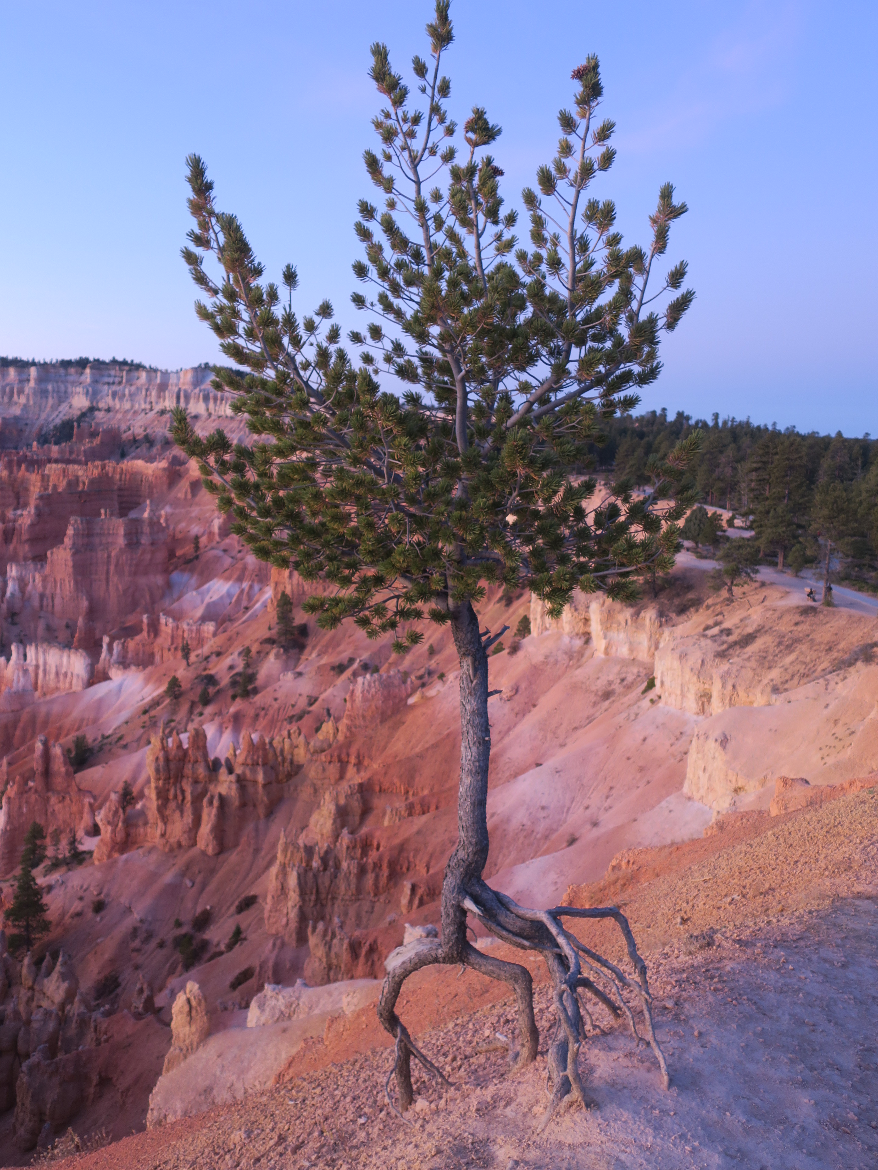
Limber Pine – an ultra resilient tree growing out of the rocks in Bryce Canyon
It dropped to -7C that night. I hadn’t planned to get up for the sunrise view, but then I realized sunrise wasn’t until after 7am, an hour past my usual waking time. So, I experienced yet another incredible view. The dawn light created softer and more understated tones along the rock.

Bryce at sunrise
Leaving this majestic place behind, the route followed a backroad out of the park, only opened to administrative personnel and cyclists. What followed was more pine, some scrub brush and rolling hills with no traffic. Above the treed canopy, the odd red rock formation poked out. In the Western Wildlands Route guide, there is a note saying that the final 40 miles were the “fastest of the segment.” Hitting some nasty, mushy gravel and wash board, I wondered what kind of shitty roads I must have avoided further north.
Eventually, I hit pavement and descended through many miles of private land. I ended up camping about 10km from Kanab just off of the main highway. I took a side road and pushed my bike behind some houses far enough until I hit a sliver of public land beside on ATV trail. I could hear families playing with their children into the night – If they saw me, I wonder what they thought of this stranger camping in somewhat close proximity.

“Wild” Camping a few hundred metres from the highway near Kanab, UT
I took my time in Kanab, the last town before Arizona. I enjoyed a breakfast bagel and coffee at a local cafe, sending email updates to family and friends. When I headed back to my bike, a woman greeted me with a $10 bill.
“I saw you in Boulder, but I was too shy then to talk to you. I think what you are doing is amazing. Could I please buy you breakfast?”
I said thank you, giving her a big hug, trying to hold back tears.
Shortly after leaving Eureka, I had yet another mechanical issue. After hearing a cracking noise coming from my bottom bracket, I noticed that I had lost one of the two bolts holding the eccentric shell in place. I had foolishly forgotten to bring a spare, so I needed to order some from England. This was an exotic, finely threaded bolt I wouldn’t be able to find anyone in the USA, apparently. I had them sent to a Warm Showers host in Challis, about 10 days ride away. I would just have to deal with the annoying sound for a while.

Crossing Lake Koocanusa, MT
Quiet 2-track through the Purcell Mountains, Montana
After some fast pavement following Lake Koocanusa, I climbed into the Purcell Mountains on quiet and forested double track. Eventually I ended up in a small town called Troy, MT, which I wouldn’t say was particularly memorable if not for the very friendly residents. Stopping at a grocery store, I had several people approach me to tell me that they loved what I was doing and offered any help that I may need. This would become a trend on my travels throughout Montana and Idaho.
Leaving Troy, I passed through an area with scattered clearcuts by a river. The landscape was unique with a sparse scattering of spindly conifers that had been left behind.


Now on the official Western Wildlands Route, I had luxury of using an app that would provide me with all sorts of useful information such as water sources, towns with resupply, sights of interest and spots to camp. Usually, I would avoid official campgrounds to in order to save money. I was pleasantly surprised, however, by the number of high quality and free campsites both in Montana and Idaho.
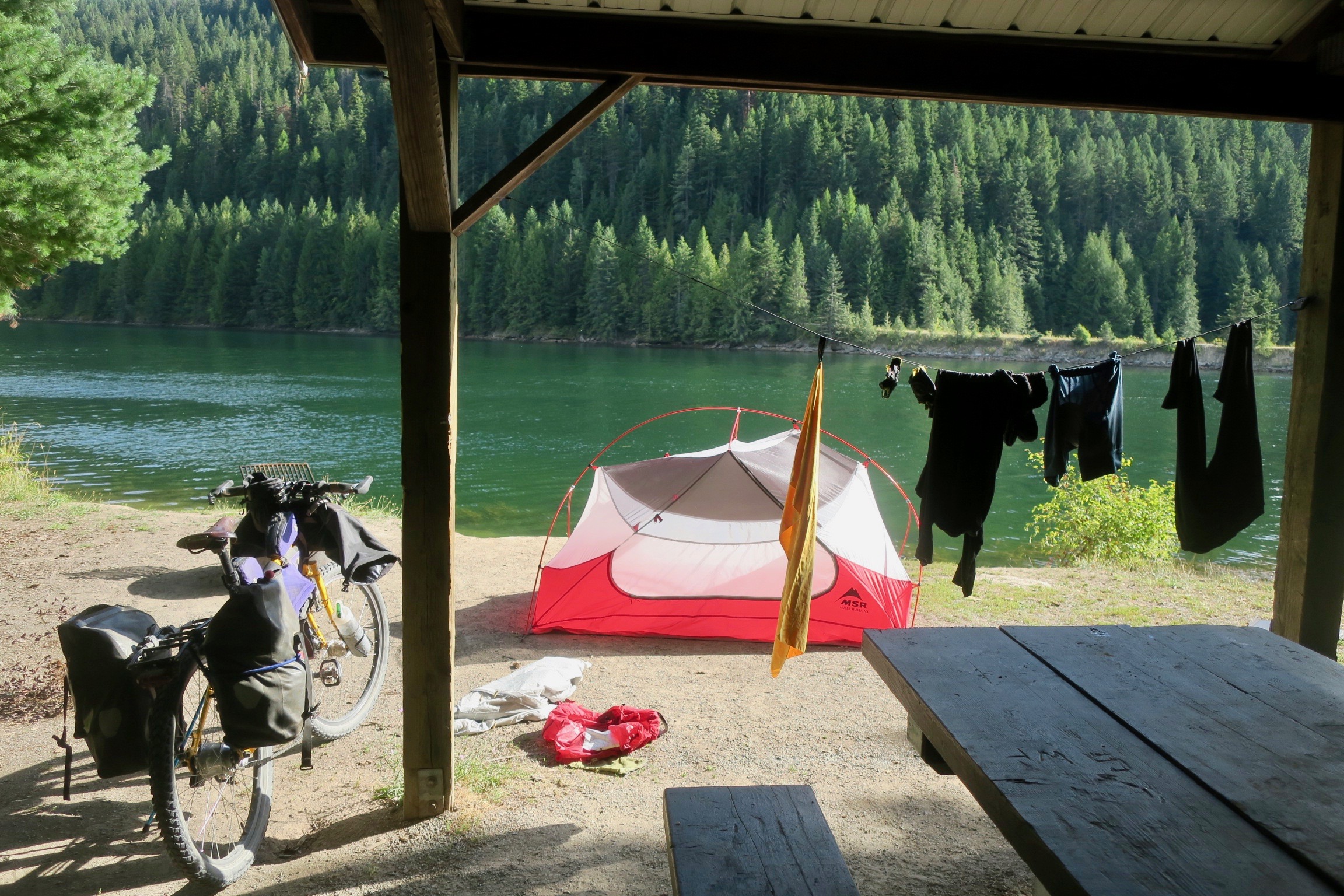
Marten Creek Campground, Montana, one of the many free sites
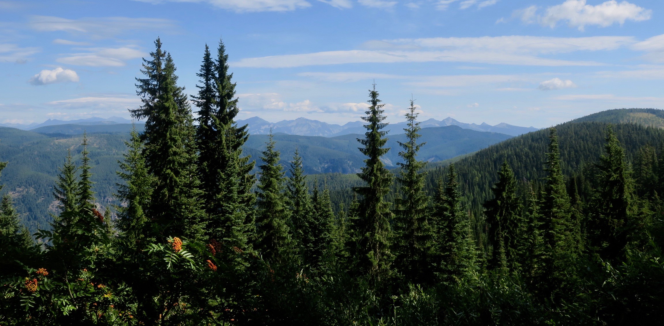
Towards Porcupine Pass into Idaho
The smoother tracks deteriorated as I climbed Porcupine Pass into Idaho. On the rough descent, I encountered my first bikepacker on the WWR – Geert, a Dutchman living in Adelaide, Australia. He was in his late sixties. I later found out through social media that he was the first to ride the entire Wild West Route Northbound. He was also an extraordinary artist, using watercolour to paint the landscapes he passed through on his bike tours.
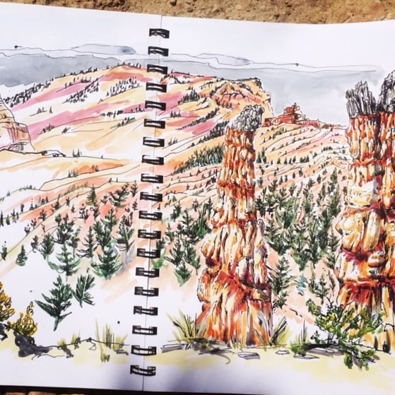
One of Geert’s paintings. Photo from Bikepacking Roots Facebook page
We chatted for about 45 minutes in the middle of the dirt road, without having to move for a single vehicle. He gave me some information about the long ride ahead of me, including a stiff warning about using tubes in Arizona – he told me he had 20 flats and switched to tubeless! This worried me a bit as I was planning to use tubes the whole way!
Saying goodbye to Geert, I pushed on to Wallace, Idaho. Camping in City Limits RV park, I was spoiled by RV campers who gave me beer, a bag of fruit and energy bars for the road. The local generosity was really never-ending.

Wallace, ID
Leaving charming and historic Wallace, I climbed steadily onto the Route of the Hiawatha, a bicycle trail built from old rail grades. For me, normally a “rail trail” isn’t the most exciting for cycling, but this was definitely an exception. I pedalled high along old trestles that disappeared in and out of densely forested mountains. I got to experience pedalling a 3km long tunnel, which fun, if a bit claustrophobic. I was surging forward through a long, black cylinder that trapped echoing voices, chasing the beam from my headlamp. Real “tunnel vision.”
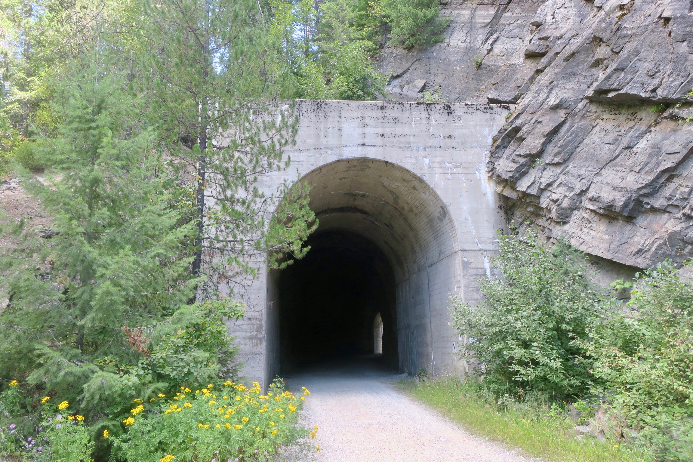
One of several tunnels (this one was short, the longest was 3km) on the Route of the Hiawatha, ID

Route of the Hiawatha, ID
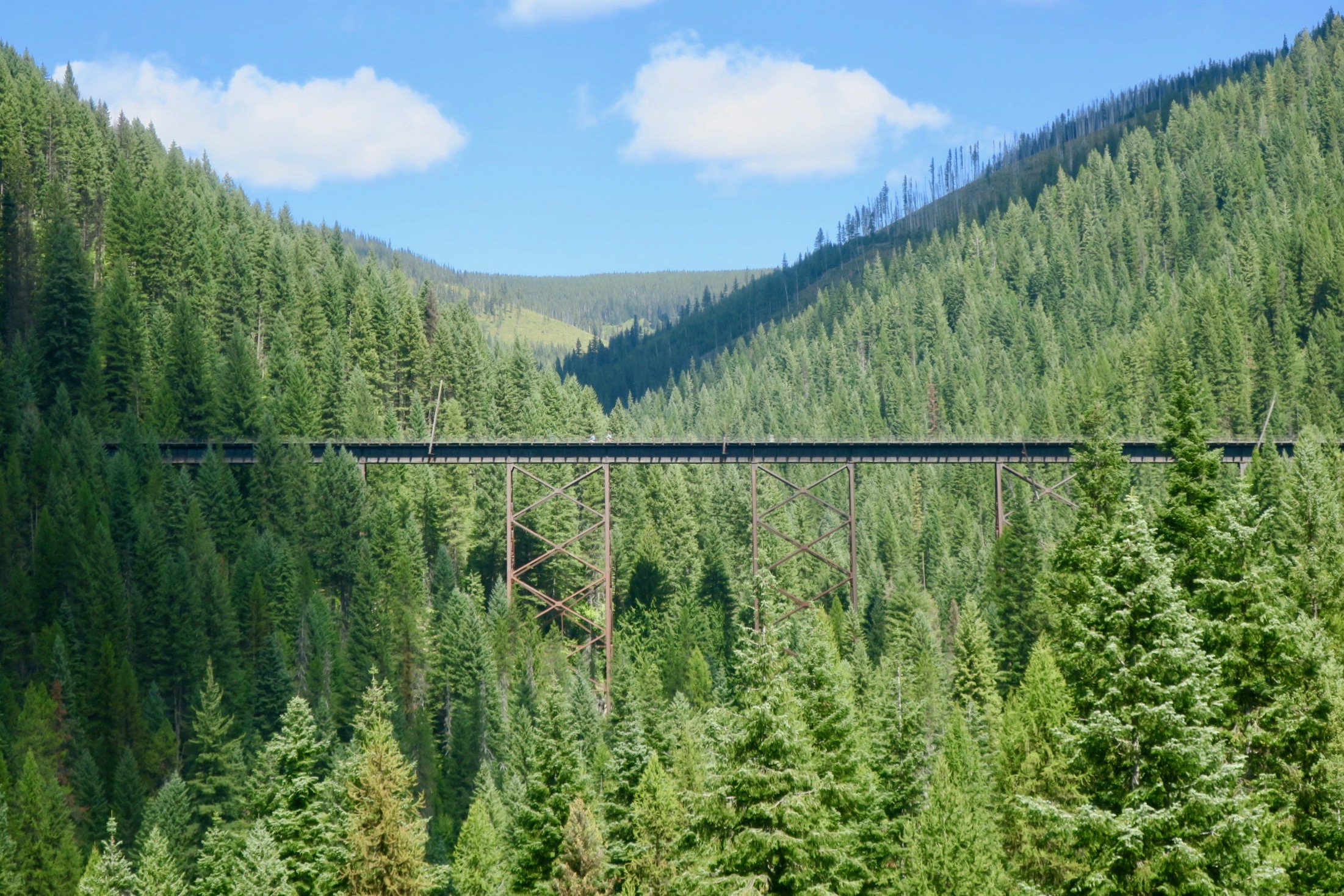
Route of the Hiawatha, ID
Back into the light, I started to make my way to the town of St. Regis, Montana The landscape was becoming more arid, Ponderosa pines still a steady companion. Now, the sound from my bottom bracket had worsened and I knew that I had many rugged and remote miles left before I would reach Challis where the replacement bolts would end up. If I didn’t find a solution, I would probably damage the bike. In St. Regis, I searched online for a bolt similar to the one I needed. It was a very unusual size and I was basically told that no hardware store (or likely bike shop) would stock it in this part of the USA. I ended up finding only one online supplier in Massachusetts that had something similar that would temporarily work. The fastest it could be shipped to me was three business days, meaning I would have to hang out in St. Regis. At the local post office, I inquired about a general delivery option and then placed the order.
Not long after, I was approached by an older man, asking me about my trip. He said that he had done some biking in the past. I said that I was riding to the Mexican border, but I needed to stay in St. Regis to wait for the replacement bolt.
“Well..” he paused “We could put you up. Let me just phone my wife.”
And that’s how I got to know Billy and Jennifer, two retired Californians living in St. Regis. I had a wonderful three days staying with them in a peaceful and beautiful little spot by the river. Once again, a mechanical breakdown resulting in amazing encounters. Jennifer couldn’t believe how “serendipitous” the whole thing was. I was so humbled by their kindness and once the bolt arrived, I was a bit sad to leave.
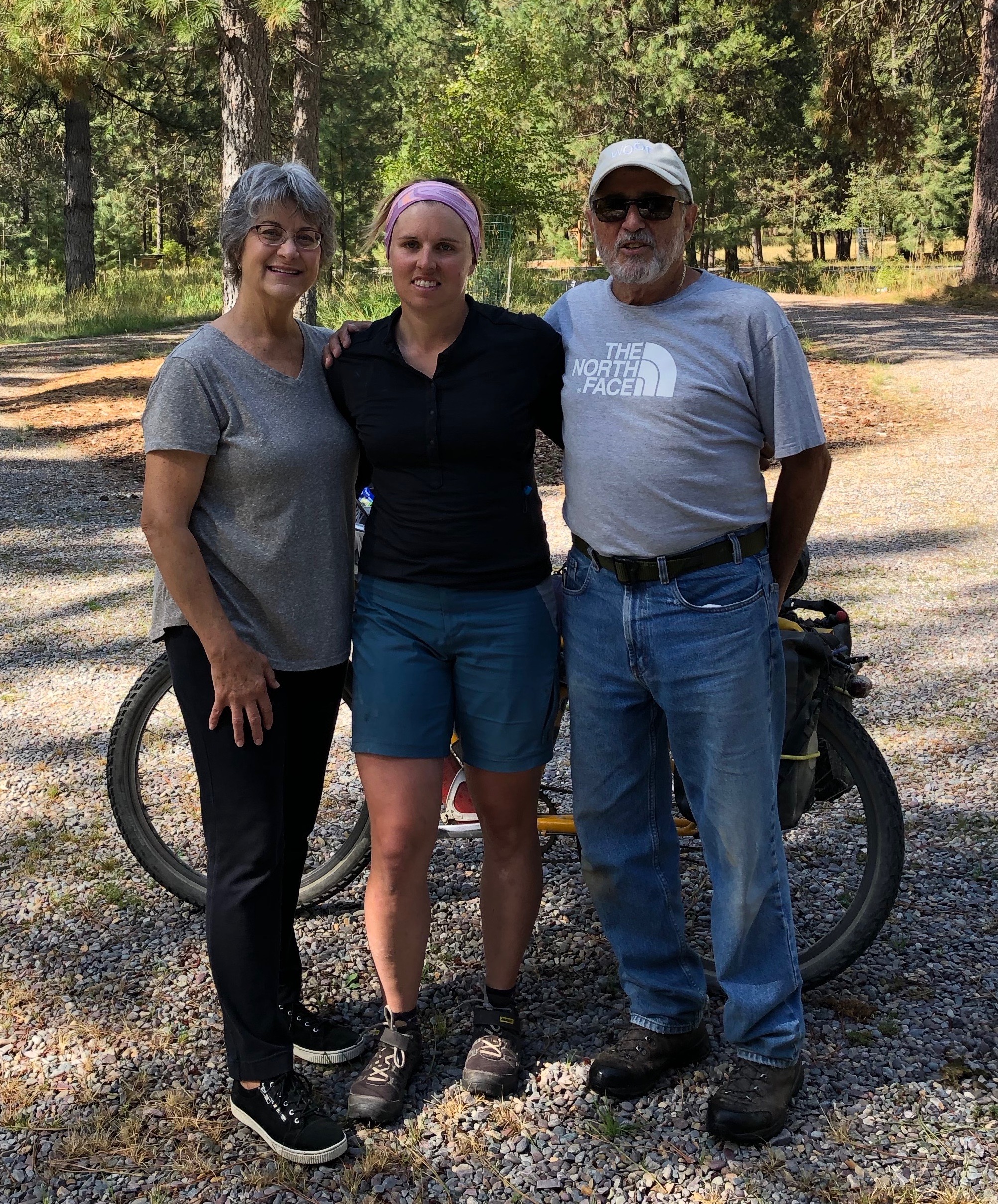
St. Regis, MT
The River
On a bicycle riding through Montana and Idaho, my life revolved around the rivers. The route often followed them closely, the cool water providing refuge in the humid summer temperatures.
I drank out of them and I washed away the day’s dirt and sweat. Climbing the Hoodoo Pass and descending to the Clearwater River was a highlight of the trip. The narrow road meandered through the woods and then rambled along the river, rock cliffs towering on either side. It was also labour day weekend, so I met plenty of ATVs. It seemed like no matter how remote the area was, I would always meet someone on a side-by-side. The majority of the riders were very courteous, often stopping to ask if I was OK.
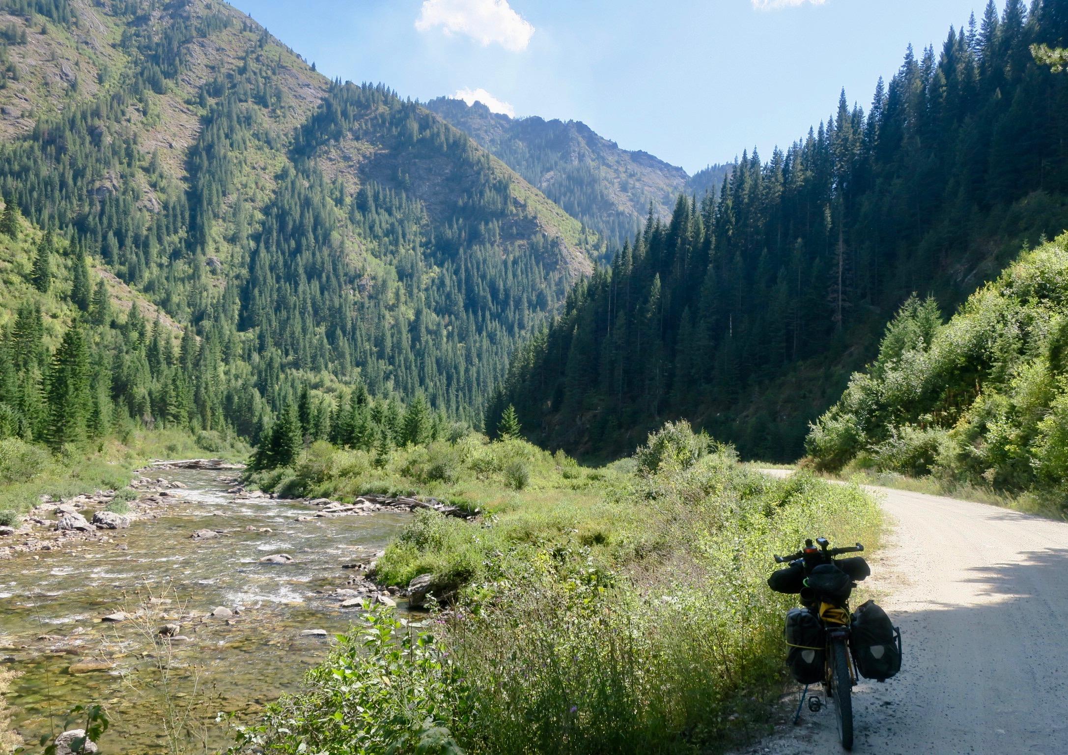
Following the Clearwater River, Idaho
This area of Idaho was becoming increasingly remote, preparing me for the crossing of the Magruder Corridor, supposedly the most rugged and remote section of the entire Wild West Route.
I passed through small towns like Pierce, with only a few hundred residents.

Most of the locals I chatted to knew all about the Magruder as it was also a popular ATV outing. Of course, everyone thought I was nuts to be doing it on a bike.
“They (the government) let the wildfires burn, so it’s not as beautiful as it used to be,” one man said.
On the hottest day of the trip, I descended to the Selway River, which I soaked in for a about half an hour to regain my energy so I could start the 40km climb towards Elk City near the beginning of the Magruder Corridor. Big elevation gains and losses were the facts of life crossing Montana and Idaho. Climbing for 30+ km up and down a mountain pass was basically a daily standard. I made it about 10km up the climb and ended the day camping at a large landing on the side of a quiet dirt road.
_ _ _ _ _ _
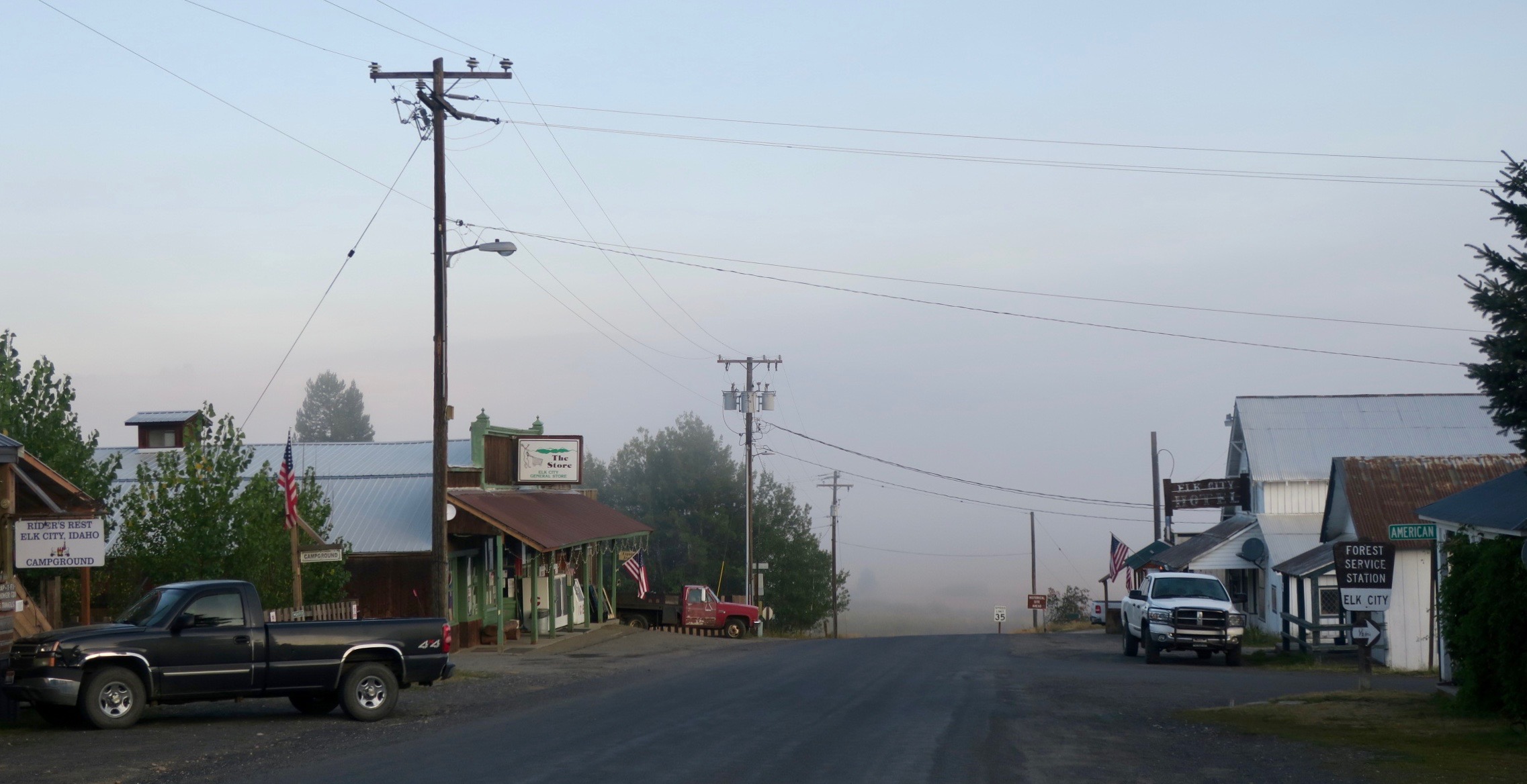
Tiny community of Elk City, ID
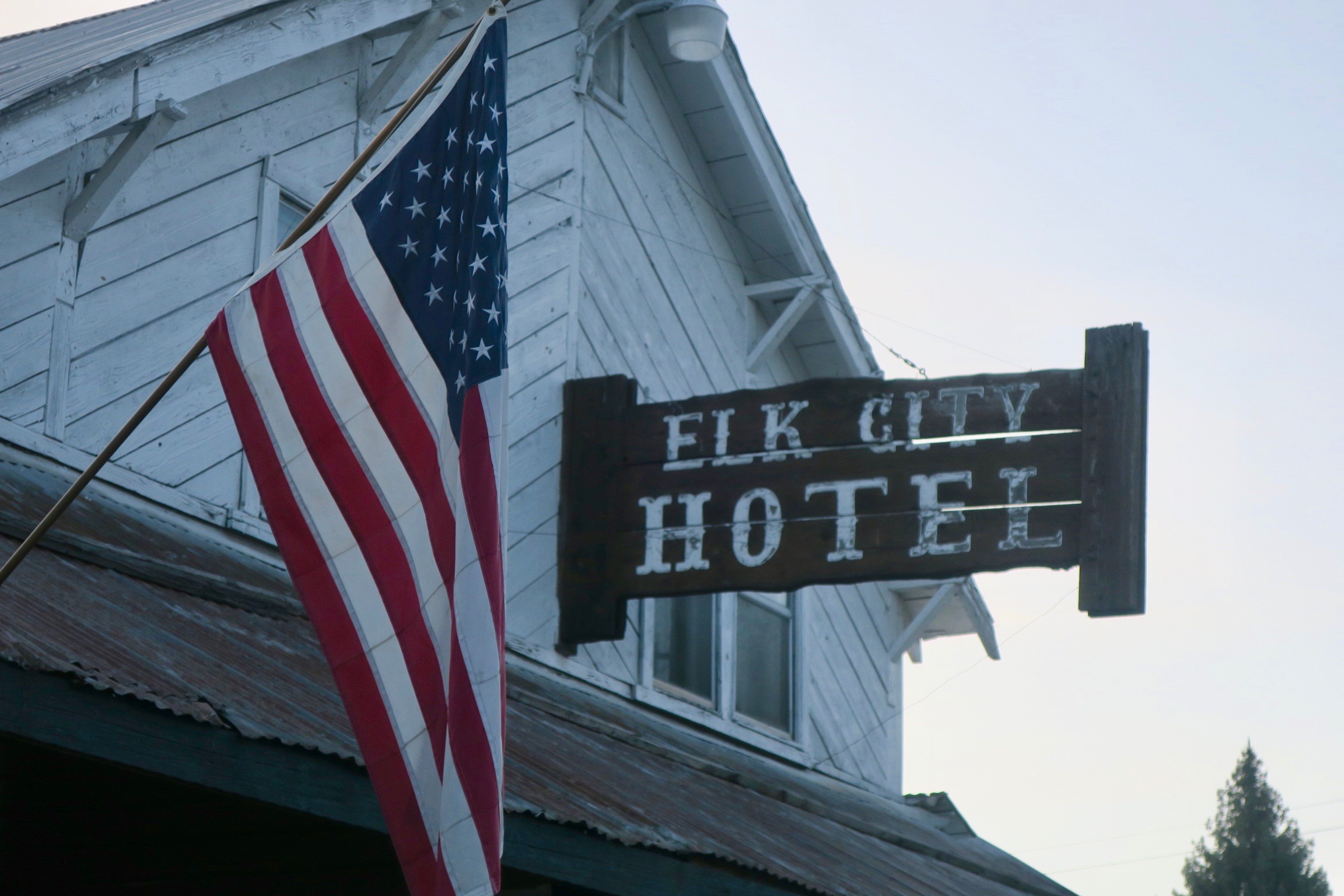
The climb to the summit was relentless and I hit the descent towards the tiny outpost of Elk City with barely any reserves left. While speeding down a paved road into town, I saw a man in full camo with one arm outstretched holding a can of beer, the other waving to me. As I slowed down, he beamed “Hi! Do you want a cold beer?!”
“Why, yes I do!!”
I gratefully accepted the ice cold Bud Light. John was a road cyclist himself and really, really into hunting…like, lived and breathed it. Inside his home he had many mounted heads of large ungulates and impressive rugs. He had a thick Idahoan accent, as dense as his moustache. He pronounced creek like “crick” and him like “eem.” He was a joy to talk to and one of the friendliest people I’ve ever met. After a couple of beer, I really started to feeling the fatigue of the climb and gratefully accepted his offer to stay the night. He made me his favourite meal, chili dogs, which are basically amped up hot dogs smothered in chilli sauce, cheese and onion. It really hit the spot. I will always fondly remember John the Elk Hunter from Elk City.
The Magruder Corridor
In the WWR guide, The Magruder Corridor crossing is described as “90 miles of rough and taking dirt and 4X4 roads sandwiched between two of the largest wilderness areas in the lower 48. So, obviously, it wouldn’t be cake walk. Several large wildfires over the last several decades had ripped through the area. They left behind large swathes of eerie skeletal trees climbing up and down the hillsides. It was a stark and surreal looking scene – blackened spears challenging a piercing blue sky.
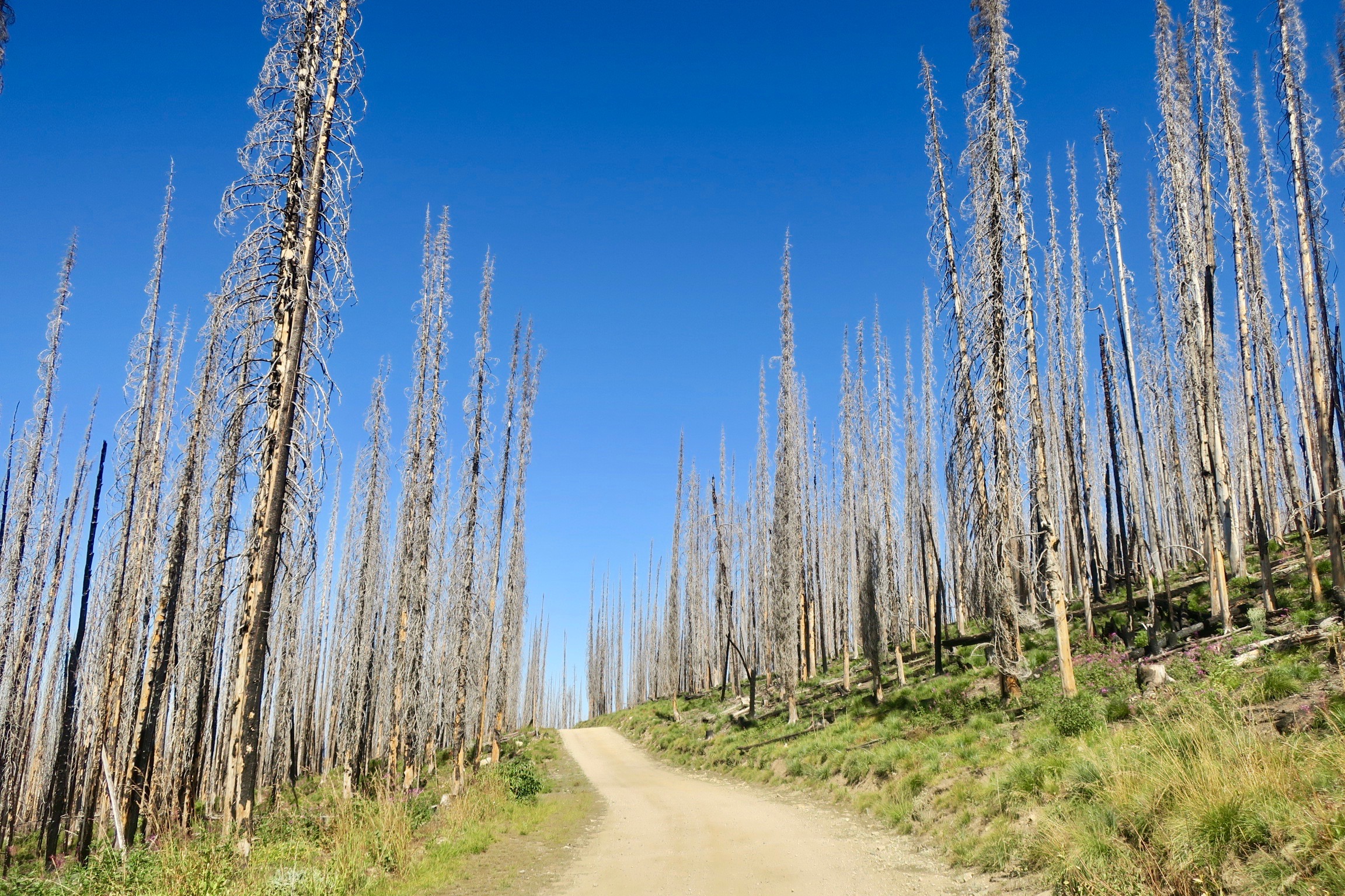
Fire damage in the Magruder Corridor
I came across a black bear with two cubs in the middle of the road in a more forested area.
I stopped and waited for them to move away from the road before I continued. Throughout the day, the views became larger and more dramatic. The road went from bad to worse – from rough dirt to large rocks. I wasn’t alone in this wilderness as there were quite a few people on side by sides and a select few willing to beat the shit out of their trucks. I also met two other bikepackers doing a section of the WWR – only my second and third at that point. I left the most brutal climb for the end of the day after an equally tough descent to Poet Creek.
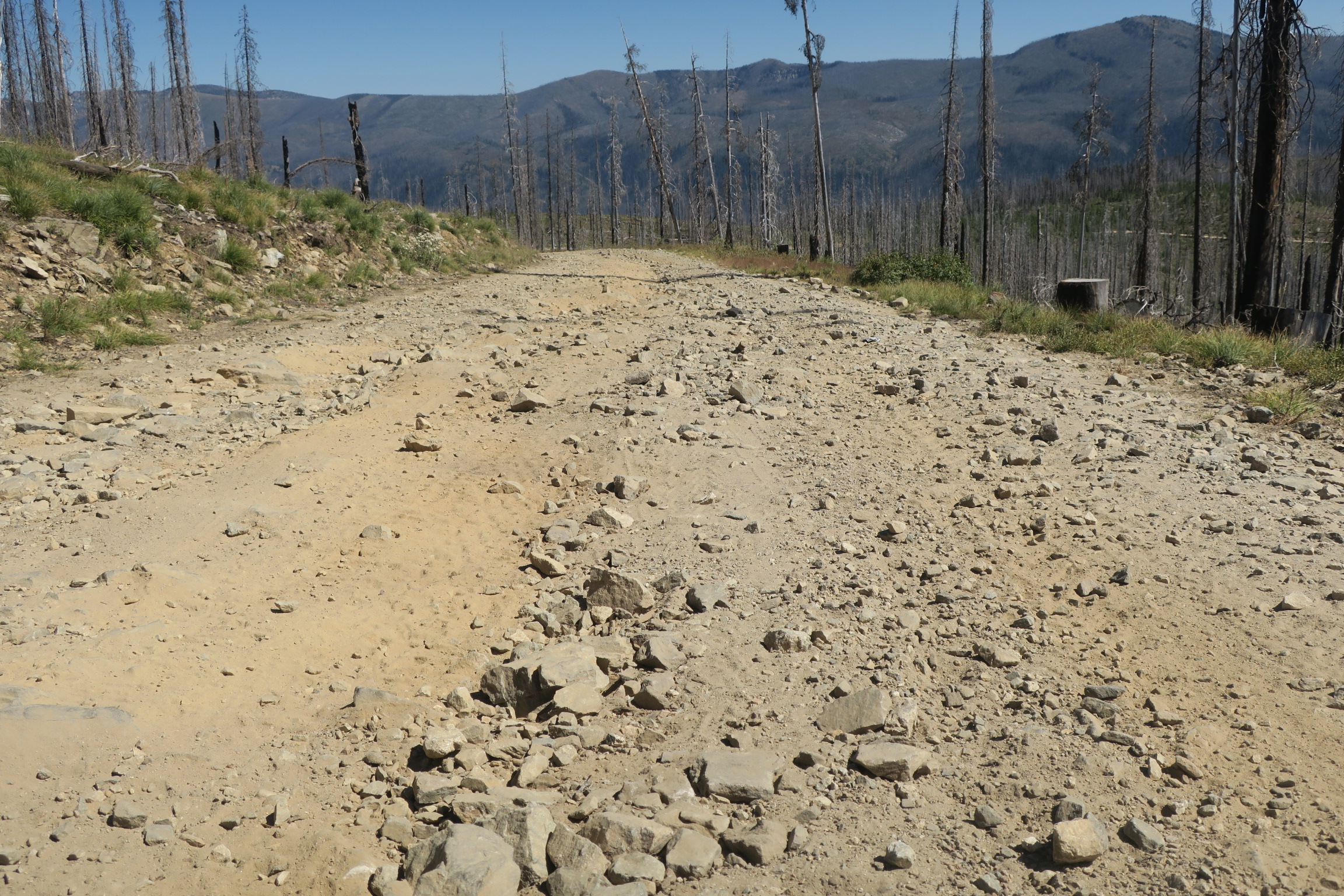
Rough road, Magruder Corridor
Within the last 800m of the summit I had absolutely nothing left in my legs and opted to push the rest of the way, which wasn’t much easier that riding. I had really hoped that I could camp somewhere once I got to the top, because there was no level ground anywhere, it seemed. Huffing and puffing, pushing and dragging, I finally made it to the top of the climb. I was in luck – a pullout! Large enough for me to camp. It was next to the road but there was very little traffic and I was too tired to care. I was so tired that it was almost a bit discouraging – I was suddenly having doubts about my ability to physically cope on this trip. These negative thoughts were temporarily cast aside when the sun began to set. The silhouettes of a broken woodland stood strong against an extraordinary palette of colours.
I slept hard that night.
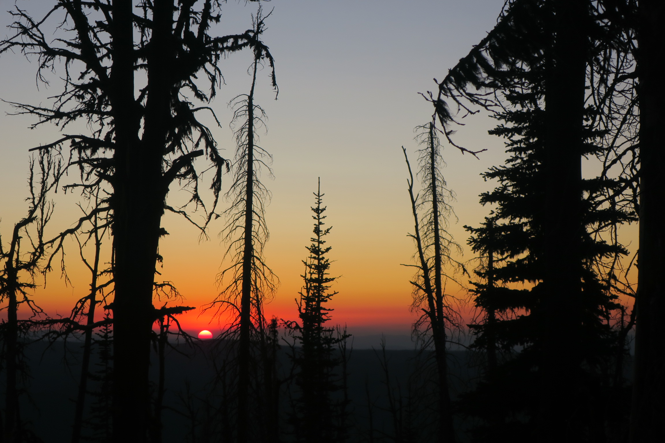
Sunset, Magruder Corridor
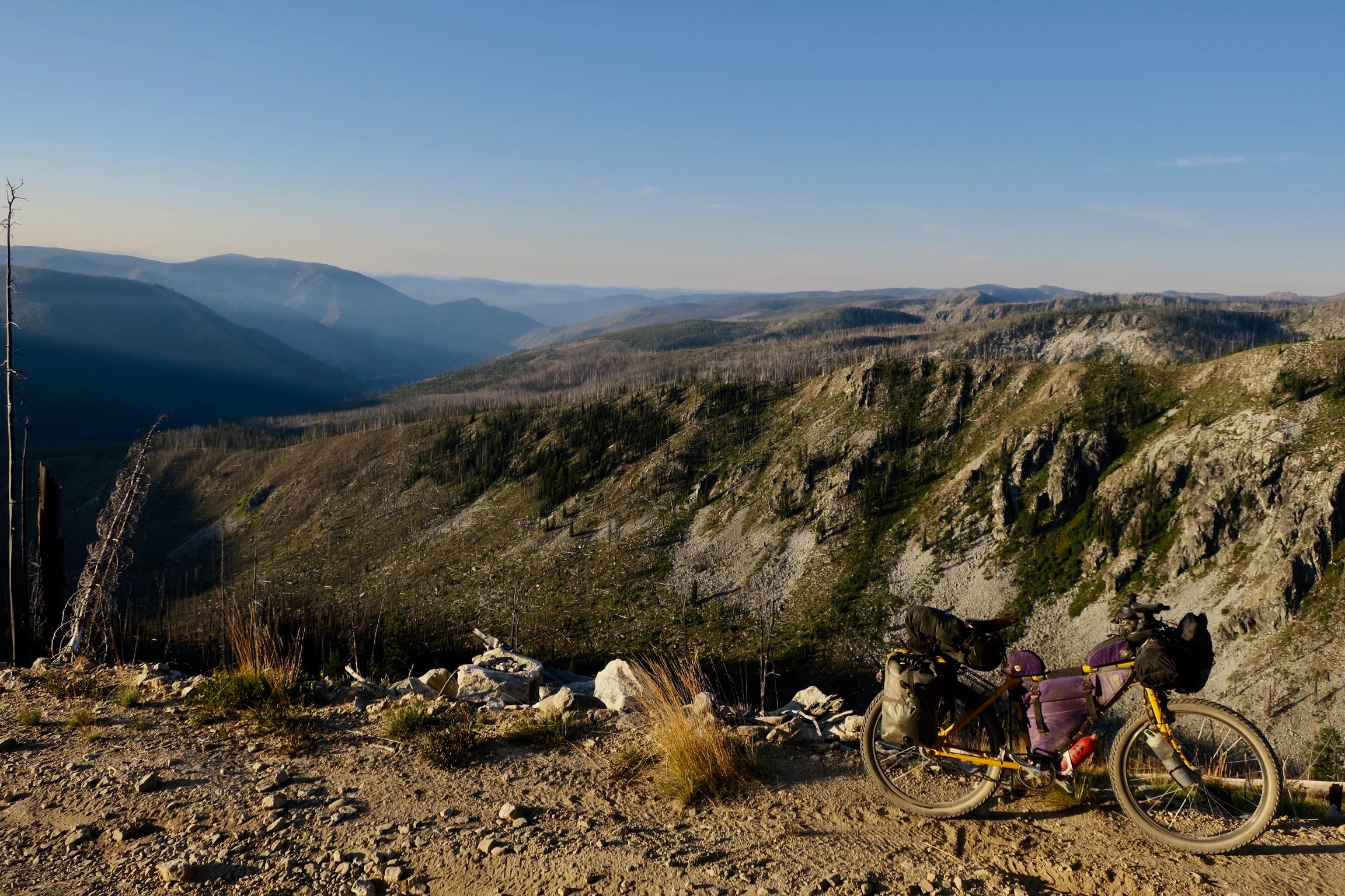
Magruder Corridor

Magruder Corridor
The following morning, all doubts from the previous day seemed to disappear. The toughest part of the Magruder crossing was over, but there was still some climbing to do and a very rough descent. My goal was to reach a campground called Deep Creek. In my tired state, I thought of the movie “Get Him to the Greek” and came up with “Get Me to the Creek” to try and give myself some motivation. Definitely more amusing to me at the time…
The cheesy title didn’t motivate me enough, but I did end up camping by a creek, grateful to have a wash at the end of the day.
_ _ _ _
After resupplying in the touristy town of Darby, Montana I headed off to climb the Horse Creek pass back into Idaho. Like the Magruder Corridor, the area had extensive amounts of fire damage. It was a lonely and eerie climb. The sky was heavy with greyness, with the odd sliver strand of sunlight fighting its way through. I slept beside the road at the top of the pass. It was one of the quietest nights of trip – no wind, no stars. I was only surrounded by lifeless limbs burnt to the bone. These trees offered no shelter, no protection and held no secrets.
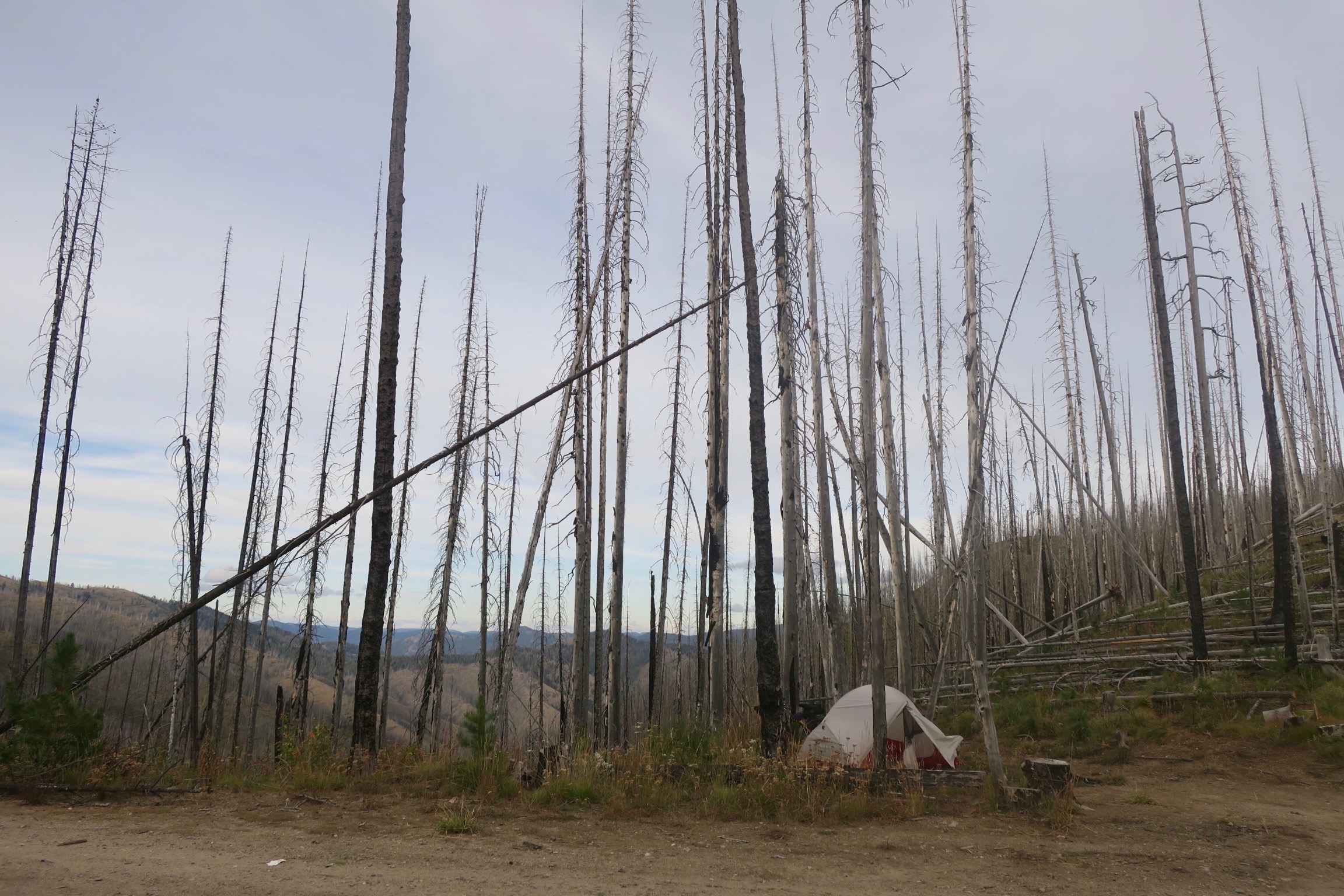
Camping at Horse Creek Pass, Montana

The Climb to Horse Creek Pass, MT
The next morning, the climbing continued, leading to a massive and hairy descent down to the Salmon River Canyon through dramatic, rocky hillsides dotted with ponderosa pine.
I continued along the Salmon River, when the weather began to turn. It rained steadily the rest of the day and I arrived at McDonald Flat campground soaked and cold. I didn’t waste any time and set up my tent as quickly as I could. While I was doing so in the persistent drizzle, a pickup pulled up beside me. An older man and woman were in front.
“We saw you riding further up the road. You were moving fast, but you looked cold. It didn’t look like you were having a lot of fun!” the man said.
“Yeah,” I laughed, “Heavy rain isn’t my favourite!”
“Do you drink beer?” he asked.
They invited me to come and hang out at their campsite after if I wanted. I said that I would come over. Freezing cold and starving, I first ran to the public bathroom and cooked pasta inside. When I finished doing that, I changed into dry clothes and crawled into my sleeping bag, where I laid for about 30 minutes before I felt warm enough to go anywhere.
Later, I went over to the campsite where Kevin and Pat where staying, whom I had met earlier. They were a local retired couple camping out in their RV for a week. I was greeted by a raging fire and offered beer and food. These wonderful people completely turned my day around. I stayed with them until darkness fell. We exchanged stories by the flickering light, while my cycling clothes dried out over a camp chair. They told me to come back the next morning for coffee.
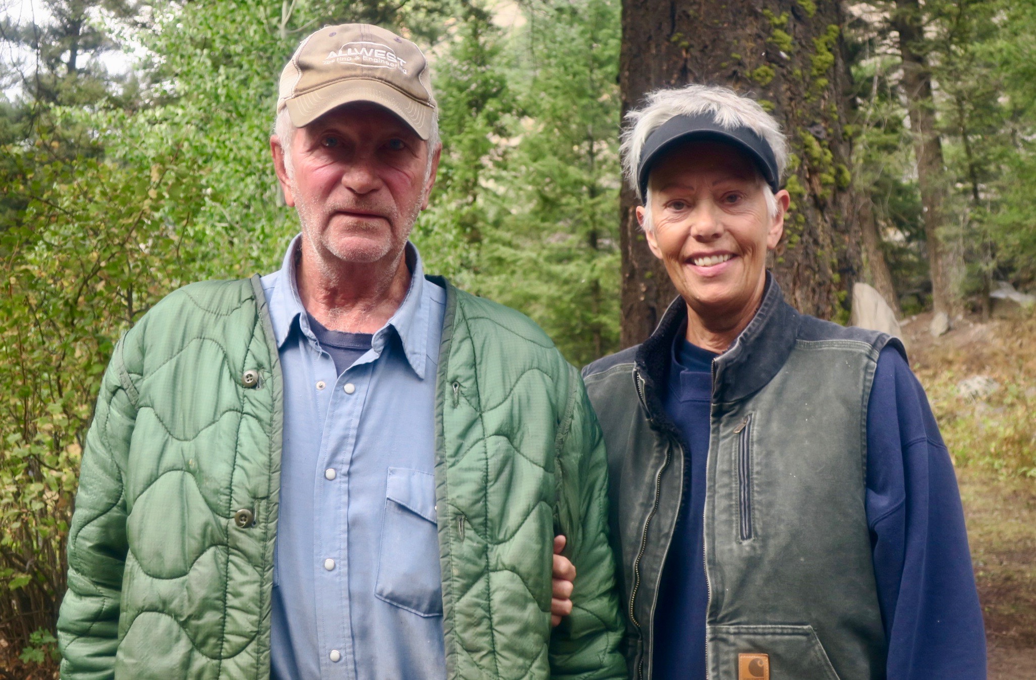
Trail angels, Pat and Kevin
I savoured the following morning with them, sipping slowly at my coffee with honey. Once again I was so grateful to have encountered such wonderful human beings. Departure is a thrilling part of nomadism, but the “goodbye” isn’t always easy.
Unfortunately, the rest of the day didn’t turn out so well. There was now a more distinct chill in the air and the aspens fluttered in gold. Fall was here. I was shivering most of the day and it seemed like I couldn’t shake the chill no matter how many layers I put on. I soon hit a big descent towards Challis – the coniferous forests changed into sage-covered hills once again.

Scenery approaching Challis, ID
I had absolutely no energy when I arrived in town and I even considered walking the last flat and paved mile, because I wasn’t sure I could make it.
At my Warm Showers host’s place, I felt completely out of it, thinking it was just fatigue and I struggled to keep it together. When I left the next morning, I suddenly decided that I felt too ill to ride and went straight to a hotel. I didn’t leave the room for two days – I believe I had food poisoning of some kind, but even now I am not exactly sure.
When I managed to ride away from the hotel in Challis, I was far from 100%, but I had to keep going. Another big climb followed over the old Custer Motorway and past several small ghost towns. On the way to Stanley on a chilly morning, I passed some hot springs right on the side of the road. I almost choked on the steam, lushly hanging in the cold air. I took off my gloves and shoes, dipping my cold hands and feet in the hot water. It was heaven.

Hot springs on the side of the road near Stanley, ID
The tiny town of Stanley, with the dramatic Sawtooth mountains as backdrop, seemed to attract outdoor hipster types. After a latte at a hip food truck, I headed off to explore the valley.

Stanley, ID
On some double track near town, three bikepackers raced downhill at full speed, hollering as they ripped past me. I assumed that they were on a day trip because of how light their rigs looked. Throughout the day I started to see more and more riders pass me. Eventually one guy stopped and asked if I was on the “Smoke and Fire.”
“The what?” I asked.

Russ, Idaho Smoke and Fire 400 racer
The Idaho Smoke and Fire 400 is a self supported bikepacking race that takes place every September. I ended up seeing about 25 riders that day. It was sort of exciting, because I had only met about three other bikepackers since beginning the Western Wildlands Route. I chatted with quite a few of them – some looking disoriented and sleep deprived, but still having a great time. It made me happy to be in such a large community of cyclists, which is something I am definitely missing in my home life. I really got to experience the depth of the field – from the leaders at the front, to those chilling at the back. I met two guys who said they started each morning of the ride with a bloody mary and were in no rush. Apparently the winner of the race completed the 640km-ish course in an astounding 48 hours!

Sawtooth Valley, ID


That same night I met two guys doing a section of the WWR on a fat bike and a plus bike. They both joined me at camp. Around 10pm, a woman from Boise, Idaho racing the Smoke and Fire also joined us. All three were traveling ultralight and sleep in bivy sacs. It was great to have the company.
After the beautiful ride through the Sawtooth Valley, I passed by the mountain bike hub of Galena Lodge on my way to Ketchum and Hailey, ID.
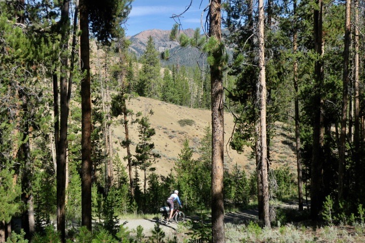
Mountain biker on the route near Galena Lodge, ID

near Galena Lodge, ID
Beyond Hailey, the stands of trees started to disappear and the landscape became even drier and more wide open. Golden coloured grasslands and sagebrush dominated. These were the vast “wild west” type vistas I had envisioned.


Craters of the Moon National Monument presented a very unique volcanic and blackened landscape. I was unfortunately unable to appreciate it as I was still recovering from my sickness from less than a week ago. I could barely stay awake at the visitor’s centre and decided to keep moving on. I had to take a nap in a ditch on a quiet dirt road just so I could keep going. Luckily, it helped.
Snake River Plain
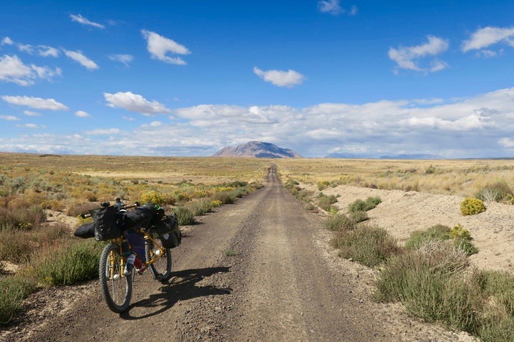
Snake River Plain, ID
Pedalling across the vast intermountain Snake River Plan brought back the feeling of crossing the Australian outback or Mongolia. It was a huge sky tucked into a sea of sage brush from where the odd lone peak emerged. I loved the solitude. In the distance, I could see a storm cloud growing. I decided to stop early to set up my tent, knowing I would be fully exposed. I ended up stopping just in time. With no real wind shelter, the storm hit hard. The blasts of wind were intense and I attempted to brace my tent poles with my hands, fearing they would snap. After about 15 minutes, the winds began to calm. I watched as the navy clouds pulled the storm away across the treeless plain. The sun battled through the dark skies and glazed the scrublands in gold. It was a surreal sight.

Storm, Snake River Plain, ID
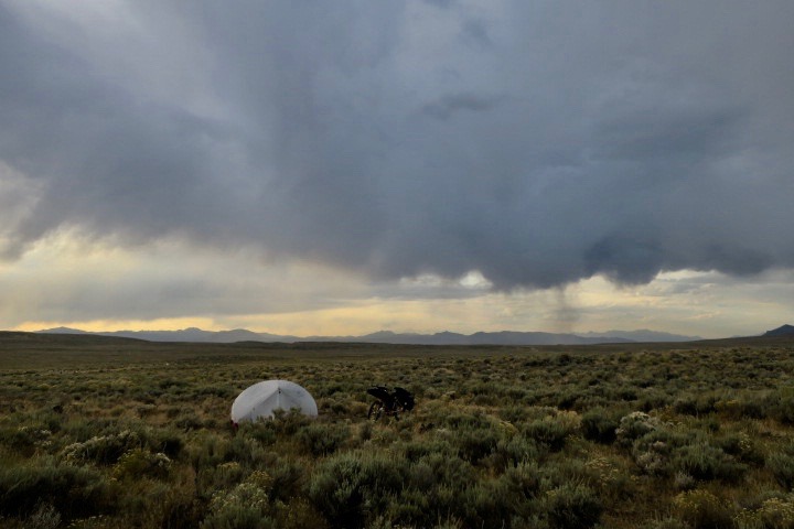
After the storm, Snake River Plain, ID

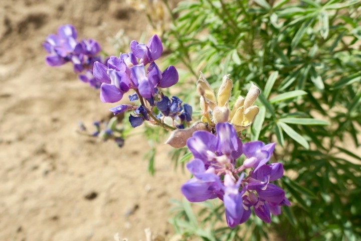
Wildflowers on the Snake River Plain
The wind stayed strong the following morning, delivering me a good combination and headwind and crosswind. Crossing the Snake River plain was a highlight of the journey for me, because of how remote it felt. Unlike the Magruder Corridor, I was completely alone. I was a mere speck in the vast kingdom of sage brush.
Characters of Soda Springs
The very south of Idaho was quite different because I was now surrounded by more farmland. Wild camping became a bit trickier. Just outside of Blackfoot, a generic town full of chain restaurants, I had a dog follow me for about 10km. I was passing through some farming areas and while many dogs barked threateningly, I had one that hollered with excitement and began to follow me. He ran beside me, occasionally fighting with other dogs and chasing away cats. When I hit the busier road to Blackfoot, he finally stayed put, standing in the middle of the road watching me pedal away. I hope he made it home, wherever that was!
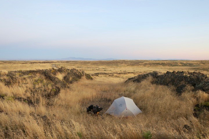
Wild camping near Soda Springs, ID
I navigated some more hilly country and private land before reaching Soda Springs, following a brutal day of headwind. I enquired at an RV park about somewhere to camp for the night and the owner was generous enough to let me stay for free. I was warned about some rain coming in the next day. From this point until pretty much the very end of the Wild West route, most of the roads would become impassible when wet, due to the clay-rich soil.
The following morning, I packed up and went for breakfast at the Main St. Diner. This seemed to be the meeting point for all of the retirees in town. It was a no frills, friendly, small town kind of place. I talked to a guy smoking outside, who told me he had met a French Canadian girl a week previous doing that same route I was. I had already known about Rose, a friend of a friend on the route who I communicated with throughout the ride. He advised me against heading into the hills, because in the rain it would turn “into concrete.” Over a massive breakfast skillet loaded with bacon and sausage, I made the call to wait out the rain and leave the following day.
I ended up in a basement room in a cheap motel to hide out from the weather. A few doors down, a long haul trucker and his apprentice were stuck, waiting to get their rig fixed after a breakdown. In their tiny room, he was making beef stew in a slow cooker, the savoury smell wafting down the hallway. He said they were likely leaving in a few hours and I could have as much as I wanted. The trucker was like a character out of a pickup commercial with a full, deep voice and a pronounced drawl. We exchanged stories about life “on the road,” even though my version of life on the road couldn’t be more different. He talked about endless miles across the prairies, sleepless nights, dreams of hauling up to Alaska.
“…and then,” he said, “there were the truck stop girls…”
It was a good way to spend a rainy day and to gain insight into what was for me, such a foreign way of life.
I ended up at the Main St. Diner again the next morning and met the same man smoking outside in the same spot at probably around the same time. After another massive breakfast, it was time to leave the characters and stories behind to hit road.
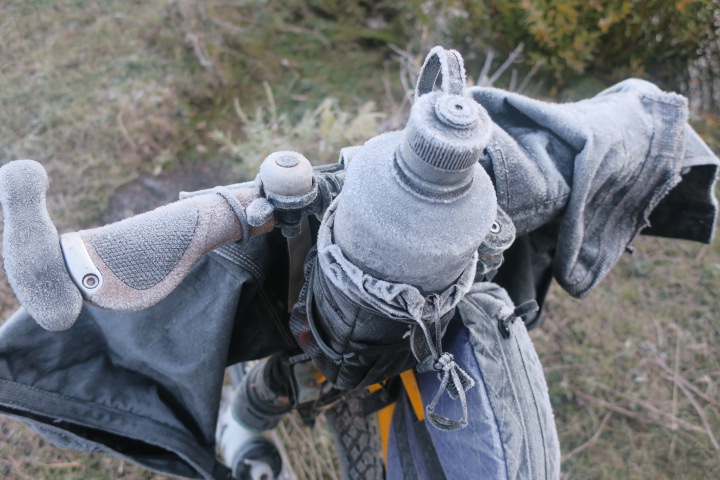
Weather turns cold in Southern Idaho
In the rugged Preuss Range, I started to feel like I had a narrow window of good weather left. It was late September and the days were cold now, but luckily I had no snow. I did manage to get caught in a hail storm on a climb not too far from Soda Springs. The roads turned to mud, but luckily the weather improved throughout the day and I was able to avoid camping in the rain.
I woke up the next morning to a frozen bike. Yes, winter was just around the corner.
I climbed up through more rolling and sage covered hills. The roads were ribbons of crimson coloured dirt slicing through. In the distance, I saw the bright blue waters of Bear Lake, which straddled the border between Utah and Idaho. It was a fast descent on dirt, which eventually led to smooth paved road following the lake. I was now in Utah, beginning the next chapter of the ride. Utah is a place I had dreamed about cycling for years and I had finally made it.
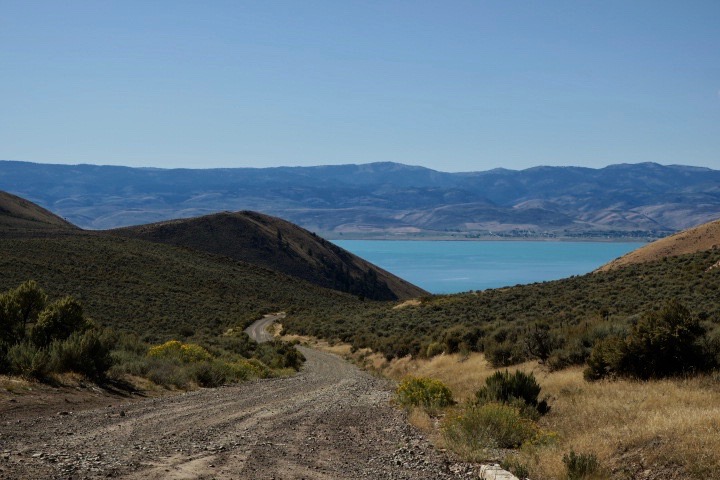
Descending to Bear Lake, Utah/Idaho
I loved the Idaho and Montana sections of the route – both people and scenery.
But what called me the most was the desert.
Next post…Utah!
Day one and I am buzzing from head to toe. I pedalled out of the same driveway in Canmore where an injury forced me to end my trip a year ago. I was filled with excitement and anxiety. Although I was coming to the start fit and healthy, I was anxious that my knee issue might resurface. I wanted to continue doing what I loved most. Leaving the town behind, I started to slowly climb to new heights. The mountains beckoned, surrounded, cradled me like a new life.
I had a wonderful few days with my Warm Showers hosts Toivo and Suzanne in Canmore. These two had taken me in the previous year when I had decided that I was unable continue my planned route on the Great Divide. It was also great for my dad to join us – a lifelong cyclist was a new interest in touring.
This year, I had a new plan. In May 2019, I came across a Facebook post about a new long distance bikepacking route through the USA called the Western Wildlands Route (then named the ‘Wild West Route’ but changed in 2020 out of respect for First Nations as it passes through traditional territories). The route claimed to be “more remote and rugged” than the Great Divide.” The 2700 mile route passed through Montana, Idaho, Utah and Arizona. The crossing of Utah and Arizona is what hooked me in. I had planned to deviate from the Great Divide anyway to go to those states. It seemed too perfect and I was beyond excited.

Goat and her kids near Canmore, AB
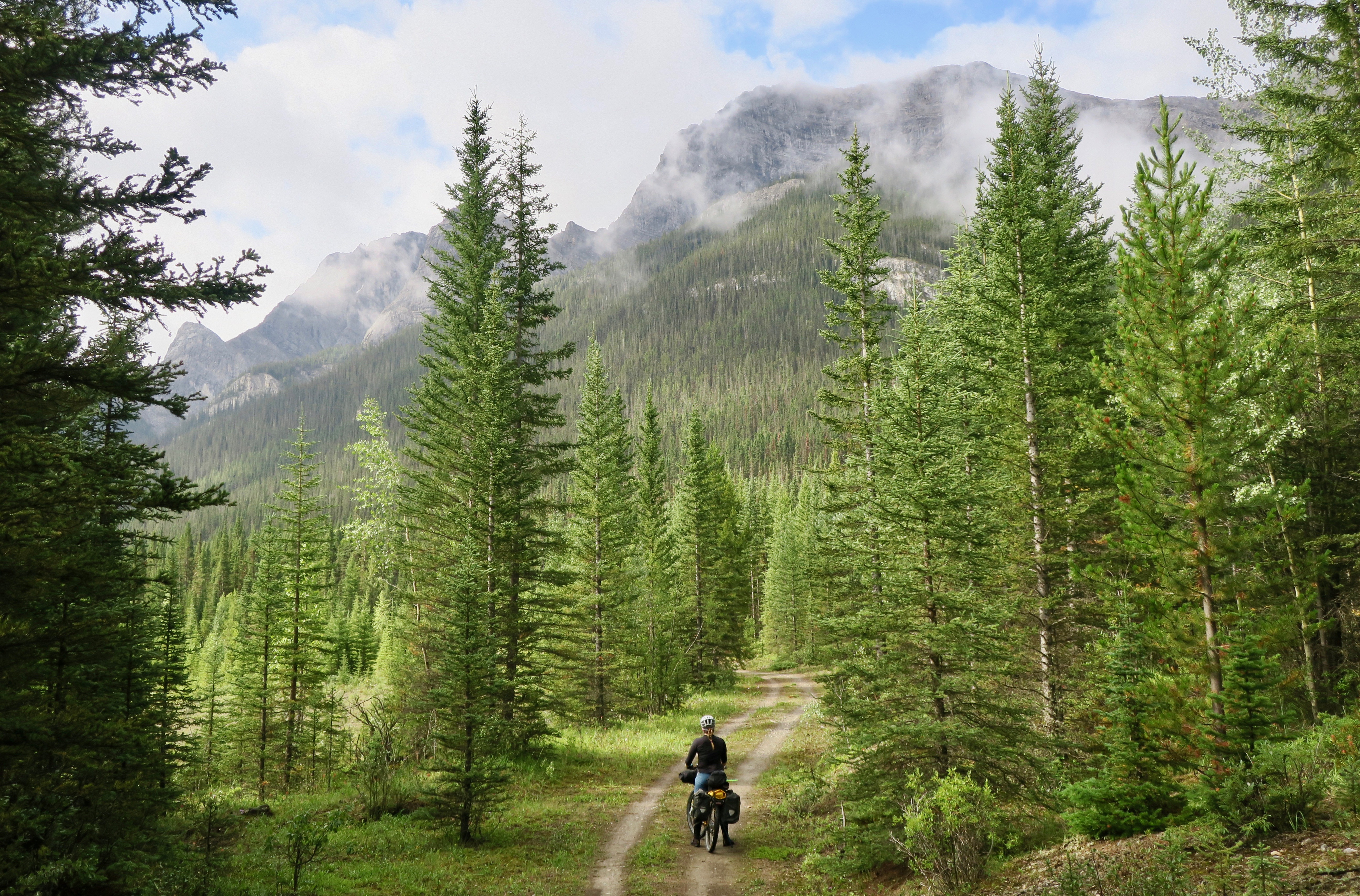
Goat Creek Trail near Canmore, AB
Back to the beginning – after a decent climb out of Canmore, I turned off onto the Goat Creek trail, following blissful double track through the woods.
I was alone, fiercely in tune to my surroundings. The sun appeared every now and then, illuminating a corridor of green.
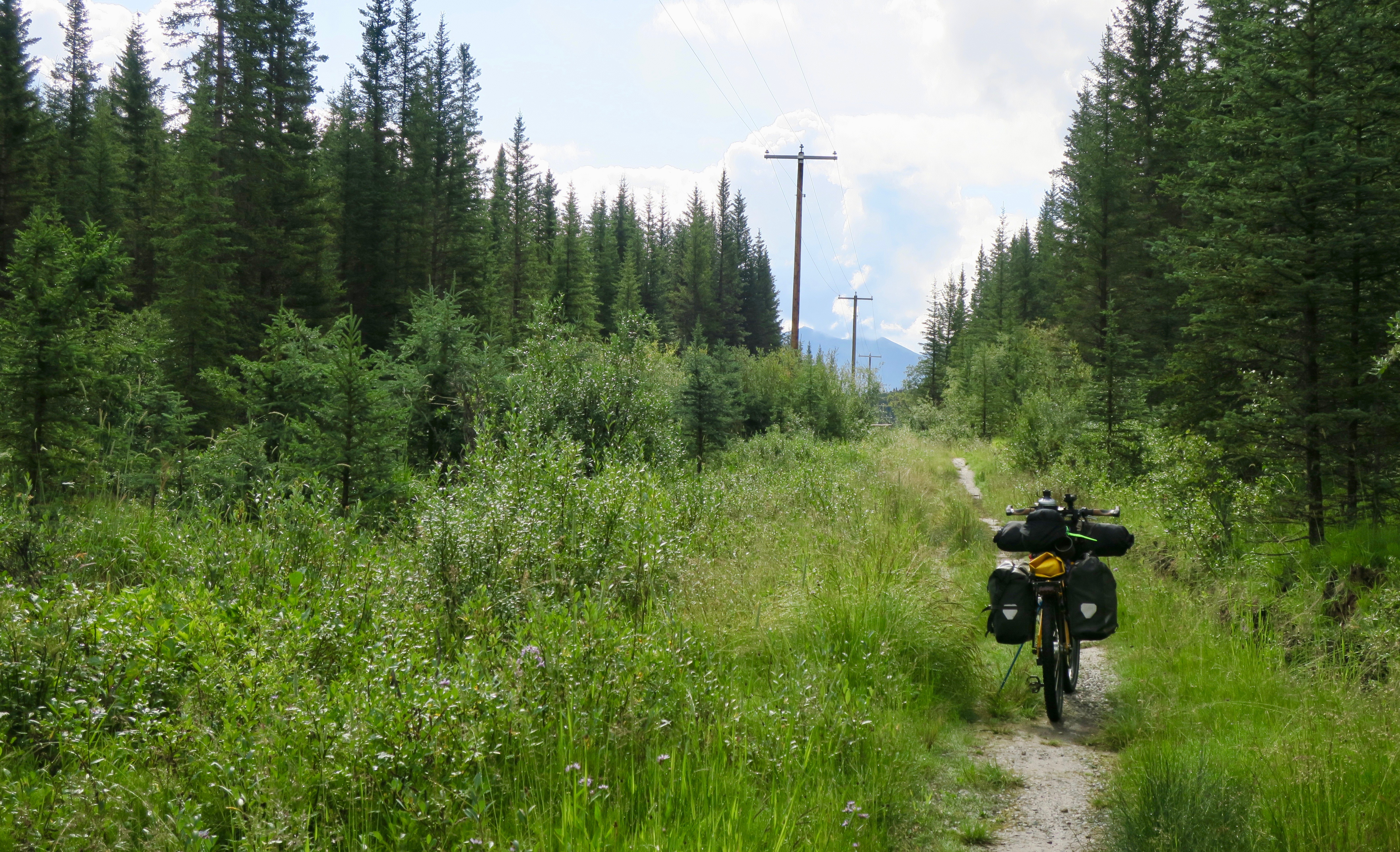
I passed by several small lakes and travelled along power line tracks.
Eventually, I left the tracks behind and entered the Spray Lakes Road. Kananaskis area is a very popular area to visit in the summer, so I saw a little bit of traffic on this road.
The views continued to amaze.


Spray Lakes Road
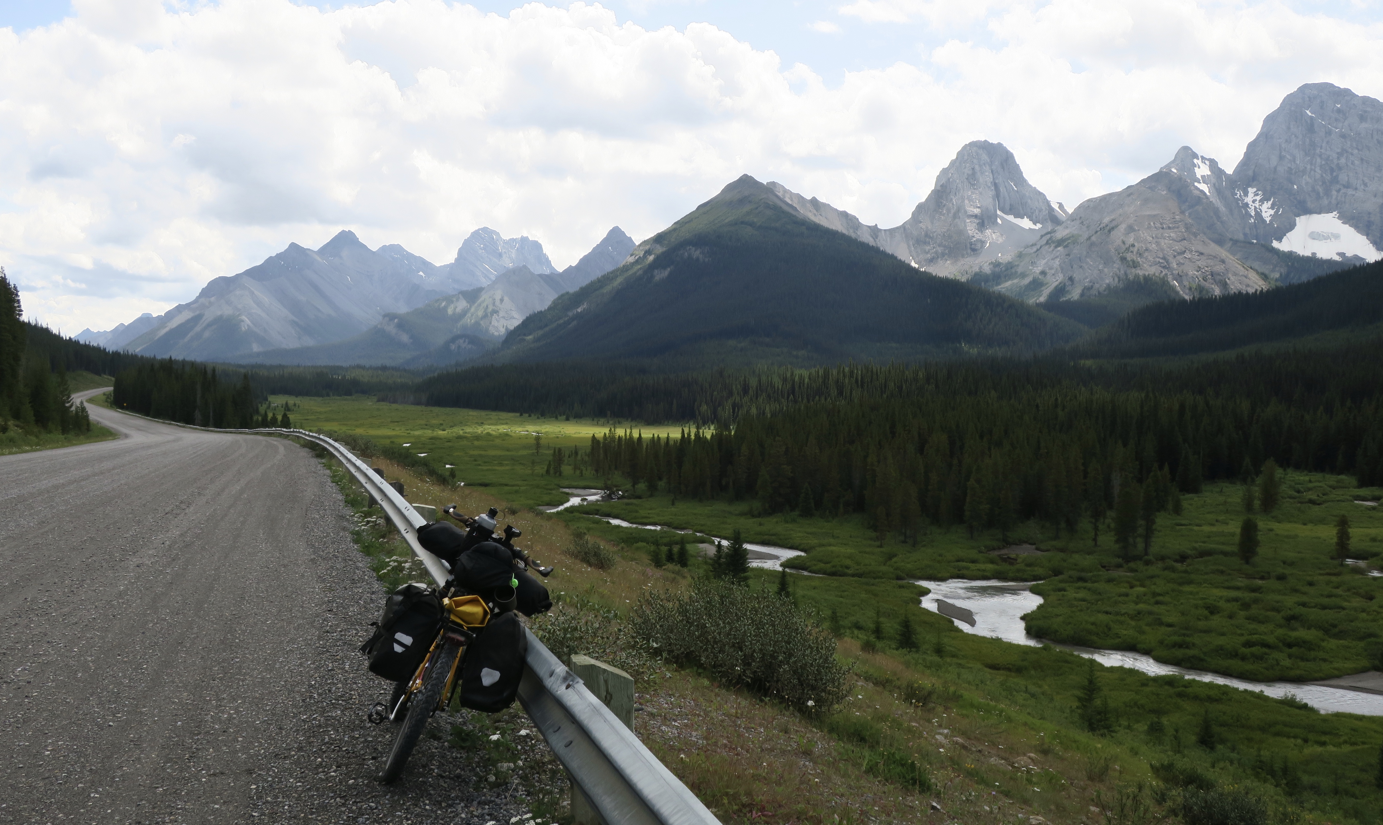
Spray Lakes Road
Wanting to avoid the busier and pricey campgrounds in the provincial park, I opted to wild camp. I ended up camping near a MTB trail by a river, pushing a bit into some tangly undergrowth in attempt to conceal my tent. Being in grizzly country, I made sure to clear all food and smelly objects out of the tent and hang them in a tree. Although I have wild camped many times solo around the world, overnighting in bear country always made me feel slightly uneasy.
Leaving camp the next morning, I began the climb up a remote power line trail towards Elk Pass. Travelling through bear country, I like to make some noise, so as to avoid a surprise encounter. This would usually involve some singing or occasionally yelling out “whoa, bear! Hey bear!” or something of the sort. I guess I was too focused or winded from the climbing that this time it escaped my mind. Cresting a smaller hill, I suddenly laid eyes upon a grizzly with two cubs, maybe 50m away.
As one would expect, my adrenaline shot up to the max. Luckily, years of experience working in the bush helped me to stay calm and react rationally.
I got off my bike and began to walk backwards very slowly. She stayed put and merely gazed at me, sniffing the air. The cubs were large enough to be small black bears. A trio I wanted nothing to do with.
When I was a ways away, I slowly turned around and started to descend slowly, making sure I wasn’t being followed. I ended up finding another MTB trail that would take me around to Elk Pass, avoiding that section of the power line and the grizzly hangout.
I was still experiencing the rush, afraid that she could reappear at any moment. The alternate trail followed a narrow, scenic corridor carved out around a stream. Eventually, the trail left the waterway and climbed steeply to Elk Pass, back on the original power line trail. I scanned my surroundings and to my relief saw no grizzlies.
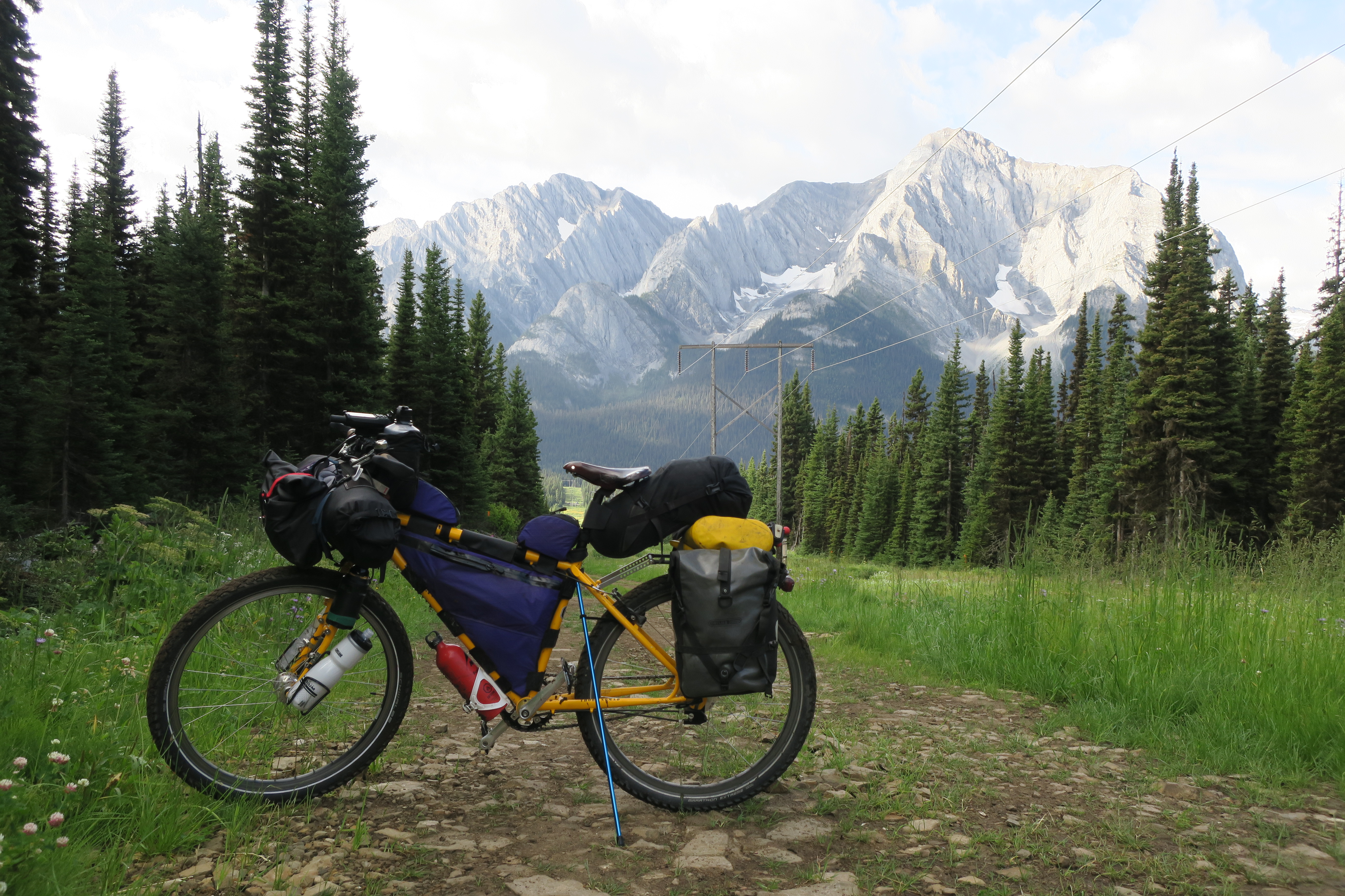
The descent from Elk Pass, power line trail where I encountered a grizzly and two cubs!
The descent that followed was spectacular. I ripped down the flowing power line trail towards a sky dominated by the giants of rock and ice.
Eventually the trail led to the Elk Lakes Forest Service Road, one of the most spectacular I have ever travelled on.
Elk Lakes Forest Service Road
After a while, the big mountain scenery disappeared slightly behind denser forest and hilly clearcuts.
A man in a pickup soon pulled up beside me. He had a long scraggly white beard and a gruff voice, likely formed by years of bush work, booze and cigarettes. He was falling danger trees and asked me if I was going to New Mexico, because he had met an Irish cyclist earlier.
I always enjoyed these brief encounters in the middle of nowhere. A human voice to ground my drifting thoughts from being lost to the land.
A few hours later, I ended up seeing another grizzly cub on the side of the road! I was relieved when the bearded man drove by in his pickup again moments later – perfect timing.
Coming out of Round Prairie (merely an area, not a town of any kind) the Divide route turned onto some singletrack. I was uncertain about this section because I felt like my moderately heavy load and lack of mountain biking experience might make it a bit of a struggle. I ended up having a lot of fun with it. If I had to push a little bit, who cares, thought. I wasn’t in a rush.
I loved the windy bits through the woods, the foliage filtering the sun’s rays, dispersing them in golden strands.

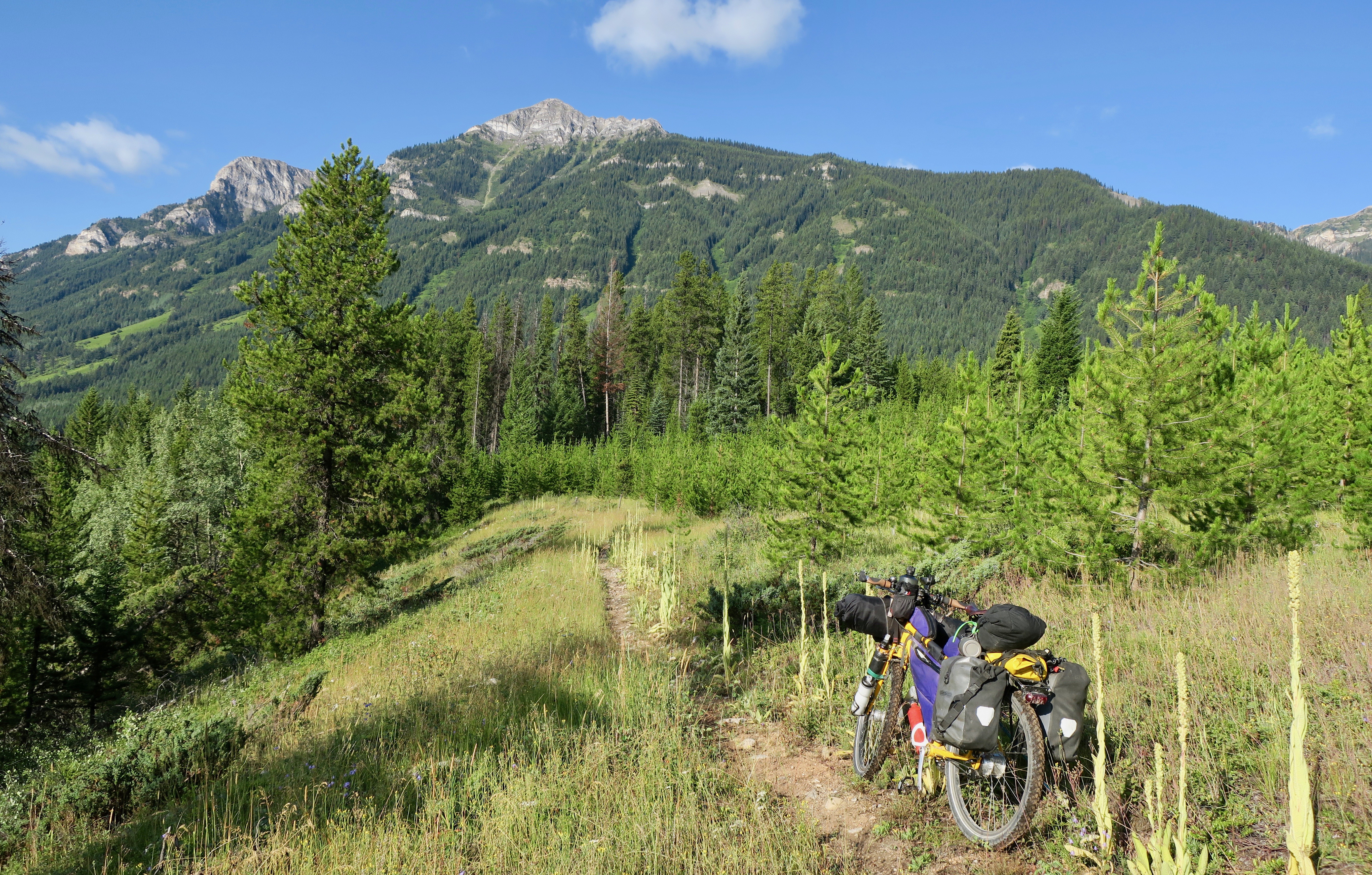
In Elkford I stopped at the gas station for some late morning instant noodles, eating them at a picnic bench outside. I joined a crew of colourful local characters – some retired, some just bored. I told them my grizzly story and they followed with some bear stories of their own. Apparently there were a few “locals” around town that were spotted often. They even had names for some of the bears and complained about them like a surly neighbour. “Last time, I got ‘im, Billy, with birdshot, told ‘im to fuck off.” An entertaining stop it was.
The single track continued for a while until I hit the paved road to Sparwood, where I would take a day off to meet my friends Lucas and Starr, whom I met working in natural resources years ago.
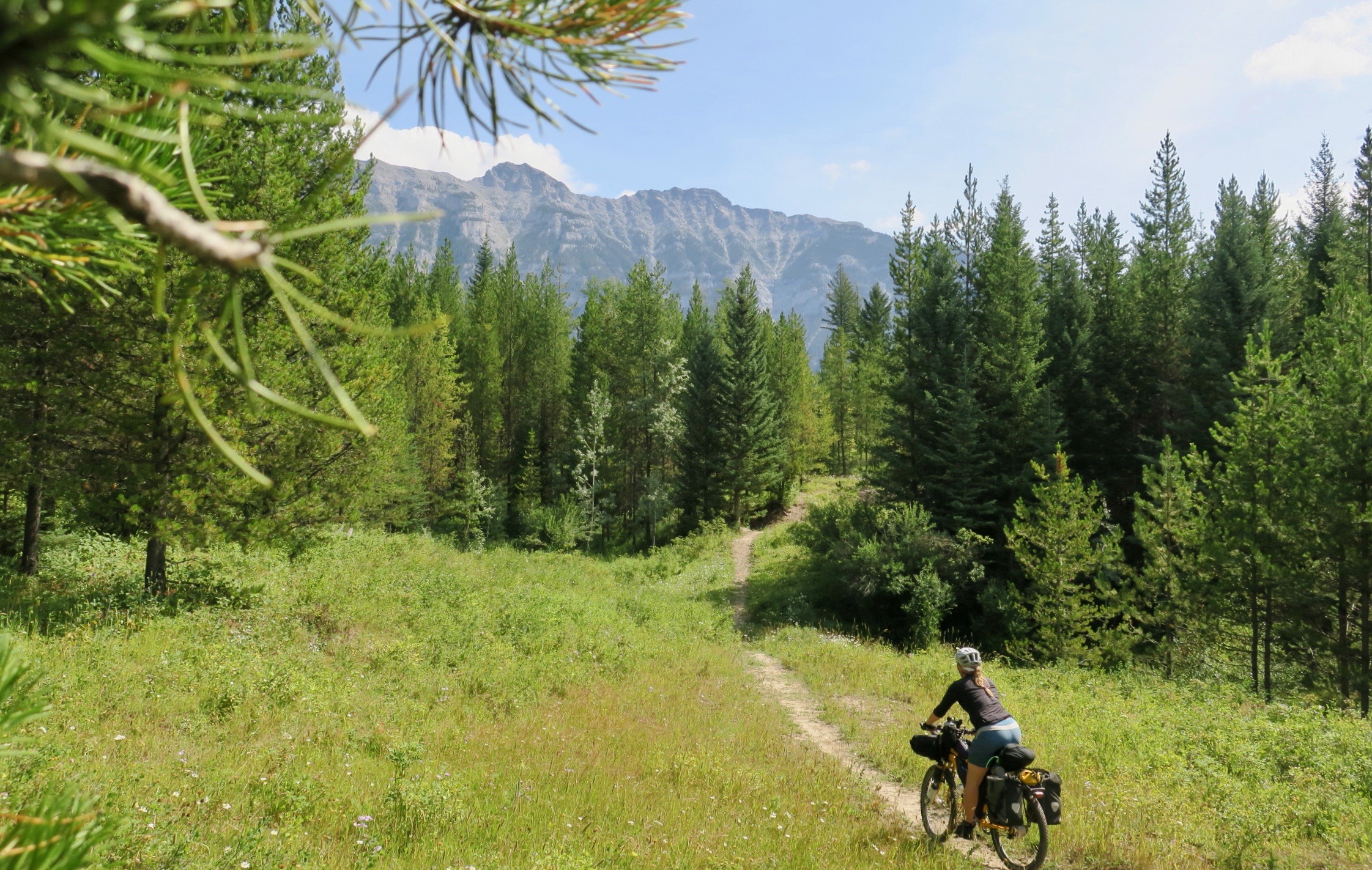
Riding singletrack near Sparwood, BC
Of course I had to take a photo of me and my bike with “Titan” the gigantic mining truck.

Titan truck: Two pickups and two Greyhound buses can fit into the box of this thing!
Lucas came to pick me up to take me and my bike to their beautiful little town of Bellevue in the Crowsnest Pass. One planned night off turned into a full day off as I couldn’t resist their amazing company and a chance to go canoeing on Beaver Mines lake. Heavy rain was also in the forecast for the late afternoon and early morning, which I certainly didn’t mind hiding out from.
They spoiled me to the max with good food and company.I felt so lucky to have friends like them!
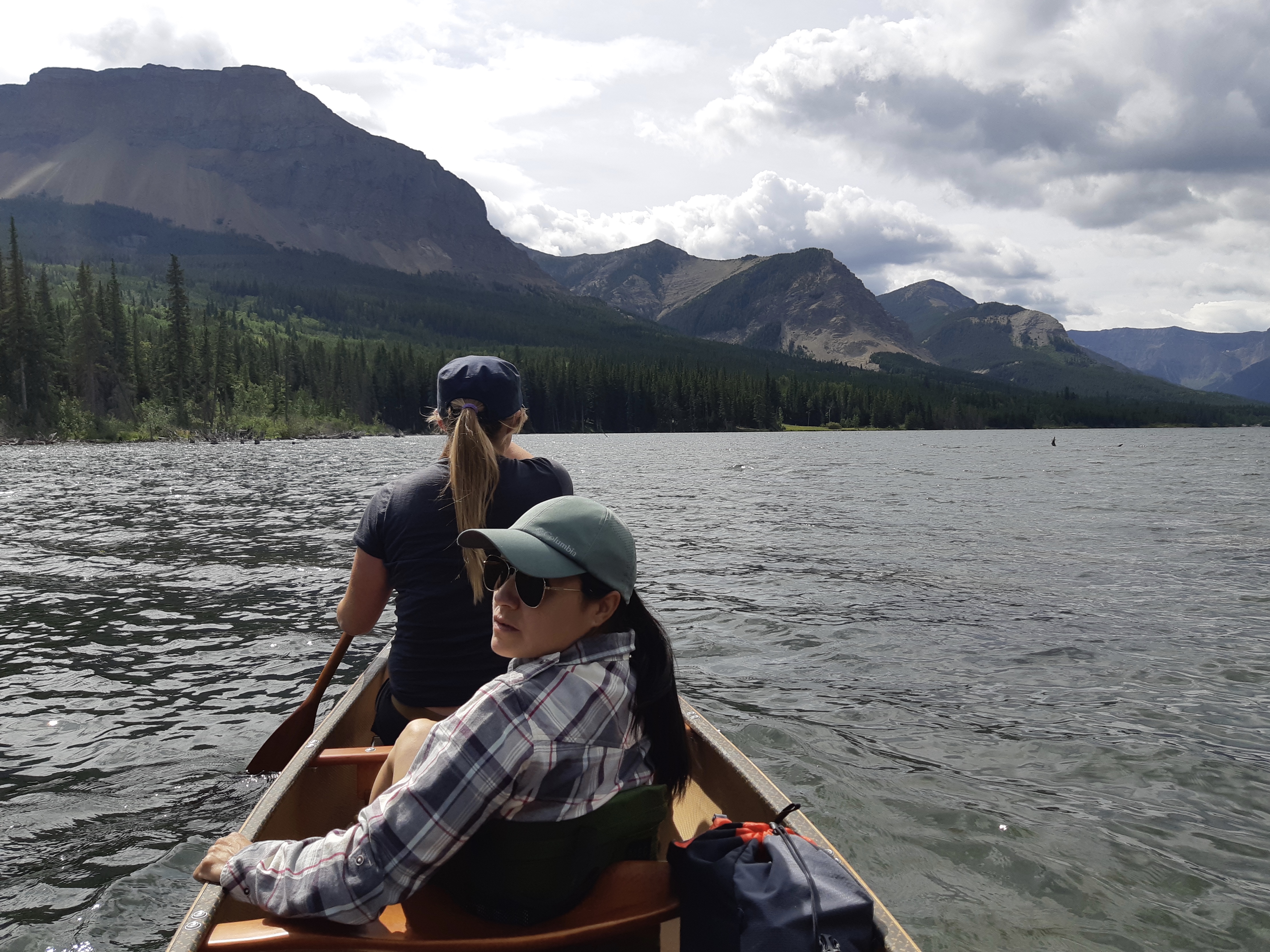
Beaver Mines Lake, Alberta

The next day, they drove me to the start of the Flathead Valley at Corbin Rd. so I could avoid backtracking to Sparwood and riding the highway. After the pavement, I turned onto the muddy Flathead FSR. On the Great Divide routes there are two options from Sparwood to the USA border. The first is to head south towards Fernie on a mellower route with slightly more pavement. The second is to head southeast into the remote, rougher and untouched Flathead Valley, nicknamed “Grizzly Highway” and the “Serengeti of North America” for its high concentration of wildlife. I opted for the more adventurous route.
The start of the Flathead was very slick and I was glad I had waited out the rain the day previous. I met more than a few side-by-sides on the road, which became a common sight on many parts of the ride. It was also the weekend and people were out to play. I stopped a few times to scrape the slimy mud off of my tires. Eventually the surface solidified a bit, only to morph into a bumpy and rocky mess and then to a full on riverbed.
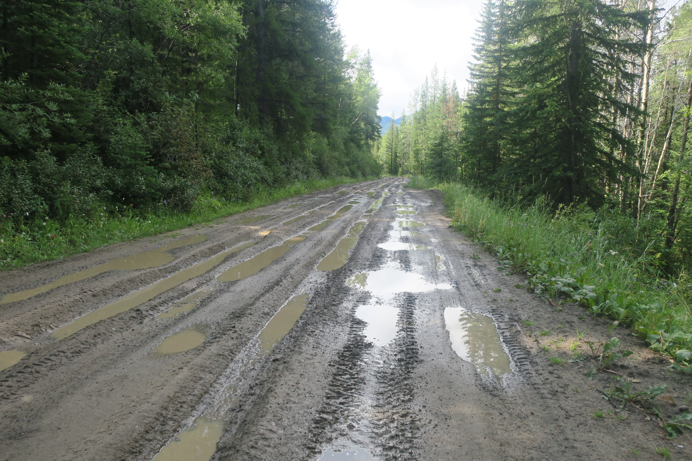
Start of the Flathead Forest Service Rd.

The road and the river become one.
I spotted one jeep crazy enough to attempt the journey. They barely made it across some sections and were moving about as slow as I was. One motorcyclist I met said that he saw someone trying to make it through with a camper. Only parts of it survived the haul apparently.
Apart from the odd ATV parade about once an hour, I had this wonderful place to myself. The dense forests of the valley crawled up the mountainsides. A wild landscape free from the scars of clearcuts and seismic lines.

The rough and remote Flathead Valley, BC

I had planned to get to Butt’s Patrol Cabin that night as it was not recommended to wild camp in an area with such a high grizzly population. I was worried that I wouldn’t make the 80km distance because of the super rough road conditions. Luckily, they improved and I eventually hit smooth dirt.
I had the tiny, spartan cabin to myself. I slept with the bike inside, cozy yet unable to shake off that “Cabin in the Woods” kind of creepy feeling in the dark and total silence.

Butts Patrol Cabin for the night
The next day, I can say, was one of the best I have ever had on a bike.
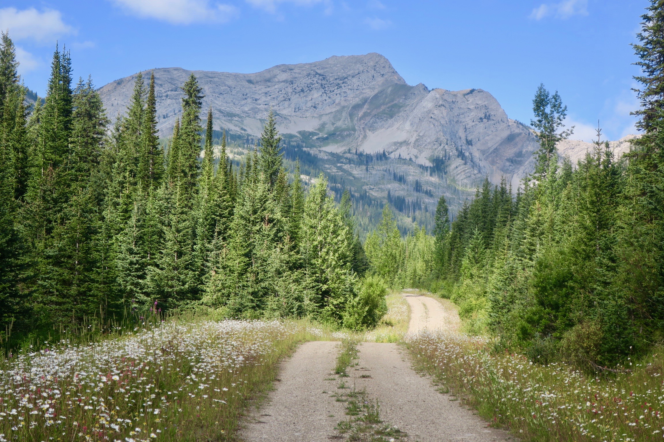
Perfect track on a perfect day to Cabin Pass, BC

Hello, little friend.
I had already been lucky with such amazing weather on this stretch of my trip and that day it continued. The climb up to Cabin Pass along smooth double track track was like slowly moving through a pleasant, familiar dream. Purple, white and yellow wildflowers lined the path, softly illuminated by the sunlight. Drifting clouds created shadows that shifted on the high peaks, defining its contours. There was a light breeze – just enough just to tickle my face and not hinder my forward progression. Bliss on a bicycle, this was it.
I only saw two parked vehicles that day and a few other bikepackers. After the magnificent climb, the track became much rougher on the descent. I met up with the Wigwam River Rd. a double track trail that was closed to motorized vehicles. I met a pair of French cyclists along the way who were doing a small section of the Great Divide. I meant to ask them about the infamous “Wall” that lay ahead on the route, but it slipped my mind. I was on such a high from the day that i sort of brushed off the thought of any potential difficulty that might lay ahead.

More singletrack, the easier section before I had to walk it…
Eventually I left the relatively easy 2-track in exchange for rougher overgrown single track that eventually followed a river. I was unable to ride most of it and resorted to walking. Then, the beast revealed itself. “The Wall” was an accurate description: a pretty well vertical rocky and rooty hiking trail of about 60m+ (that is just a guess!). It took everything I had to push/pull/carry my bike and load up that hill. I had to unload my rear panniers and do it in two trips. I was completely wiped out.
When I finally returned to a rideable road, the climbing continued to Trapper’s Cabin where I had planned to spend the night. Completely out of energy and with my brain functioning at about 50% capacity, I saw a big pile of wood planks and briefly though that the cabin was no more. I almost cycled away, before I decided to check the map and noticed that the cabin was slightly off trail. Sure enough, it was a few hundred metres away up hill and across a stream.
I mustered just enough energy to cook my cycling special of pasta and tuna before passing out blissfully in that tiny cabin in the woods.

Inside Trapper’s Cabin where I spent the night

Lonely cabin in the woods
The next day I went over the steep and rough Dalton Pass. The descent was almost as tiring as the climb and I had to stop often to rest my hands from all the braking. The landscape changed to dry, open grasslands dotted with Ponderosa Pines. It very reminiscent of a corner of British Columbia near Kamloops that I have spent a lot of time in. The border crossing at Roosville was very laid back, the border guard wishing me well on my journey. I was now in Montana, where I would turn away from the Great Divide and begin the Wild West route.
Still exhausted from the previous day, I decided to call it quits after about 60km at a free campground called “Camp 32” close to the quaint town of Eureka. I set up my tent and went to seek out some water, asking an older couple RV camping where I could find some. They directed me to a stream in the woods. On my return they asked what I was up to. When I mentioned that I was heading to the Mexican border on my bike, they insisted on feeding me. I went back to continue setting up camp and then returned to meet my new, interesting neighbours.The guy had been drinking a little bit when I first met them, but now he was completely hammered. He praised me over and over saying how “awesome” and “crazy” I was. The conversation topics ranged from tales of my cycling life, to anti-Trump rants to their working life in the wilds of Alaska. Then, things got extra interesting.
“Do you have a gun?” he asked, “what do you do for protection?”
“I have bear spray, which I would hope to not have to use on a person.”
Then, he paused for a minute and reached into a case under the picnic table.
“You are from Canada, so you might find this a little strange…”
He slapped two handguns on the table and said I could have one if I wanted.
“I think I’m OK, thanks!” I said, a bit surprised.
Then, the conversation took a wild turn.
“Would you kill someone if you had to?” he said, in a drunken slur.
That was a bit jarring. “Ummmm….if I had to in self defence, I guess?”
“What if acted like I was going to get you with one of these guns?”
“I’d shoot ya!” his partner glared at him.
“Ah cummon, honey, calm down, I’m not serious obviously!”
Then he proceeded to tell me that he had been in jail a few years from acting in self defence and was still healing from his time there.
After a while it seemed that these two were harmless, if a bit wacky. Amongst the wild stories and gun offerings they fed me heaps of food, offered me drink and continued to praise me. I excused myself around 11pm and they said to come back for coffee in the morning. What an entertaining night!
The next morning I went to oil my chain and noticed that I had a broken link. I took out my chain tool, only to realize that it was damaged to the point where it was useless. The lady I had met the previous night was heading into town with her pickup and offered to take me and my bike in.

My amazing hosts Jim and Sue in Eureka, Montana
In Eureka, I asked at the local hardware store if there was some way I could repair my tool. “Nope, nothing like that here,” the guy at the counter said. Then, right behind me in line, a man said, “Go to the high school and ask for Jim, he rides bikes a lot.” I went straight to the school and it turns out that Jim, the superintendent of the school was already waiting for me. He said that he would help get me back on the road. He didn’t have a chain tool, but he was headed to Kalispell, Montana for the day and could drop me in Whitefish at a bike shop along the way. I gave my older friend a big hug and thanked her for everything she and her entertaining husband did for me.
After a great afternoon in Whitefish, I met up with Jim and his wife Sue again to take my fixed bike and new chain tool back to Eureka. Jim and Sue said I could spend the night at their place and I gratefully accepted. They took me to an absolutely beautiful outdoor restaurant that was an old barn house converted into a restaurant and micro brewery. I enjoyed their company so much. Jim’s own story is highly inspirational. He used to be dangerously overweight and is now an Ironman triathlete and ultra runner at 59 years old. He told me that he had an interest in bikepacking and was intrigued by my own experiences on the road. Sue was also a gem of a human – easy going and kind. I felt so privileged to have met these two. When I left, I joked that I was glad to have broken my chain, because it brought me to them.
While nature will thrill and amaze on a cycling tour, I feel that it is those human encounters that truly define the experience. And here I was, living these encounters, on the road again.
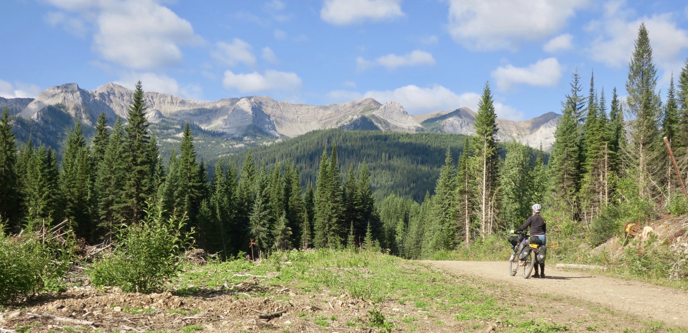
This summer I completed a 5300km ride from Canmore, Alberta to Arizona/Mexico border via the Canadian side of the Great Divide and the Wild West Route. The trip was approximately 80% off road and is now one of my favourite tours to date. I will be posting photos and stories eventually (as you can tell, I don’t update very often!) while hanging out in Patagonia for the 2019/2020 winter.
Here is an interview I recently did with Steve O’Shaughnessy, host of the Bikepack Canada podcast about this trip and my touring life in general. Enjoy!

First, let’s rewind about a year and half….


Well, it appears that I have neglected this blog for some time. It would be impossible to sum up the last year and a bit in a few introductory sentences. A lot has happened and a lot has changed since I was last touring. While I had the idea to continue pedalling around the world last year, the passion and the forward momentum that I once had was starting to fade. I was worn out and feeling a bit aimless. After a failed attempt at a summer tree plant in Australia I had planned to return home for only a few months to a new forestry job to replenish my savings. I guess it was a result of being away from home for so long that I ended up loving that job and loving Canada again. I started to notice all of the very “Canadian” things – a familiar mosaic of my surroundings that I used to pass off as part of a mundane, every day existence. I loved how “Canadian” the radio journalists sounded, seeing Canadians with their Tim Hortons coffee addiction, how so many Canadian men wore baseball caps and hearing again that two letter word we are so famous for:
“Buddy’s just givin’er, eh?!” (Note I am in the north of BC).
The day I had planned to quit my job again in August 2017, I had a conversation with a friend. I told her that I suddenly felt hesitant to get on the road again. Then, she asked me a vital question: Are you doing this because it is something you feel like you should be doing? Or is it something you want to be doing? I really thought about this. It felt like being a world cycle traveller had become part of my identity. It was a point of pride – being able to travel under my own steam, pushing my body to the limits. On my bicycle I felt unsurpassed freedom – nothing else had rivalled it. But I was burnt out, in need of lasting personal connections and community. I was also starting a intriguing relationship which didn’t feel right to abandon.
So, I ended up staying.
I fuelled my outdoor adventure/fitness addiction through work – making it through a winter that I would classify as significantly harder than any bike tour I have ever done. I lived in a wall tent with a wood stove for three weeks at a time, sometimes at -30 temperatures. It was surprisingly warm! I will always look back on one brutal work shift though. In a unexpected and bizarre flooding event in the dead of winter, I came back to a tent frozen under 6+ inches of ice. My co-worker and I spent an entire work shift trying to chip that thing out. It was so severe even chainsaws got involved to cut through the ice. It was a surreal moment for me as I suddenly had a flashback of tree planting a year prior in the tropics of Australia, almost passing out from heat stroke. Literally from one extreme to the other. We spent eight hours per day snowshoeing in thigh deep snow and returned home to spend about an hour each night chipping away at the ice. We were beyond exhausted at the end of those three weeks. It was so intense my already lean co-worker returned home 35 pounds lighter.
Soon, the great thaw began and winter’s grip began to loosen. I was getting ready for my ride that I had put off for a year. My plans had changed a lot, though. I would only ride to Arizona, not down to Argentina. I planned to ride from where I was based in Dawson Creek, British Columbia down to Hinton, Alberta where I would connect with the Great Divide Mountain Bike Route. I would ride until Colorado, where I would turn West to one of my dream cycling destinations: Utah. I would end the ride in Phoenix, before flying home. With almost three months of riding planned, I left Dawson Creek mid August 2018. I was riding towards a horizon choked with wildfire smoke. This was set to be one of the province’s worst fire seasons on record. After a week on the road I came across a new obstacle and the smoky skies became the least of my concerns…
I was moving at a blistering pace towards Grande Prairie on an uninspiring highway, thanks to a mad tailwind. Perhaps riding 135km on the first day of a bike tour wasn’t the wisest decision, but I was determined to get off the highway as quickly as possible. Unfortunately in this part of the province there are few options for side roads that aren’t busy industrial haul roads. I had calculated four days to Hinton, where I could finally get away from traffic and onto dirt.

With my friends. Lorry and Alanna at the start in Dawson Creek, BC
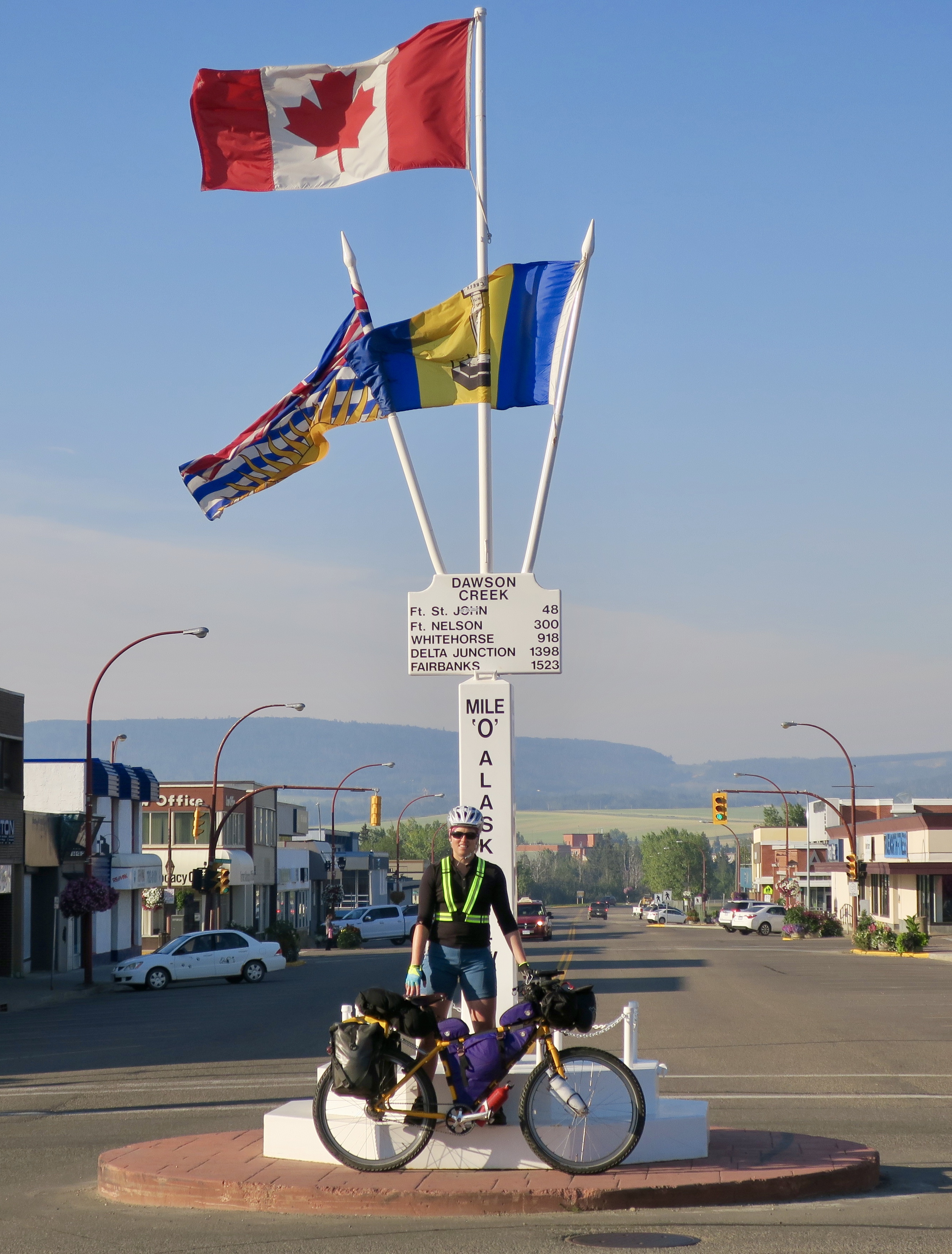
Dawson Creek, BC: Mile “0” of the Alaska Highway and my trip. I wasn’t actually heading towards any of those places on the sign and going in the opposite direction of Alaska…
Earlier in the day I met up with my friends Lorry and Alanna to take a touristy photo at the Mile Zero sign post in Dawson Creek, perhaps the “highlight” of the town for a passing tourist. Dawson Creek is the beginning of the Alaska highway. I joked that it was the “Mile Zero” marker of my trip, but I was going backwards, heading further and further away from Alaska. Mile 0 and negative:-25km, -80km, -1000km…
I chatted with some colourful characters at a gas station in Hythe, my first break of the day. I had forgotten how much attention you receive as a bike tourist. Once again I had become a bit of a novelty. Suddenly everyone wanted to talk to me and know my story. One older man on a $10 bike began to reminisce about local life back in the day in “tougher times.” A disheveled Hollywood stereotype of “that crazy old man” he started going on about life on a potato farm outside of town and coming to the very gas station we were at to siphon gas from other vehicles because it was too expensive. It made for an entertaining lunch stop. I was amused by these random encounters on the road, when suddenly a group strangers become temporarily drawn into your equally strange day-to- day existence.
Aside from the dull riding, which I had done many times by car, it was fun to play tourist. I even stopped at Beaverlodge’s most famous exhibit. I was also particularly amused by the hair salon nearby called the “Sheared Beaver.” Good or bad for business?
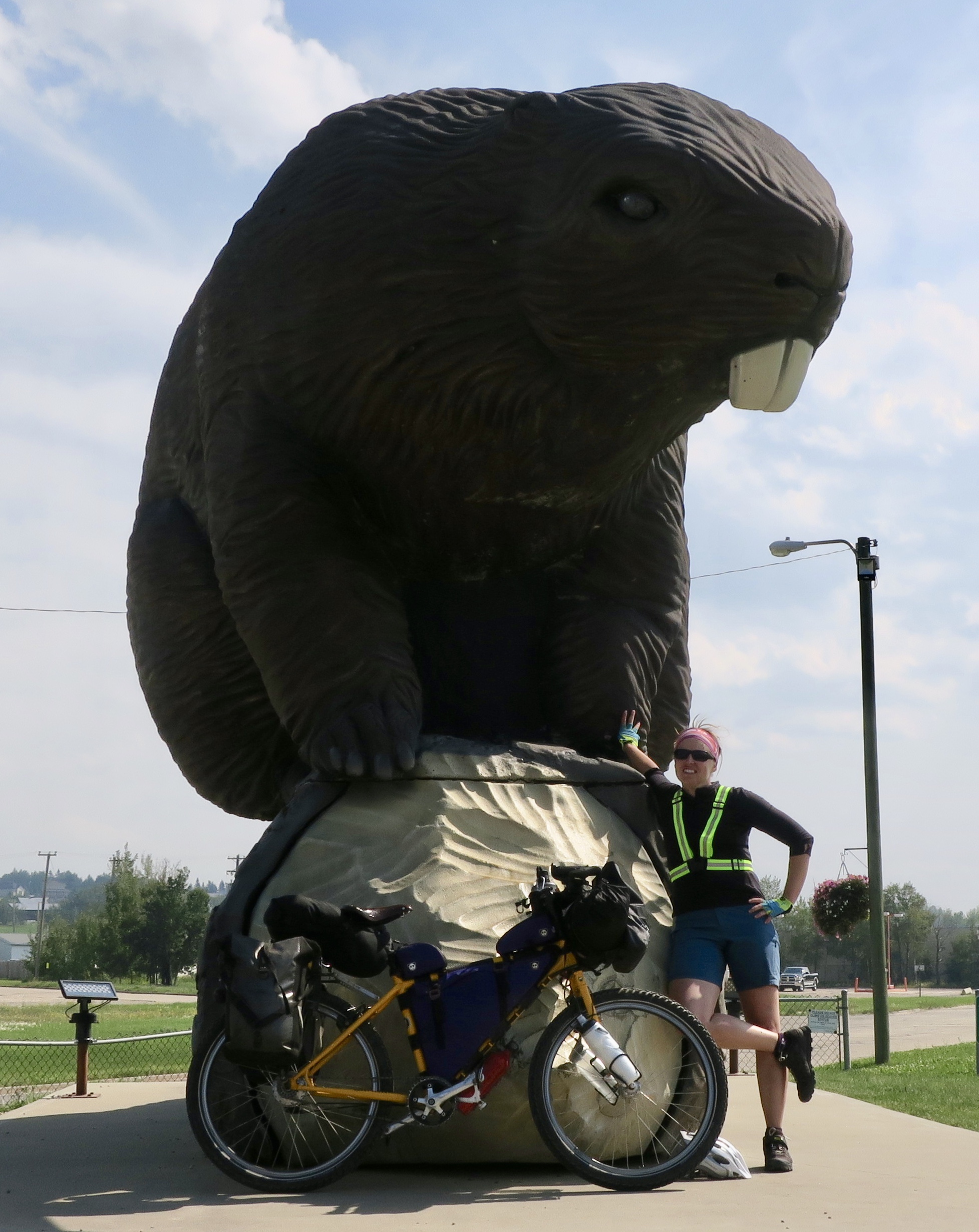
Beaverlodge’s Giant Beaver
I was welcomed into Grande Prairie, not by the angry and insane drivers, but by my awesome Couchsurfing host Ken. It was awesome to share stories with a like minded traveller again.
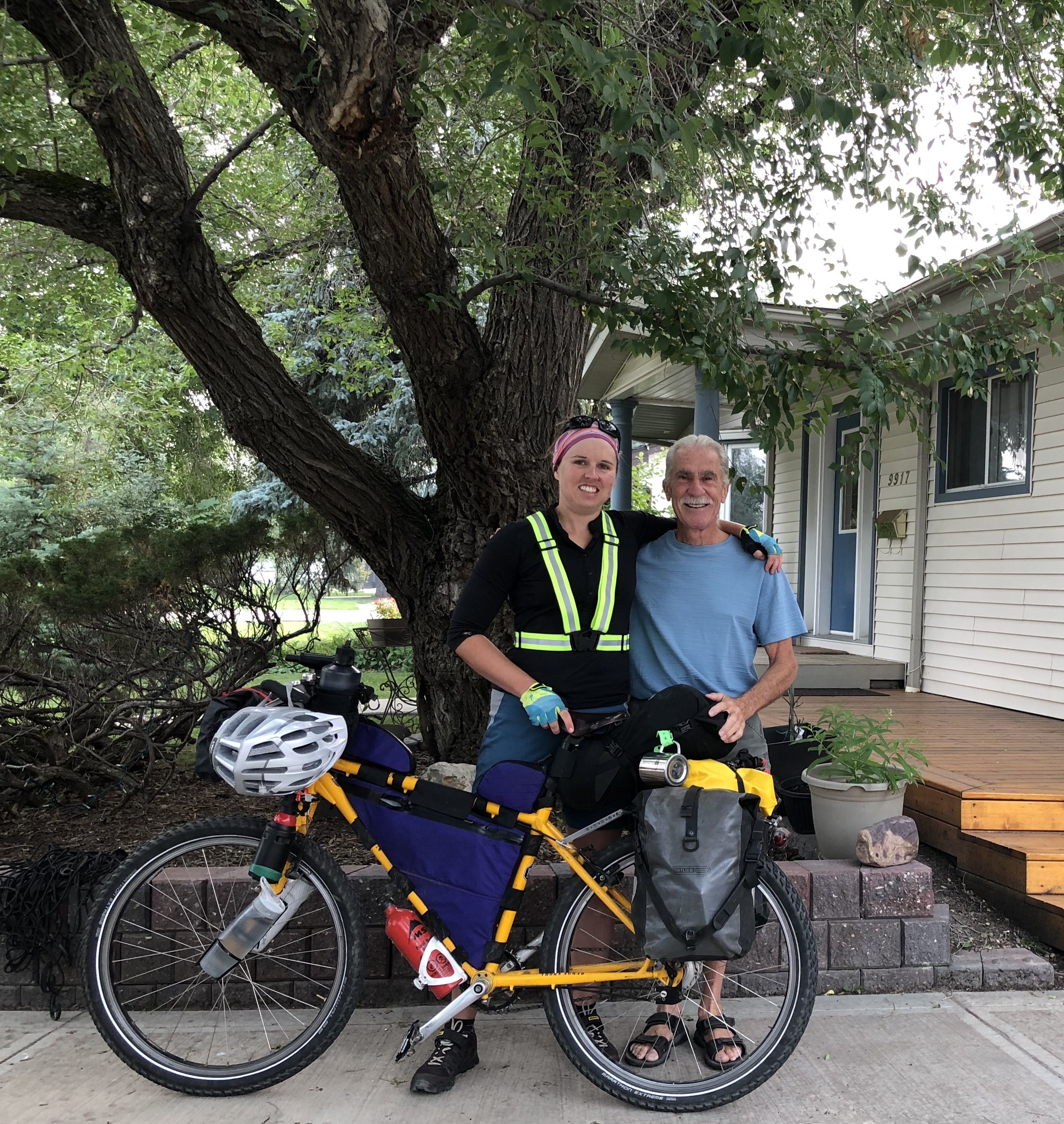
With my Couchsurfing host Ken at his home in Grande Prairie
Grande Prairie is a truck type town – the bigger, the more accessorized and jacked up, the better. A bicycle on the road is a rarity indeed. This is probably the reason why I was approached and encouraged by many people when I stepped off the bike (away from the crazy main road) for a break. I was probably one of a handful of touring cyclists to pass through that year, whereas in a mountain mecca like Canmore further south I would be cyclist #600.
Leaving Grande Prairie, the traffic became heavier and the wildfire smoke thicker. It was like biking into fog all the way to Grande Cache. The sun’s blood orange rays struggled to escape the haze like a beacon of hope. The road began to swell as I pedalled closer to the mountains. My legs battled against the transition and I struggled up the steeper hills. I was completely wiped out when I arrived in Grande Cache. Arriving at a gas station, a man approached me and asked me if I had ridden from Grande Prairie. He described an apocalyptic scene, driving into black with his headlights on in the middle of the day. “I thought I was right in the middle of a fire!,” he said. I did an online search and sure enough found videos showing exactly what the man was describing. It was the road I had cycled the day before in a complete blackout from the smoke. Freaky.
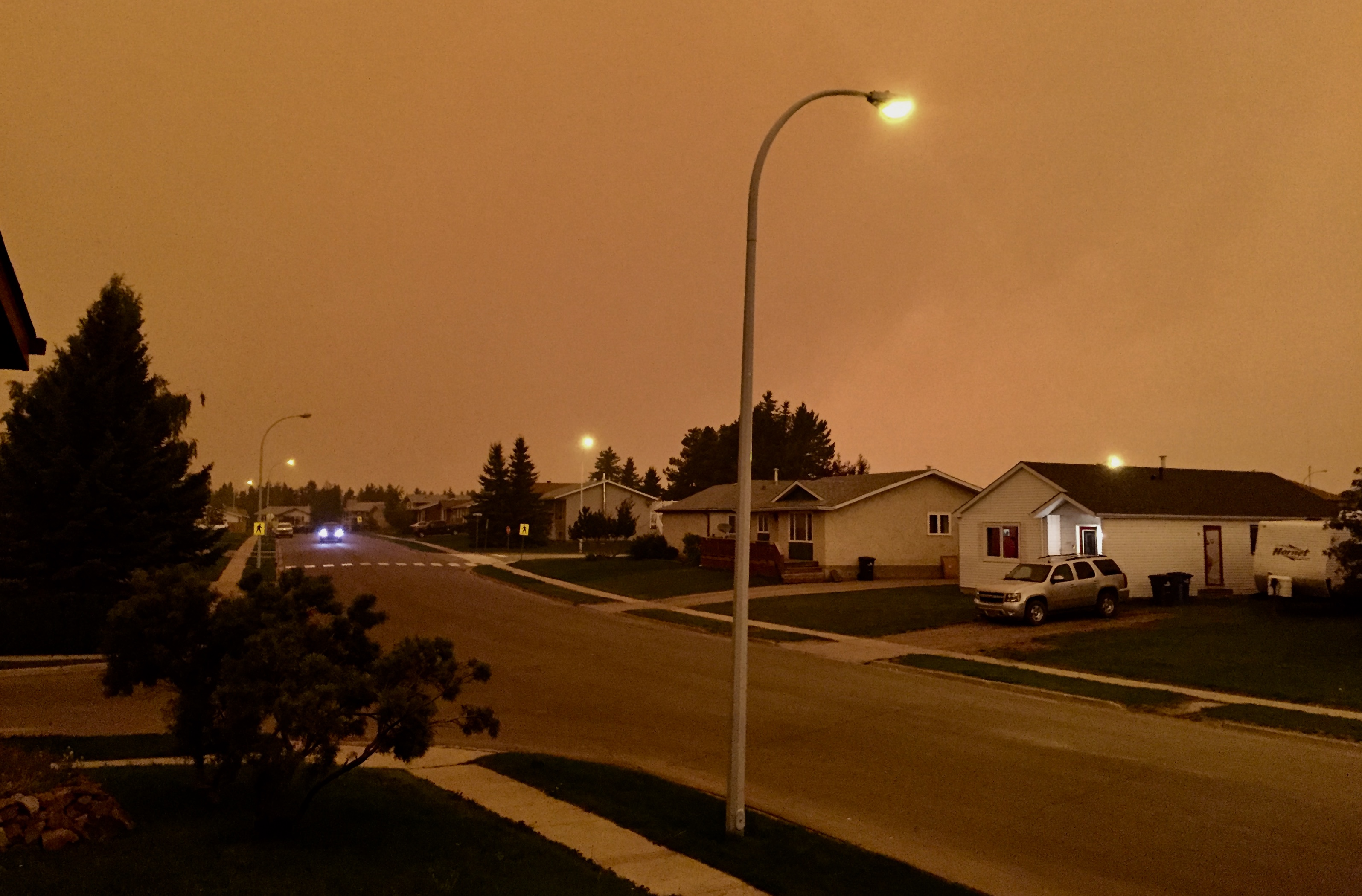
The smoke apocalypse hits Grande Cache. This was around 3:30pm.
I experienced a similarly eerie scene later that afternoon at my Warm Showers host Laverna’s place in Grand Cache. At around 3:30pm the sky turned dark orange and the streetlights went on. I had never experienced anything like it in my life.
Laverna took my around Grande Cache, a very cool little mountain town. It is home to the popular Canadian Death Race – a gruelling 125km ultra marathon. If only I could see the mountains. From her porch she told me that only on clear at least five peaks were visible. Instead, they were engulfed in a sea of white.

Pointing at the non-existent view

Smoke galore in Grande Cache
That night with Laverna and her friend Chris, I was drawn into another world of adventure. The two had made an impressive slideshow about their cycling and hiking expedition to the other worldly volcanic peninsula of Kamchatka, Russia. I saw photos of landscapes that held a surreal beauty far beyond anything I had ever experienced. These two traversed active volcanic fields, turning around when the air became too heavy with sulphur. It was the most impressed and inspired I have felt by an adventure in a long time. Definitely check out their story.
In Hinton at another Warm Showers place, I met Becky and Graham from Washington D.C., a tandem couple cycling the Great Divide Route. I guess I have a knack for running into the rare tandem cycle tourists, like my round the world cycling friends Marcus and Kirsty of shesnotpedallingontheback.com. The were held up because of a damaged fork caused by mishandling on the airline. I wondered how they would fare because of the challenges my friends faced going off road on a tandem on their world tour.
Leaving Hinton, my wheels were finally hitting gravel. I was thrilled to be off the highway. To celebrate the 20th anniversary of the Great Divide Mountain Bike route, its creators added a section connecting Jasper with Banff, via Hinton and the Forestry Trunk Road. I had cycled the spectacular paved route from Jasper to Banff, the Icefields Parkway, some years ago with my dad. The few passing vehicles left behind a cloud of dust that coated me and my bike. At one point I had considered wearing a buff to save my lungs. I was riding into a rather unhealthy concoction of dust and wildfire smoke.
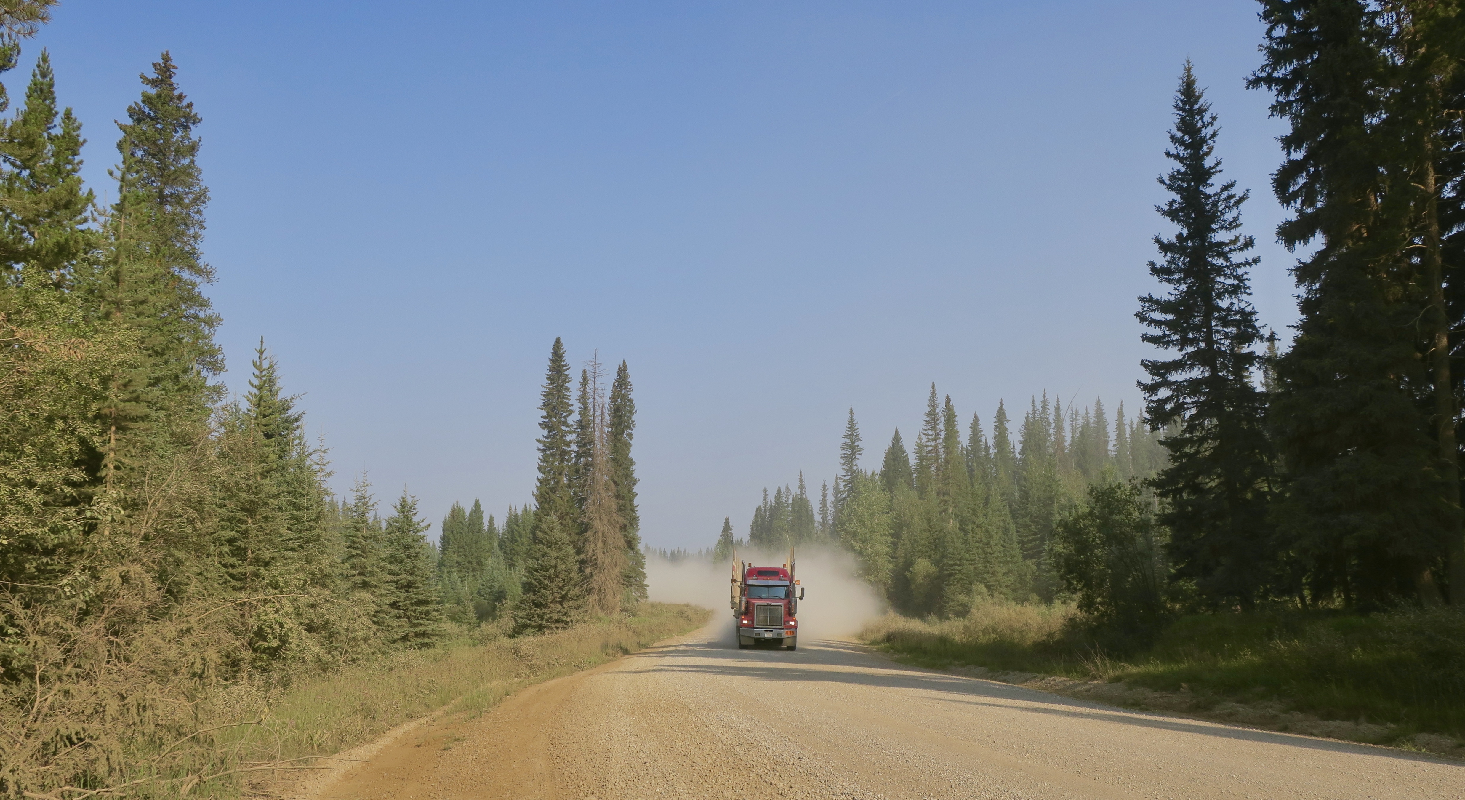
A bit of traffic at the start of the lonely Forestry Trunk Road
Briefly back on pavement, I came into the semi- ghost town of Robb, where I had expected to find at least a gas station or convenience store. I knew of one hotel in the town that was open. The only visible shop was boarded up, the lacklustre paint job and company slogans fading away into history. I admit it was sort of amusing to visit these oddball spots in my own country.
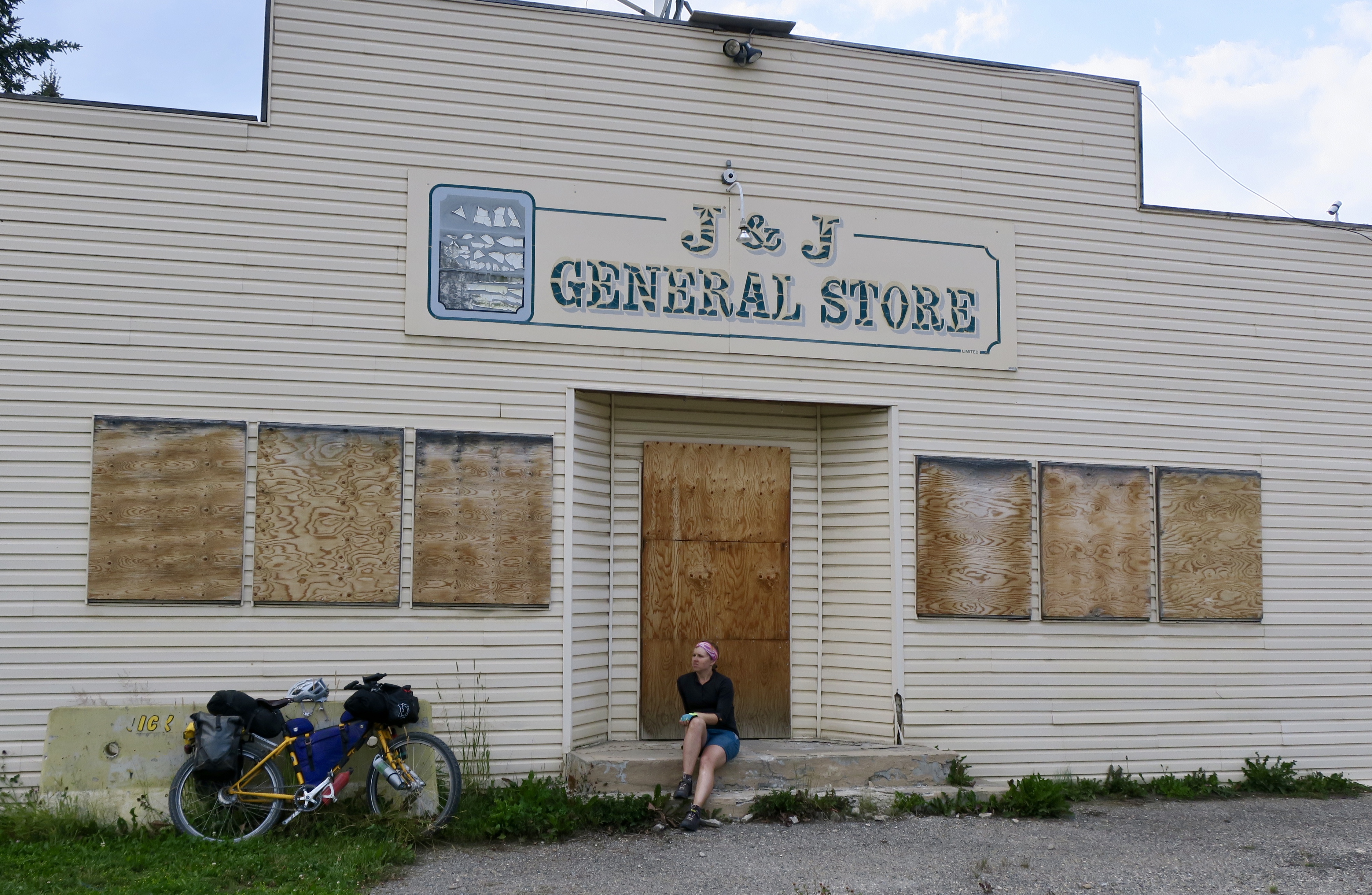
A closed convenience store in the semi-ghost town of Robb, Alberta
The next few days I rode through a tunnel of spruce trees and relentless hills, with the odd clearcut on the Forestry Trunk Road. I had been down many of these types of roads before in a vehicle for work as a forestry technician

Finally a blue, semi-clear sky on the Forestry Trunk Road
South of the old mining community of Nordegg, the trees lining the road suddenly stretched higher towards the sky as the smokey haze finally departed to reveal a piercing blue. The landscape continued to swell from rolling green hills to dramatic rocky mountains.
Sometimes the trees parted to unveil an expansive wetland cradled by mountains in the distance.
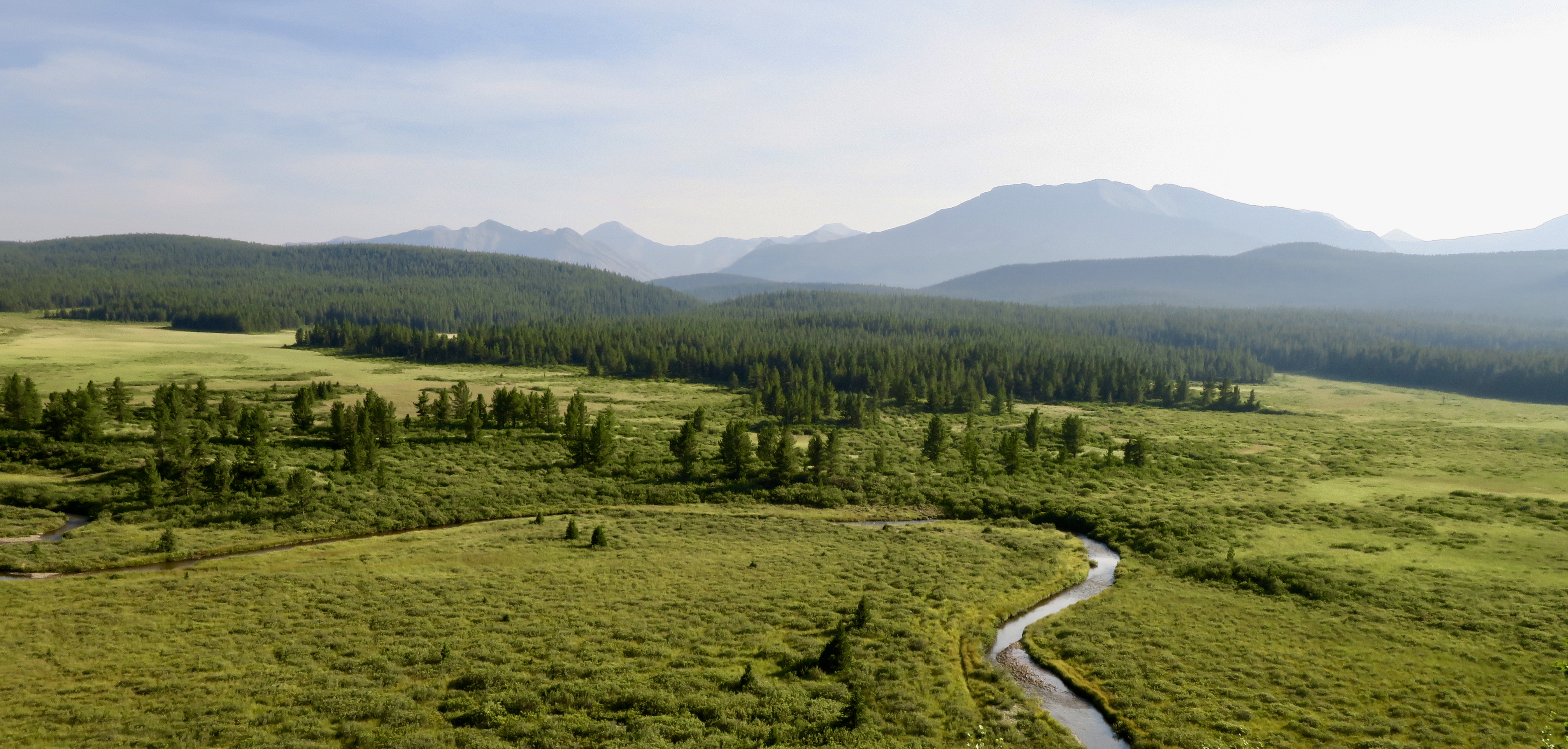
Waterways abounded and I stopped for a break at a particularly large one – the Saskatchewan River. Unfortunately a steep sweeping descent to a river always meant a steep climb out of it.
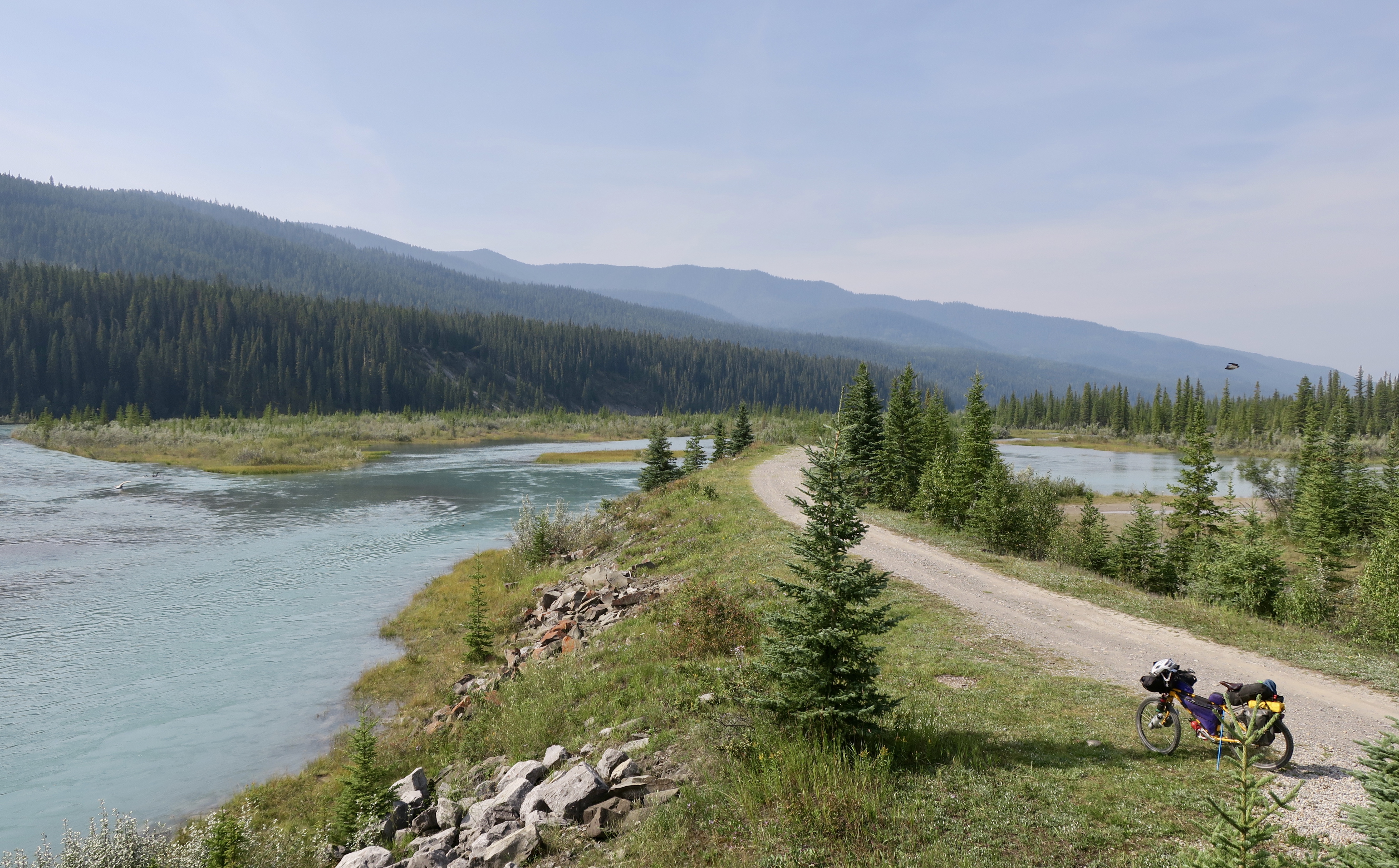
Taking a break at the Saskatchewan River
This characterized the rest of the Forestry Trunk Road – fly down to the river, crawl out of it. The scenery ranged from beautiful mountain landscapes to to ugly clearcuts. The scarred hillsides lay defeated like wounded animals, their hides torn apart by predators.

A hideous hillside of clearcuts
After about five days of fairly aggressive riding, I started to have pain on the left side of my body.
First my lower back and then my IT band. I would finish each day exhausted, hoping that stretching and a good nights sleep would cure it.
Despite my aching body, I was enjoying being on the road again – not even minding the haze that often blocked out most of the scenery. I had the attitude that I had already experienced so much beauty in my travels by bicycle, that it almost didn’t matter. I was enjoying the forward momentum towards that liberated mental state. It is something unique that I can only achieve while cycling and also running – solo, in remote places.
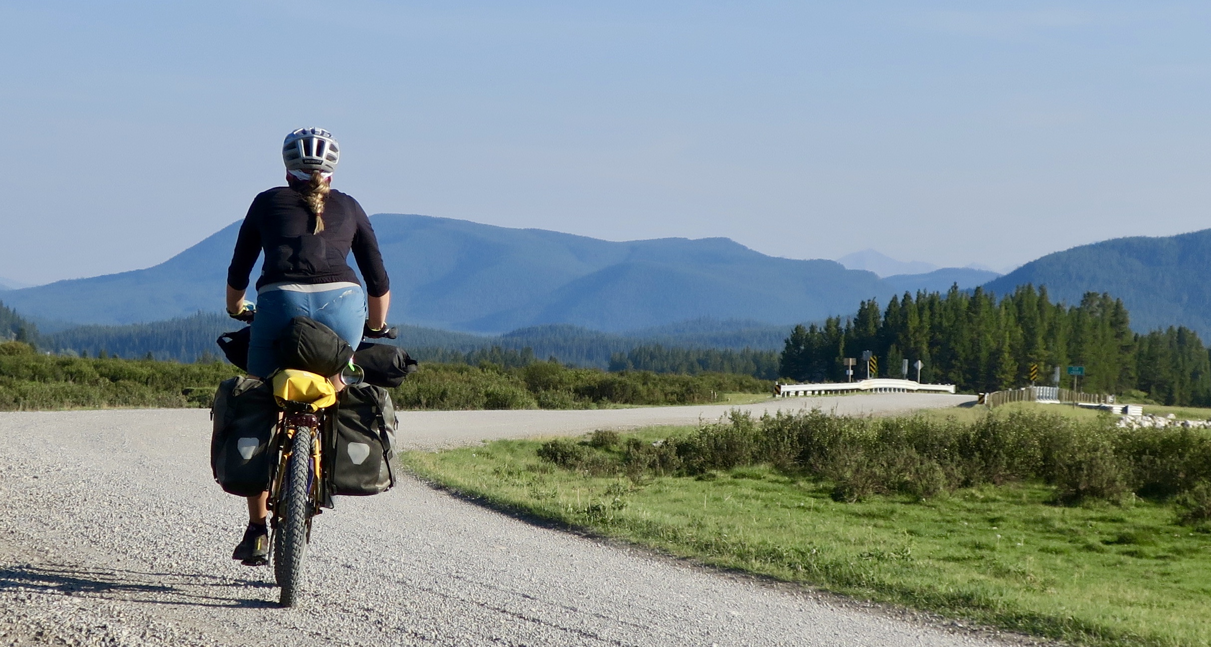
Gravel grinding
I had also missed wild camping, which was also a bit of an adventure in bear country.
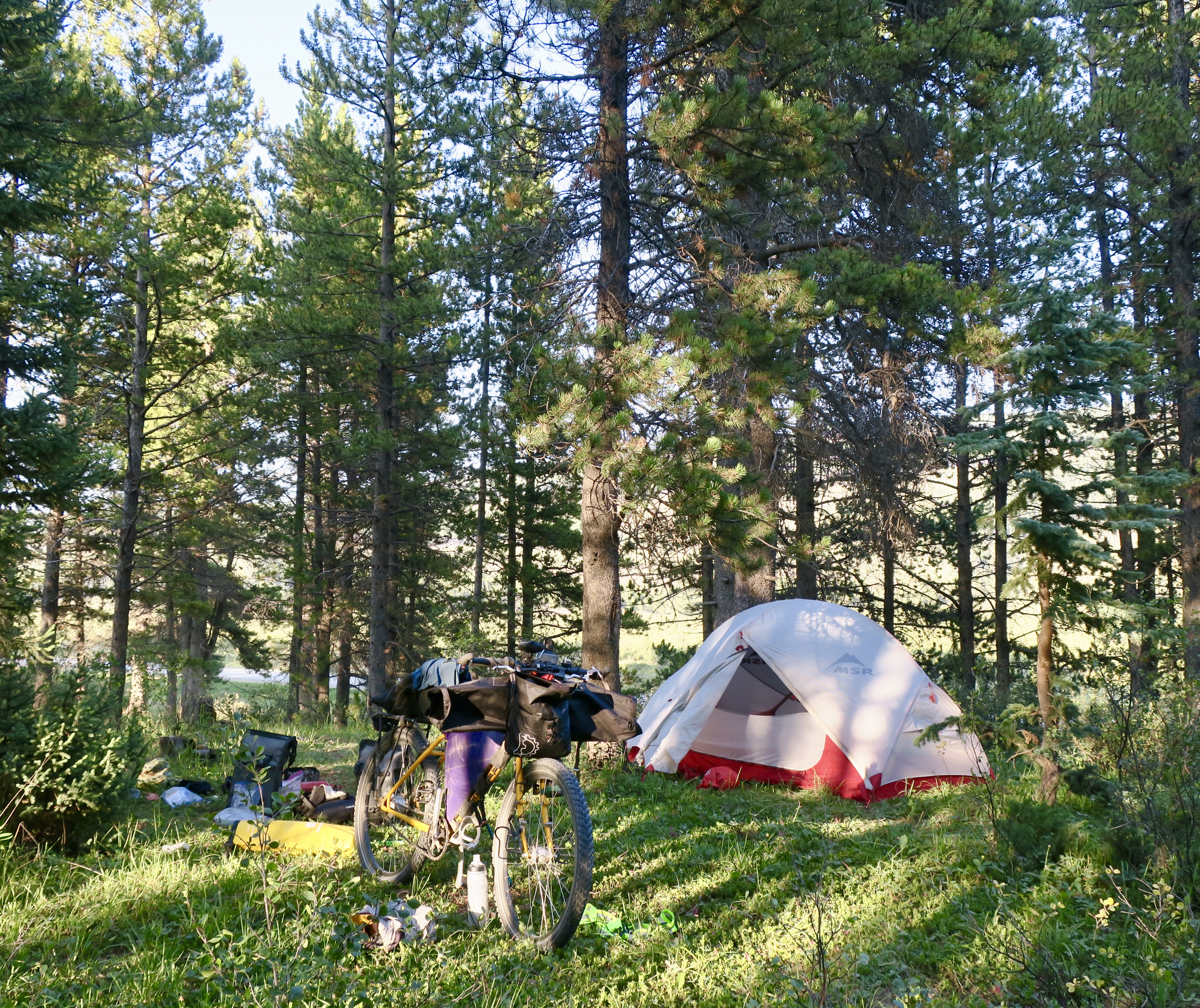
Good wild camping spots were in abundance


I was practicing “bear aware” practices by clearing my wild camp site of all food and scented objects (even toothpaste) by placing them in a stuff sack and hanging them in a tree. I found a useful instructional video for hanging food with a stuff sack. On the first night I attempted it, the pot (used for weight) got stuck high in a tree when I attempted to swing it over a branch. I ended up having to climb fairly high to get it down. I eventually got better at it.
The pain in my leg had now progressed to my knee, and this was quite worrying. I had a couple days left to Canmore, where I decided to take a few days rest. On day 10 of my ride I awoke to stormy skies and a loud crack of thunder outside of my tent. I lay there for a hour longer than usual as the rain began hammering my tent. I suddenly remembered that this was my least favourite part of cycle touring. I was stealth camping in the woods fairly close to an expensive campground, so I felt pressure to get going sooner rather than later. Amazingly, the heavy rain stopped around 10am. I packed up and headed towards Canmore.
My body felt relief when I hit the paved road again after a challenging five days on the Forestry Trunk Road. My knee was really acting up now and I rode the last 100km on painkillers to get me through.

Towards Canmore and the smoky/foggy mountains…
Arriving into town wet and tad cold, I was super grateful to once again be taken into the company of my wonderful Warm Showers hosts Toivo and Suzanne. After a few days off, it became apparent that my knee wasn’t going to heal very quickly. I ended up making the difficult decision to temporarily abandon my ride and let the knee heal. I left my bike behind in Canmore and took the bus to Vancouver to stay with my sister. Unfortunately, my knee didn’t heal in the few weeks that I had hoped. Eventually I made the tough decision to continue the tour next year.
I am now at home in Dawson Creek, my bike in Calgary, where it will sit until next summer (thanks to my awesome friend Lucas for dropping it off and Kelly for storing it!). I don’t know the exact cause of my injury. This is my first ever from cycling. The culprits were likely a very tight IT band or position of my cleats or my saddle causing my patella (kneecap) to track or be pulled out of proper alignment.
Dealing with an injury is incredibly tough if you are an active person. My athletic endeavours are very much a part of who I am and to have that taken away has taken a very big hit on me mentally. As a non-driver, travel by bicycle is my ultimate freedom and I feel like I have had my independence taken away from me. As I explained earlier, it has also become a point of pride over the years, perhaps unhealthily so. I has also spent a year planning and dreaming about the ride, giving me motivation through the toughest days at work in the winter. Also, now that I have months off, boredom is a big challenge to overcome.
The first few weeks I felt depressed, frustrated, defeated, directionless. After a month off, I still struggle with it, but I am getting better. I am trying to see this as a chance to learn about my own body and perhaps treat it better in the future. I went through a similar overuse type injury with running five years ago. I had just finished a tree planting season, feeling more in shape than ever. I jumped right into high mileage training, because I had the lungs, stamina and mental endurance. I ended up paying for that with a severe shin split that lead to me pulling out of a marathon race that I had planned and it resulted in no running for 6 months. It is never a good idea to go headfirst into any sport without preparing your body for it. I should have ridden 60km my first day and not 135km. My drive and stubbornness put an end to my tour. And (trying to avoid the topic) I guess I am not in my 20s anymore!
So, the advice I would give to cyclists, or any endurance athletes of any level is to ease into it! No matter how fit you are from another sport. Get a proper bike fit, take it easy your first week. These are the things I plan to do next year when I get better. With patience, I know that I will.
Even though I only got 10 days on the road, I am grateful for those miles and the people I encountered. I was able to live in that world again, even if only for a short time. That glorious state that I reach pedalling towards an undulating horizon along a bumpy swath of dirt. My thoughts become a bit of a shock absorber for the the terrain that rattles body and bike. I temporarily drift into the trees, the mountains moving past like an old film reel. It’s kind of like floating, as Gary Klein put it:
“Riding is about rhythm and flow. It’s the wind in your face and the challenge of hammering up a long hill. It’s the reward at the top and the thrill of a high-speed descent. Biking lets you come alive in both body and spirit. After awhile the bike disappears beneath you and you feel as if you’re suspended in midair.”

Descending the Baralacha La, Indian Himalaya 2015. Photo Credit: www.shesnotpedallingontheback.com
Toronto’s Globe and Mail newspaper online is publishing travel stories written by women in a series called “In Her Words.” Here is a small feature about my travels by bike. Check it out.


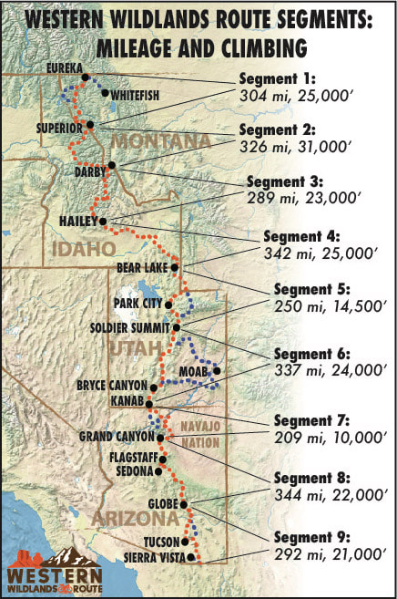